| Memorials | : | 0 |
| Location | : | Purley, Caswell County, USA |
| Coordinate | : | 36.4653900, -79.3306230 |
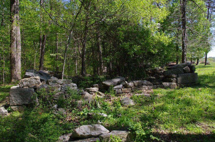
| Description | : | Family Cemetery on Private Property No Recorded Right of Public Access Property Owner's Permission Required This cemetery is the burial site of members of the Thomas Slade and Mary Elizabeth Tabor family. Sea Captain C. W. Fowler is believed to be buried in the adjacent stone-walled enclosure. Thomas Slade's beautifully maintained home place house is nearby. This family cemetery does not have a survey of record. In the vicinity of 571 Slade Road. Carolina Caswell identified this cemetery by Caswell Co NC Map Book 1 Page 55 (Tract 7). Carolina Caswell conducted a photographic survey in July 2011 with the generous assistance of... Read More |
frequently asked questions (FAQ):
-
Where is Slade Cemetery?
Slade Cemetery is located at Slade Road Purley, Caswell County ,North Carolina ,USA.
-
Slade Cemetery cemetery's updated grave count on graveviews.com?
0 memorials
-
Where are the coordinates of the Slade Cemetery?
Latitude: 36.4653900
Longitude: -79.3306230
Nearby Cemetories:
1. Hatchett Family Cemetery
Covington, Caswell County, USA
Coordinate: 36.4593400, -79.3389940
2. McFarling Family Cemetery
Blanch, Caswell County, USA
Coordinate: 36.4702600, -79.3442490
3. Totten-Finch-Foster-Taylor Cemetery
Blanch, Caswell County, USA
Coordinate: 36.4780770, -79.3336000
4. Totten Homeplace Cemetery
Blanch, Caswell County, USA
Coordinate: 36.4782200, -79.3339900
5. Sassafras Grove Baptist Church Cemetery
Covington, Caswell County, USA
Coordinate: 36.4599240, -79.3487440
6. Family Cemetery
Yanceyville, Caswell County, USA
Coordinate: 36.4634700, -79.3111800
7. Slade Farm Community Cemetery
Yanceyville, Caswell County, USA
Coordinate: 36.4594880, -79.3120620
8. Community Baptist Church Cemetery
Yanceyville, Caswell County, USA
Coordinate: 36.4570000, -79.3503000
9. Perry Family Cemetery
Yanceyville, Caswell County, USA
Coordinate: 36.4674300, -79.3082700
10. Purley United Methodist Church Cemetery
Purley, Caswell County, USA
Coordinate: 36.4675690, -79.3549450
11. Hooper Family Cemetery
Yanceyville, Caswell County, USA
Coordinate: 36.4460470, -79.3212250
12. Harrelson-Durham-Hodge Family Cemetery
Blanch, Caswell County, USA
Coordinate: 36.4862360, -79.3307370
13. Harrison Family Cemetery
Purley, Caswell County, USA
Coordinate: 36.4851290, -79.3221740
14. Powell Cemetery
Yanceyville, Caswell County, USA
Coordinate: 36.4432000, -79.3252100
15. Smith Family Cemetery
Hamer, Caswell County, USA
Coordinate: 36.4573260, -79.3041660
16. Page Family Cemetery
Yanceyville, Caswell County, USA
Coordinate: 36.4429320, -79.3245720
17. Harrison Family Cemetery
Purley, Caswell County, USA
Coordinate: 36.4782000, -79.3579000
18. Ware-Pleasant Family Cemetery
Yanceyville, Caswell County, USA
Coordinate: 36.4686500, -79.3624200
19. Barfield Family Cemetery
Purley, Caswell County, USA
Coordinate: 36.4797400, -79.3587100
20. Everett Family Cemetery
Blanch, Caswell County, USA
Coordinate: 36.4925680, -79.3288380
21. Slade Family Cemetery
Blanch, Caswell County, USA
Coordinate: 36.4982900, -79.3191100
22. Montgomery Family Cemetery
Blanch, Caswell County, USA
Coordinate: 36.4868150, -79.2946710
23. Gunn Family Cemetery
Yanceyville, Caswell County, USA
Coordinate: 36.4302090, -79.3458260
24. Family Cemetery on Chandler Road
Yanceyville, Caswell County, USA
Coordinate: 36.4263600, -79.3327700


