
| Memorials | : | 49 |
| Location | : | Long Branch, Monmouth County, USA |
| Coordinate | : | 40.2997700, -74.0127700 |
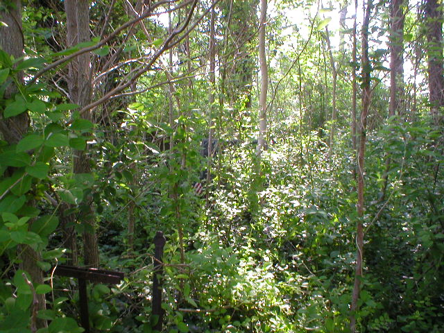
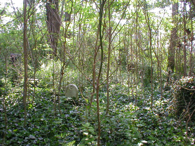
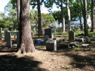
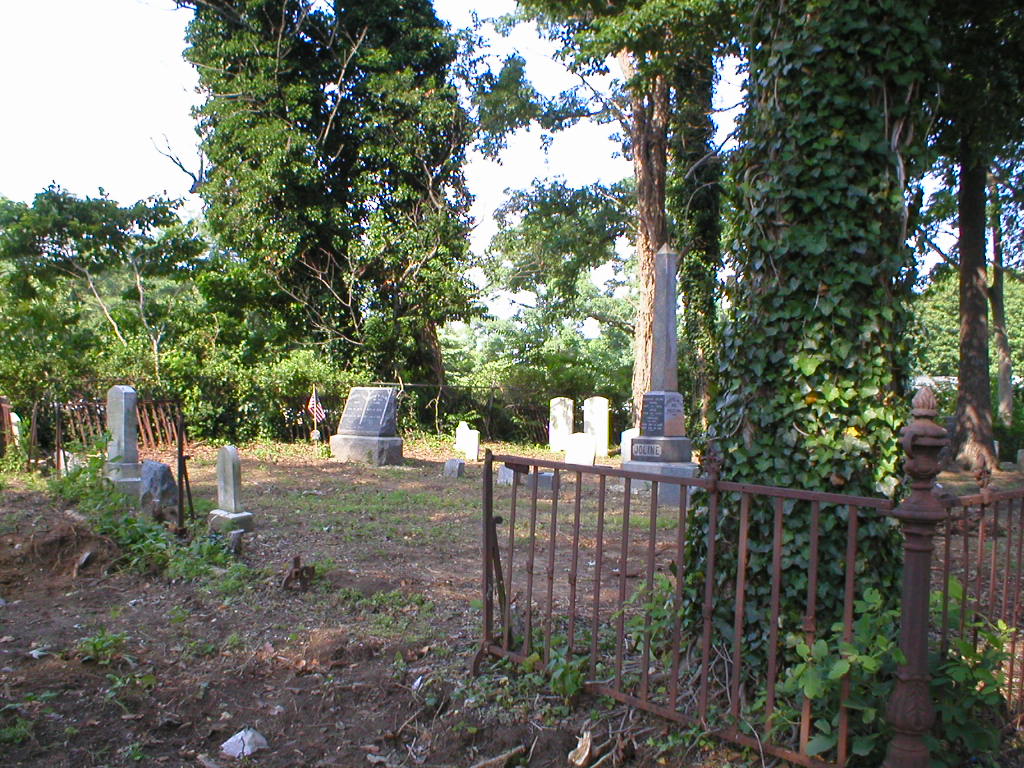
| Description | : | The Slocum Family Burial ground is a separate cemetery in the Greenlawn cemetery. It is surrounded by an iron fence. For years it was almost impossible to enter due to overgrowth (see pictures) but in 2008 was cleaned up and restored.(see pictures) |
frequently asked questions (FAQ):
-
Where is Slocum Family Burying Ground?
Slocum Family Burying Ground is located at Long Branch, Monmouth County ,New Jersey ,USA.
-
Slocum Family Burying Ground cemetery's updated grave count on graveviews.com?
49 memorials
-
Where are the coordinates of the Slocum Family Burying Ground?
Latitude: 40.2997700
Longitude: -74.0127700
Nearby Cemetories:
1. Congregation Brothers Of Israel Cemetery
West Long Branch, Monmouth County, USA
Coordinate: 40.2998619, -74.0133362
2. Monmouth Fields Cemetery
West Long Branch, Monmouth County, USA
Coordinate: 40.2989200, -74.0143900
3. Greenlawn Cemetery
West Long Branch, Monmouth County, USA
Coordinate: 40.2988892, -74.0143738
4. Congregation Brothers of Israel Cemetery Annex
West Long Branch, Monmouth County, USA
Coordinate: 40.3009033, -74.0190964
5. Mount Carmel Cemetery
West Long Branch, Monmouth County, USA
Coordinate: 40.2891998, -74.0102997
6. Glenwood Cemetery
West Long Branch, Monmouth County, USA
Coordinate: 40.2947006, -74.0269012
7. Woodbine Cemetery and Mausoleum
Oceanport, Monmouth County, USA
Coordinate: 40.3011017, -74.0294037
8. Old First Methodist Church Cemetery
West Long Branch, Monmouth County, USA
Coordinate: 40.2847214, -74.0178452
9. Old Free Church Cemetery
West Long Branch, Monmouth County, USA
Coordinate: 40.2770844, -74.0177765
10. White Ridge Cemetery
Eatontown, Monmouth County, USA
Coordinate: 40.2863998, -74.0496979
11. Locust Grove Cemetery
Eatontown, Monmouth County, USA
Coordinate: 40.2924309, -74.0535431
12. Saint Johns Memorial Garden
Little Silver, Monmouth County, USA
Coordinate: 40.3339091, -74.0326643
13. First Presbyterian Churchyard
Shrewsbury, Monmouth County, USA
Coordinate: 40.3240280, -74.0604477
14. Christ Church Episcopal Graveyard
Shrewsbury, Monmouth County, USA
Coordinate: 40.3236122, -74.0613174
15. Friends Meeting House Burial Ground
Shrewsbury, Monmouth County, USA
Coordinate: 40.3244438, -74.0611115
16. Evergreen Cemetery
Little Silver, Monmouth County, USA
Coordinate: 40.3410492, -74.0413208
17. Fields Cemetery
Eatontown, Monmouth County, USA
Coordinate: 40.2849998, -74.0736008
18. Rumson Burying Ground
Rumson, Monmouth County, USA
Coordinate: 40.3535995, -74.0149994
19. Drummond Cemetery
Wanamassa, Monmouth County, USA
Coordinate: 40.2459300, -74.0212800
20. Wayside United Methodist Cemetery
Oakhurst, Monmouth County, USA
Coordinate: 40.2600300, -74.0695000
21. Chadwick Family Burial Ground
Red Bank, Monmouth County, USA
Coordinate: 40.3521042, -74.0509186
22. Saint George by the River Episcopal Church Scatter
Rumson, Monmouth County, USA
Coordinate: 40.3635800, -73.9778800
23. Grover Burial Ground
Lincroft, Monmouth County, USA
Coordinate: 40.3384400, -74.0929900
24. Enslaved Black Burial Ground
Tinton Falls, Monmouth County, USA
Coordinate: 40.3175614, -74.1049500