
| Memorials | : | 2 |
| Location | : | Jackson Township, Clermont County, USA |
| Coordinate | : | 39.1168790, -84.0518720 |
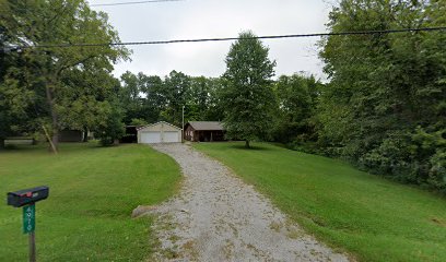
| Description | : | 4970 St. Rt. 133, Jackson Township N 39˚ 06.994 W 084˚ 03.124, 894 elev. Directions: Take Rt. 50 from Owensville east towards Monterey. After passing through Monterey make a right on St. Rt. 133 towards Williamsburg. You will come to an intersection of Aber Road, Blue Sky Parkway and St. Rt. 133. Stay to the right on St. Rt. 133. Start looking for 4970 on left side. The cemetery is located in rear to left of this property location about 200 feet off of St. Rt. 133. It is... Read More |
frequently asked questions (FAQ):
-
Where is Smith Cemetery?
Smith Cemetery is located at 4970 St. Rt 133 Jackson Township, Clermont County ,Ohio ,USA.
-
Smith Cemetery cemetery's updated grave count on graveviews.com?
2 memorials
-
Where are the coordinates of the Smith Cemetery?
Latitude: 39.1168790
Longitude: -84.0518720
Nearby Cemetories:
1. Greenberry Cemetery
Jackson Township, Clermont County, USA
Coordinate: 39.1118200, -84.0426700
2. Hartman Cemetery
Williamsburg, Clermont County, USA
Coordinate: 39.1357994, -84.0496979
3. Sharon Cemetery
Monterey, Clermont County, USA
Coordinate: 39.1428000, -84.0867000
4. Osborn Cemetery
Owensville, Clermont County, USA
Coordinate: 39.1559830, -84.0657670
5. Price Cemetery
Williamsburg, Clermont County, USA
Coordinate: 39.0900000, -84.0107000
6. Bloomrose Cemetery
Sterling Township, Brown County, USA
Coordinate: 39.1021996, -83.9982986
7. Williamsburg Cemetery
Williamsburg, Clermont County, USA
Coordinate: 39.0606500, -84.0578700
8. Thomas South Cemetery
Owensville, Clermont County, USA
Coordinate: 39.1413530, -84.1218460
9. Bamber Cemetery
Kirbyville, Brown County, USA
Coordinate: 39.1310997, -83.9741974
10. Daniel South Family Cemetery
Owensville, Clermont County, USA
Coordinate: 39.1378000, -84.1301830
11. Boston Methodist Episcopal Church Cemetery
Owensville, Clermont County, USA
Coordinate: 39.1183739, -84.1348038
12. Saint Louis Cemetery
Owensville, Clermont County, USA
Coordinate: 39.1246900, -84.1342600
13. Kramer Cemetery
Vera Cruz, Brown County, USA
Coordinate: 39.1577988, -83.9871979
14. Taylor Chapel Cemetery
Sterling Township, Brown County, USA
Coordinate: 39.0881004, -83.9756012
15. Slabs Camp Burial Site
Edenton, Clermont County, USA
Coordinate: 39.1848020, -84.0607910
16. Old Baptist Church Cemetery
Newtonsville, Clermont County, USA
Coordinate: 39.1786300, -84.0894400
17. Shumard Cemetery
Stonelick, Clermont County, USA
Coordinate: 39.1685000, -84.1202500
18. Kidd Family Cemetery
Batavia, Clermont County, USA
Coordinate: 39.1020241, -84.1463470
19. Prickett Cemetery
Newtonsville, Clermont County, USA
Coordinate: 39.1756700, -84.1188800
20. Stonelick IOOF Cemetery
Stonelick, Clermont County, USA
Coordinate: 39.1205200, -84.1549100
21. Plainview Cemetery
Newtonsville, Clermont County, USA
Coordinate: 39.1796989, -84.1177979
22. Rapp Cemetery
Belfast, Clermont County, USA
Coordinate: 39.1434900, -84.1529200
23. Vera Cruz Cemetery
Fayetteville, Brown County, USA
Coordinate: 39.1693993, -83.9669037
24. Brick Chapel Cemetery
Modest, Clermont County, USA
Coordinate: 39.1962509, -84.0938034