
| Memorials | : | 0 |
| Location | : | Edenton, Clermont County, USA |
| Coordinate | : | 39.1848020, -84.0607910 |
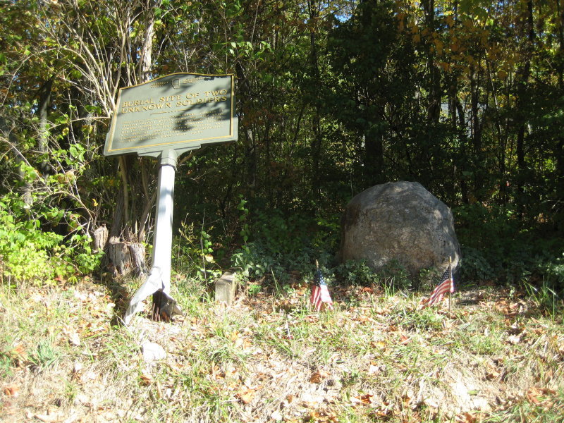
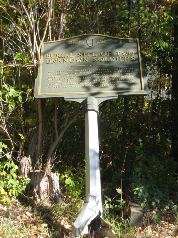
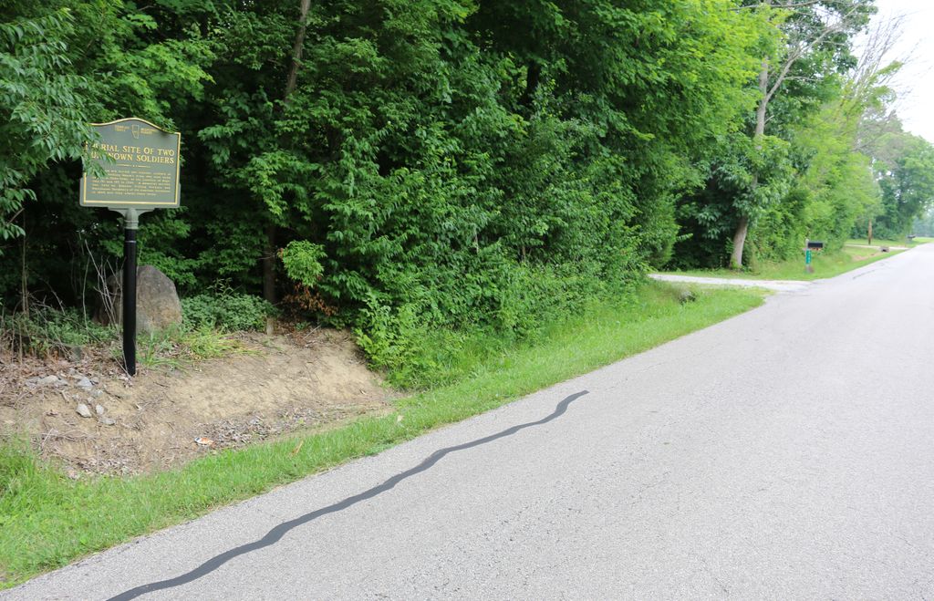
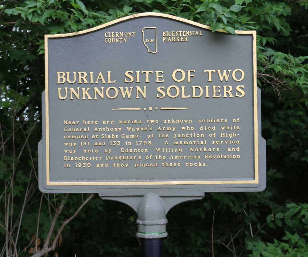
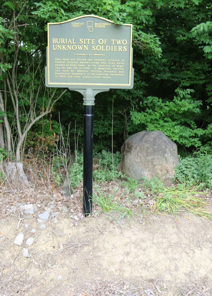
| Description | : | This memorial is located on the east side of Park Road about 1350 feet northwest of its junction with Ohio State Route 133. That junction is about 350 feet north of the intersection of Ohio State Route 133 and Ohio State Route 131. The memorial marker reads: Clermont County 1800 Bicentennial Marker Burial Site of Two Unknown Soldiers Near here are buried two unknown soldiers of General Anthony Wayne's Army who died while at Slabs Camp, at the junction of Highway 131 and 133 in 1793. A memorial service was held by Edenton Willing Workers and Blanchester Daughter's of... Read More |
frequently asked questions (FAQ):
-
Where is Slabs Camp Burial Site?
Slabs Camp Burial Site is located at Park Road Edenton, Clermont County ,Ohio , 45122USA.
-
Slabs Camp Burial Site cemetery's updated grave count on graveviews.com?
0 memorials
-
Where are the coordinates of the Slabs Camp Burial Site?
Latitude: 39.1848020
Longitude: -84.0607910
Nearby Cemetories:
1. Old Baptist Church Cemetery
Newtonsville, Clermont County, USA
Coordinate: 39.1786300, -84.0894400
2. Brick Chapel Cemetery
Modest, Clermont County, USA
Coordinate: 39.1962509, -84.0938034
3. Osborn Cemetery
Owensville, Clermont County, USA
Coordinate: 39.1559830, -84.0657670
4. McCollum Cemetery
Wayne Township, Clermont County, USA
Coordinate: 39.2053980, -84.0968030
5. Edenton Cemetery
Edenton, Clermont County, USA
Coordinate: 39.2216988, -84.0639038
6. Jordan Cemetery
Edenton, Clermont County, USA
Coordinate: 39.2254180, -84.0587770
7. Plainview Cemetery
Newtonsville, Clermont County, USA
Coordinate: 39.1796989, -84.1177979
8. Prickett Cemetery
Newtonsville, Clermont County, USA
Coordinate: 39.1756700, -84.1188800
9. Sharon Cemetery
Monterey, Clermont County, USA
Coordinate: 39.1428000, -84.0867000
10. Shumard Cemetery
Stonelick, Clermont County, USA
Coordinate: 39.1685000, -84.1202500
11. Hartman Cemetery
Williamsburg, Clermont County, USA
Coordinate: 39.1357994, -84.0496979
12. Shiloh Cemetery
Goshen, Clermont County, USA
Coordinate: 39.2328500, -84.1025500
13. Kramer Cemetery
Vera Cruz, Brown County, USA
Coordinate: 39.1577988, -83.9871979
14. Thomas South Cemetery
Owensville, Clermont County, USA
Coordinate: 39.1413530, -84.1218460
15. Smith Cemetery
Jackson Township, Clermont County, USA
Coordinate: 39.1168790, -84.0518720
16. Daniel South Family Cemetery
Owensville, Clermont County, USA
Coordinate: 39.1378000, -84.1301830
17. Simpkins Family Cemetery
Williams Corners, Clermont County, USA
Coordinate: 39.1733900, -84.1532700
18. Stouder Cemetery
Goshen Township, Clermont County, USA
Coordinate: 39.2312700, -84.1335700
19. Greenberry Cemetery
Jackson Township, Clermont County, USA
Coordinate: 39.1118200, -84.0426700
20. Vera Cruz Cemetery
Fayetteville, Brown County, USA
Coordinate: 39.1693993, -83.9669037
21. Olive Cemetery
Stonelick Township, Clermont County, USA
Coordinate: 39.1563988, -84.1552963
22. Irwin Cemetery
Goshen, Clermont County, USA
Coordinate: 39.2176850, -84.1543670
23. West Woodville Cemetery
Warren County, USA
Coordinate: 39.2561660, -84.0114110
24. Rapp Cemetery
Belfast, Clermont County, USA
Coordinate: 39.1434900, -84.1529200