
| Memorials | : | 1 |
| Location | : | Boydsville, Clay County, USA |
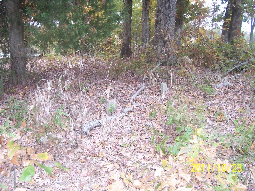
| Description | : | If you go north out of Boydsville Ar. there is a road 272 comes in from the left it used to cross 141 but to the right is hardly a road but east on 272 back in the field there is a cemetery probable 6 graves I only cleared 2 so I could read them in all of my Wallace family Records it is called Harmony Cem. |
frequently asked questions (FAQ):
-
Where is Smiths Chapel Cemetery?
Smiths Chapel Cemetery is located at Boydsville, Clay County, USA.
-
Smiths Chapel Cemetery cemetery's updated grave count on graveviews.com?
1 memorials
Nearby Cemetories:
1. Crocketts Cemetery
Boydsville, Clay County, USA
Coordinate: 36.4272400, -90.2790400
2. Liberty Hill Cemetery
Boydsville, Clay County, USA
Coordinate: 36.2872009, -90.4393997
3. Redenbo Cemetery
Clay County, USA
Coordinate: 36.3147011, -90.2913971
4. Rogers Cemetery
Clay County, USA
Coordinate: 36.4779816, -90.1641693
5. Sarver Cemetery
Clay County, USA
Coordinate: 36.4524994, -90.6038971
6. Shannon Cemetery
Clay County, USA
Coordinate: 36.4081001, -90.5014038
7. Black Cemetery
Success, Clay County, USA
Coordinate: 36.4132996, -90.5774994
8. Hitt Cemetery
Success, Clay County, USA
Coordinate: 36.4035988, -90.6632996
9. Rock Springs Cemetery
Knob, Clay County, USA
Coordinate: 36.4681015, -90.5622025
10. Cummings Chapel Methodist Church Cemetery
Pollard, Clay County, USA
Coordinate: 36.3755989, -90.3405991
11. Holcomb Cemetery
Pollard, Clay County, USA
Coordinate: 36.2590598, -90.2290688
12. Little Flock Cemetery
Pollard, Clay County, USA
13. New Hope Cemetery
Pollard, Clay County, USA
Coordinate: 36.4272400, -90.2790400
14. Bethlehem Cemetery
Clay County, USA
Coordinate: 36.2872009, -90.4393997
15. Blooming Grove Cemetery
Clay County, USA
Coordinate: 36.3147011, -90.2913971
16. Chalk Bluff Cemetery
Clay County, USA
Coordinate: 36.4779816, -90.1641693
17. Allmandinger Cemetery
Corning, Clay County, USA
Coordinate: 36.4524994, -90.6038971
18. Cantwell Cemetery
Corning, Clay County, USA
Coordinate: 36.4081001, -90.5014038
19. Corning Cemetery
Corning, Clay County, USA
Coordinate: 36.4132996, -90.5774994
20. Richwoods Cemetery
Corning, Clay County, USA
Coordinate: 36.4035988, -90.6632996
21. Williams Cemetery
Corning, Clay County, USA
Coordinate: 36.4681015, -90.5622025
22. Hardin Chapel Cemetery
Clay County, USA
Coordinate: 36.3755989, -90.3405991
23. Hargrave Parish Church
Hargrave Corner, Clay County, USA
Coordinate: 36.2590598, -90.2290688
24. Winstead Cemetery
Clay County, USA