
| Memorials | : | 0 |
| Location | : | Armstrong, Howard County, USA |
| Coordinate | : | 39.2854700, -92.7500800 |
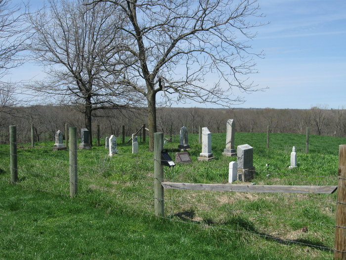
| Description | : | The Snoddy/Garner Cem., the Snoddy Cem., or the Garner/Snoddy Cem. is a small family homestead Cem. located in Howard County, Missouri a few miles west and a little north of Armstrong, Missouri. It is on the now Willard Sander`s farm on county rd. 259. Located on a small hill, south of a small pond, behind a small farmhouse, 17 marked graves and at least a dozen more are believed to be present. Three primitive concrete slabs are thought to mark the location of many slaves, some free blacks and possibly others within the 60`east/west by 50` north/south perimeter of the... Read More |
frequently asked questions (FAQ):
-
Where is Snoddy-Garner Cemetery?
Snoddy-Garner Cemetery is located at County Rd. 259- Willard Sander`s farm Armstrong, Howard County ,Missouri ,USA.
-
Snoddy-Garner Cemetery cemetery's updated grave count on graveviews.com?
0 memorials
-
Where are the coordinates of the Snoddy-Garner Cemetery?
Latitude: 39.2854700
Longitude: -92.7500800
Nearby Cemetories:
1. Walnut Hill Cemetery
Armstrong, Howard County, USA
Coordinate: 39.2500000, -92.7330000
2. Patterson-Perrin Cemetery
Howard County, USA
Coordinate: 39.3212840, -92.7306180
3. Adams Cemetery
Steinmetz, Howard County, USA
Coordinate: 39.2465800, -92.7370300
4. Mason-Mott Cemetery
Howard County, USA
Coordinate: 39.3278870, -92.7338760
5. Shifflett Cemetery
Howard County, USA
Coordinate: 39.2461014, -92.7225037
6. Evans-Walker Cemetery
Armstrong, Howard County, USA
Coordinate: 39.2605600, -92.6993700
7. Heryford Cemetery
Chariton Township, Chariton County, USA
Coordinate: 39.3140500, -92.8089200
8. Wesley Chapel Cemetery
Armstrong, Howard County, USA
Coordinate: 39.2625008, -92.6838989
9. Winn Cemetery
Salisbury Township, Chariton County, USA
Coordinate: 39.3423996, -92.7480011
10. Simmons Cemetery
Armstrong, Howard County, USA
Coordinate: 39.2442017, -92.6992035
11. Stevenson Cemetery
Howard County, USA
Coordinate: 39.2346992, -92.7157974
12. Woods Cemetery
Howard County, USA
Coordinate: 39.2263985, -92.7416992
13. Price Cemetery
Howard County, USA
Coordinate: 39.2552986, -92.8171997
14. Switzer Mill Cemetery
Salisbury Township, Chariton County, USA
Coordinate: 39.3414993, -92.7811966
15. Mansfield Cemetery
Randolph County, USA
Coordinate: 39.3321050, -92.6983690
16. Delphi Robertson Cemetery
Randolph County, USA
Coordinate: 39.3397950, -92.7044400
17. Chariton Cemetery
Glasgow, Howard County, USA
Coordinate: 39.2552030, -92.8260290
18. Lewis Cemetery
Howard County, USA
Coordinate: 39.2357600, -92.8153200
19. Crews Cemetery #1
Howard County, USA
Coordinate: 39.2157220, -92.7678570
20. Nichols Cemetery
Howard County, USA
Coordinate: 39.2164001, -92.7253036
21. Gold Dust Cemetery
Boonesboro, Howard County, USA
Coordinate: 39.2165740, -92.7207190
22. Mott Cemetery
Salisbury Township, Chariton County, USA
Coordinate: 39.3577995, -92.7394028
23. Washington Church Cemetery
Burton, Howard County, USA
Coordinate: 39.2327000, -92.6815500
24. Butner Cemetery
Salisbury Township, Chariton County, USA
Coordinate: 39.3577003, -92.7220001