
| Memorials | : | 0 |
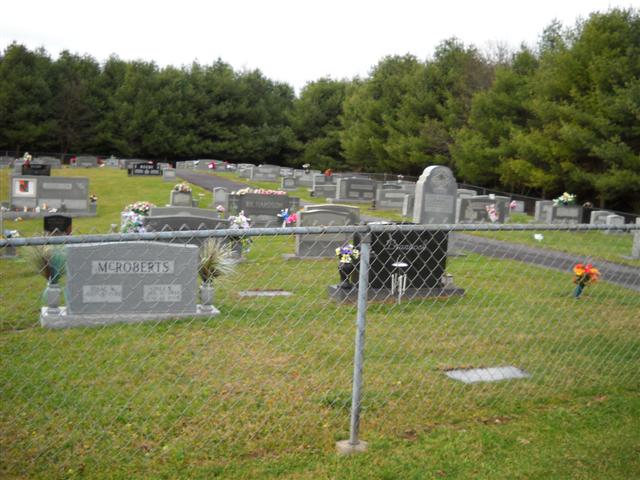
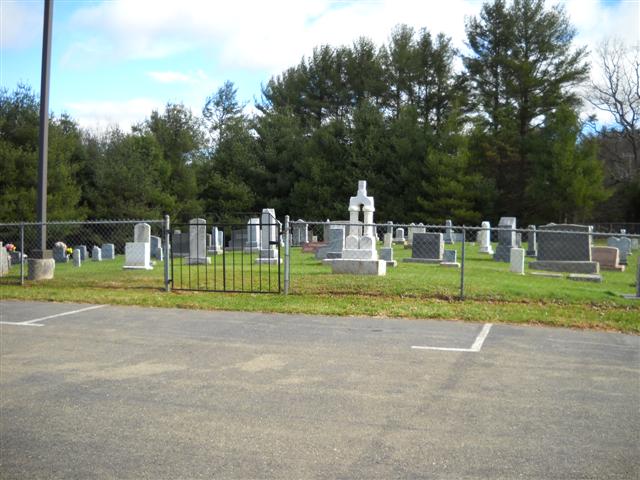
| Location | : | Low Gap, Grayson County, USA |
| Coordinate | : | 36.5859100, -80.8890390 |
| Description | : | From the intersection of Snow Hill Road (VA Route 613) and Skyline Highway (VA Highway 89), travel approximately 1.42 miles on Snow Hill Road; the church and cemetery will be on the left. |
frequently asked questions (FAQ):
-
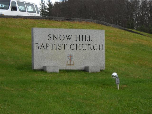
Where is Snow Hill Baptist Church Cemetery?
Snow Hill Baptist Church Cemetery is located at 1423 Snow Hill Road Low Gap, Grayson County ,Virginia , 24333USA.
-
Snow Hill Baptist Church Cemetery cemetery's updated grave count on graveviews.com?
0 memorials
-
Where are the coordinates of the Snow Hill Baptist Church Cemetery?
Latitude: 36.5859100
Longitude: -80.8890390
Nearby Cemetories:
1. Fairview Memorial Gardens
Low Gap, Grayson County, USA
Coordinate: 36.5784080, -80.9056970
2. Glades Memorial Cemetery
Grayson County, USA
Coordinate: 36.5887280, -80.9134430
3. Smith Family Cemetery
Grayson County, USA
Coordinate: 36.5701930, -80.8726180
4. Stoneman Cemetery
Delhart, Grayson County, USA
Coordinate: 36.6094490, -80.8876950
5. Goodson Cemetery
Grayson County, USA
Coordinate: 36.5688900, -80.8611200
6. Haven of Rest Bible Church Cemetery
Grayson County, USA
Coordinate: 36.5740400, -80.9222210
7. Glades Burial Site
Delhart, Grayson County, USA
Coordinate: 36.5903820, -80.9265500
8. Meadow Creek Union Baptist Church Cemetery
Grayson County, USA
Coordinate: 36.6028660, -80.9257160
9. Cumberland Knob Cemetery
Surry County, USA
Coordinate: 36.5535100, -80.9073400
10. Timothy Murphy Memorial Cemetery
Oldtown, Grayson County, USA
Coordinate: 36.5923670, -80.9380990
11. Big Springs Regular Baptist Church Cemetery
Delhart, Grayson County, USA
Coordinate: 36.5710090, -80.9352570
12. Cooley Cemetery
Carroll County, USA
Coordinate: 36.6226230, -80.8658980
13. Glenwood United Methodist Church Cemetery
Grayson County, USA
Coordinate: 36.6281377, -80.8860412
14. Mount Vale United Methodist Church Cemetery
Grayson County, USA
Coordinate: 36.6108710, -80.9339460
15. Higgins Farm Cemetery
Delhart, Grayson County, USA
Coordinate: 36.6023480, -80.9414350
16. Boyer-Davis Cemetery
Baywood, Grayson County, USA
Coordinate: 36.5759600, -80.9445700
17. Old Meadow Creek Cemetery
Baywood, Grayson County, USA
Coordinate: 36.6093500, -80.9389790
18. Kirby-Poole Cemetery
Galax, Galax City, USA
Coordinate: 36.5711200, -80.9461100
19. Rankin Cemetery
Grayson County, USA
Coordinate: 36.6318370, -80.9115510
20. Larrowe Family Cemetery
Galax, Galax City, USA
Coordinate: 36.6279297, -80.9215088
21. Camp Zion Church Cemetery
Galax, Galax City, USA
Coordinate: 36.6267586, -80.9240494
22. Edmonds Cemetery
Edmonds, Alleghany County, USA
Coordinate: 36.5593310, -80.9457070
23. Galyean Family Cemetery
Lowgap, Surry County, USA
Coordinate: 36.5346140, -80.8703660
24. Shinault Family Cemetery
Lowgap, Surry County, USA
Coordinate: 36.5333640, -80.8758540