| Memorials | : | 50 |
| Location | : | Ford County, USA |
| Coordinate | : | 37.5261002, -99.7508011 |
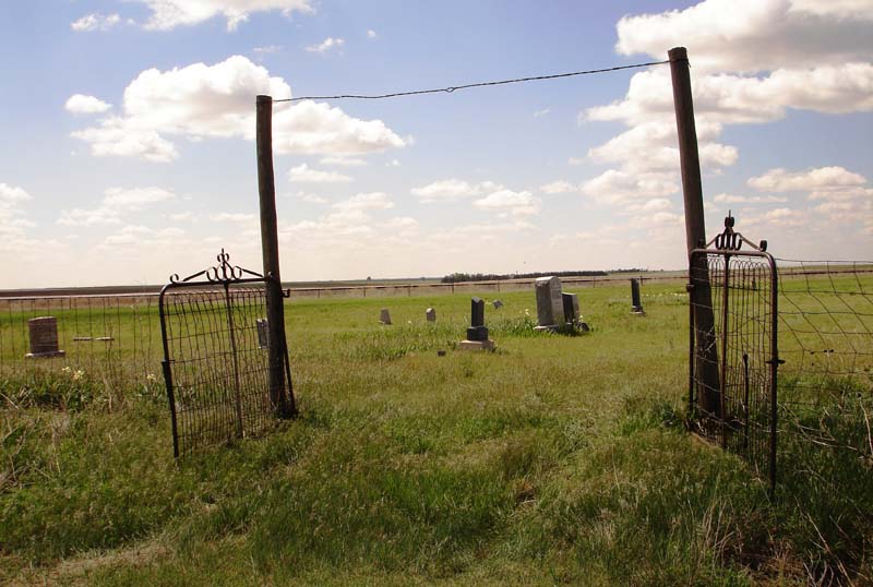
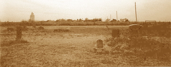
| Description | : | Turn north off of Highway 54 onto 125th Road, also known as Highway 94, and cross the railroad tracks. A small city park is located on the east side of the road. At the north edge of this park, turn east on a dirt road and travel about a 1/4 of a mile. The cemetery is on the south side of the road. Barnes family members claim that William and Eva Barnes (buried here) donated the land to the town to be used for this cemetery. The 1916 Ford County Land Plat Book seems to confirm that claim as it... Read More |
frequently asked questions (FAQ):
-
Where is Sodville Cemetery?
Sodville Cemetery is located at Ford County ,Kansas ,USA.
-
Sodville Cemetery cemetery's updated grave count on graveviews.com?
50 memorials
-
Where are the coordinates of the Sodville Cemetery?
Latitude: 37.5261002
Longitude: -99.7508011
Nearby Cemetories:
1. Bucklin Cemetery
Bucklin, Ford County, USA
Coordinate: 37.5428009, -99.6436005
2. Ford Cemetery
Ford, Ford County, USA
Coordinate: 37.6319008, -99.7431030
3. Bloom Cemetery
Bloom, Ford County, USA
Coordinate: 37.4928017, -99.8966980
4. Pleasant Valley Cemetery
Ford County, USA
Coordinate: 37.6880989, -99.6333008
5. Hillcrest Cemetery
Mullinville, Kiowa County, USA
Coordinate: 37.5922012, -99.4841995
6. Christ the King Cemetery
Ford County, USA
Coordinate: 37.6493073, -100.0056305
7. Appleton Township Cemetery
Minneola, Clark County, USA
Coordinate: 37.4011002, -100.0046997
8. McKinley Cemetery
Mullinville, Kiowa County, USA
Coordinate: 37.6324997, -99.4766998
9. Lexington Cemetery
Lexington, Clark County, USA
Coordinate: 37.3231010, -99.5841980
10. Kansas Veterans Cemetery at Fort Dodge
Dodge City, Ford County, USA
Coordinate: 37.7315903, -99.9314041
11. Pioneer Cemetery
Wright, Ford County, USA
Coordinate: 37.7783360, -99.7872570
12. German Mission Schlichting Cemetery
Dodge City, Ford County, USA
Coordinate: 37.5030530, -100.0886890
13. Zion Lutheran Cemetery
Ford County, USA
Coordinate: 37.7779300, -99.6142500
14. Zion Lutheran Cemetery
Offerle, Edwards County, USA
Coordinate: 37.7779480, -99.6141880
15. Saint Andrew Catholic Cemetery
Wright, Ford County, USA
Coordinate: 37.7790800, -99.8875100
16. Holy Cross Cemetery
Windthorst, Ford County, USA
Coordinate: 37.7874985, -99.6369019
17. Pleasant Vale Cemetery
Ford County, USA
Coordinate: 37.7933006, -99.9047012
18. Concord Cemetery
Ford County, USA
Coordinate: 37.5910988, -100.1157990
19. Wilburn Cemetery
Fowler, Meade County, USA
Coordinate: 37.4742012, -100.1264038
20. Amish Cemetery
Dodge City, Ford County, USA
Coordinate: 37.6639500, -100.0913300
21. Saint Johns Cemetery
Spearville, Ford County, USA
Coordinate: 37.8381004, -99.7536011
22. Boot Hill Cemetery (Defunct)
Dodge City, Ford County, USA
Coordinate: 37.7544800, -100.0222800
23. Prairie Grove Cemetery (Defunct)
Dodge City, Ford County, USA
Coordinate: 37.7612600, -100.0129500
24. Scroggins Mausoleum
Dodge City, Ford County, USA
Coordinate: 37.7403000, -100.0498200


