
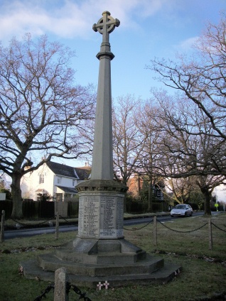
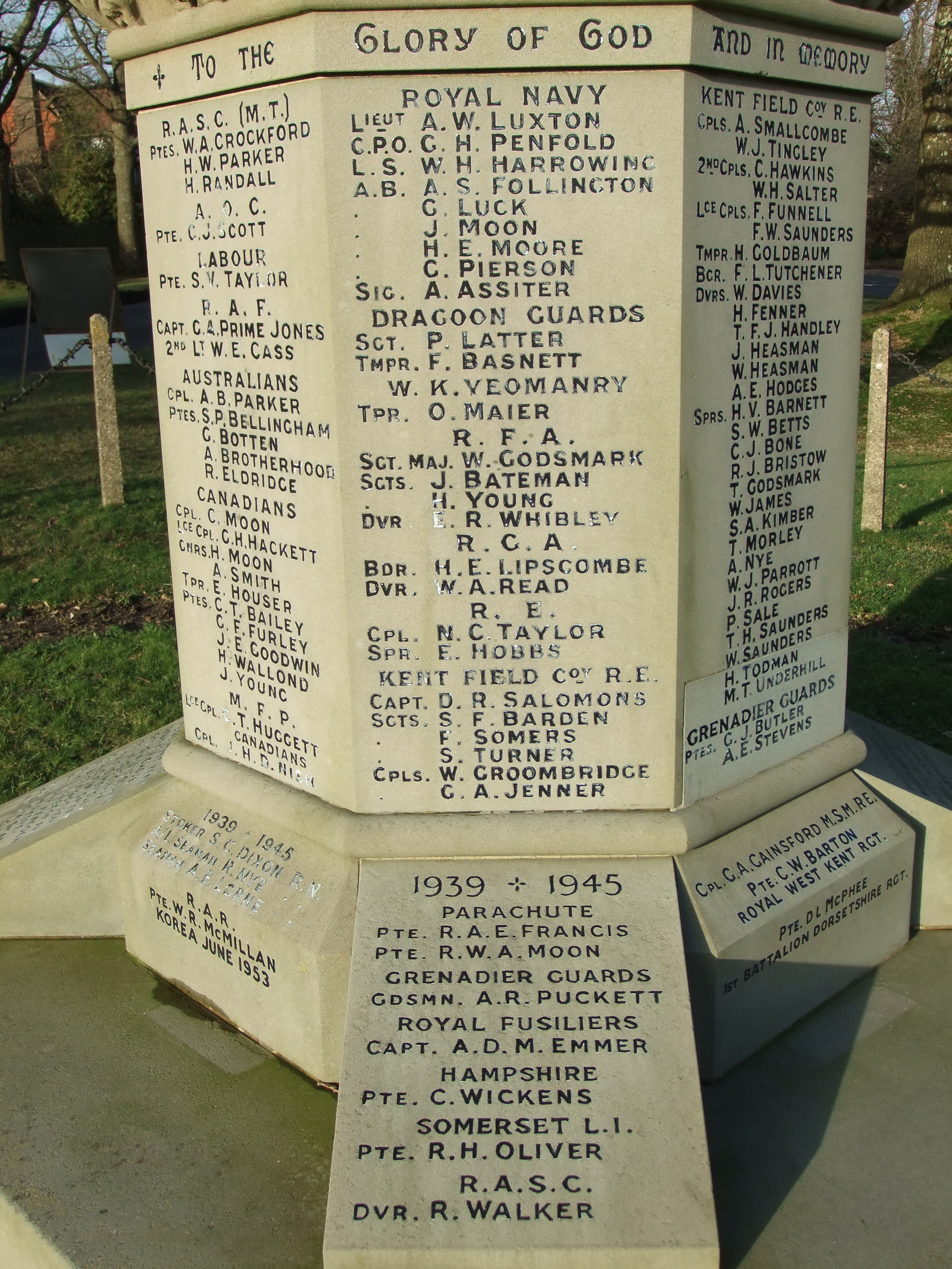
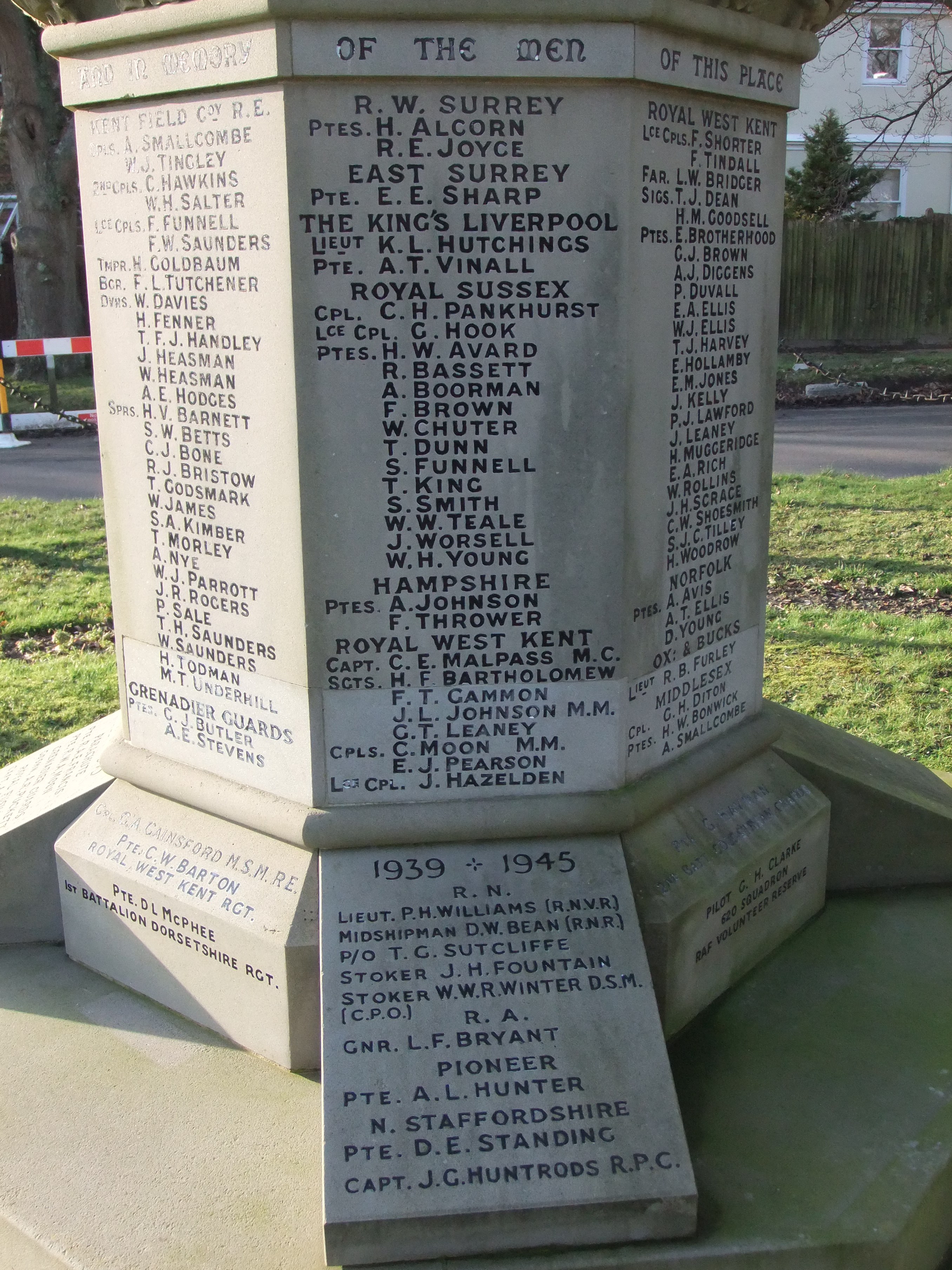
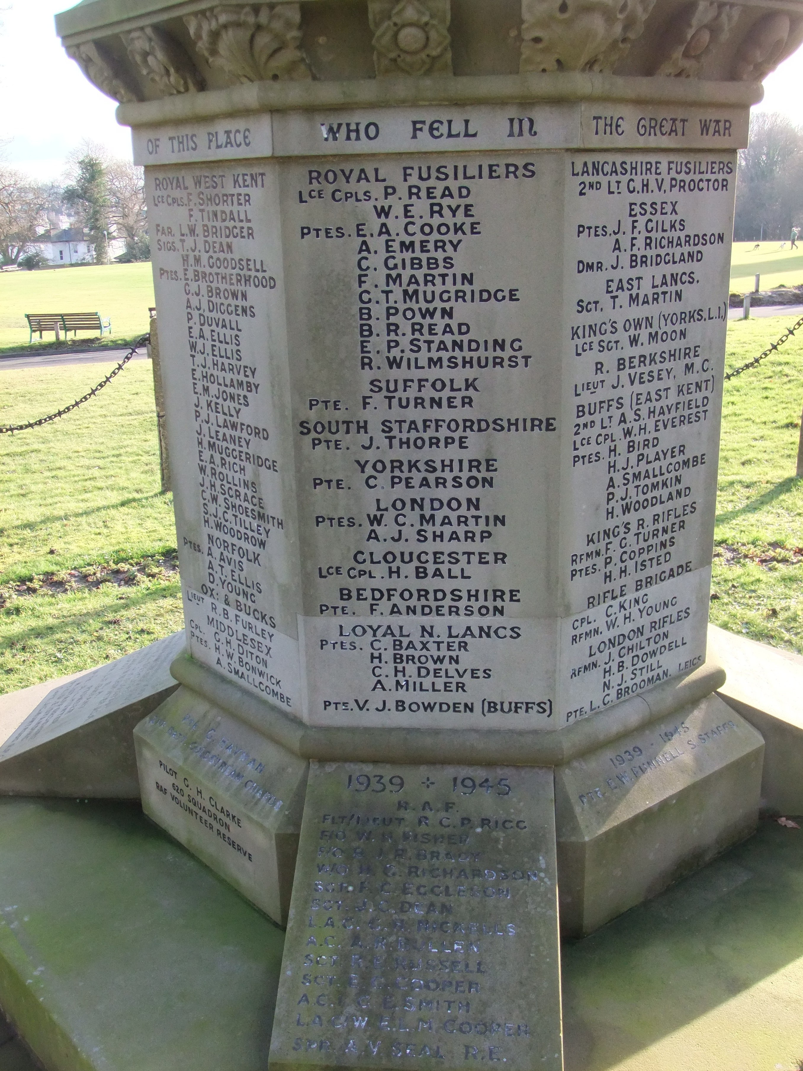
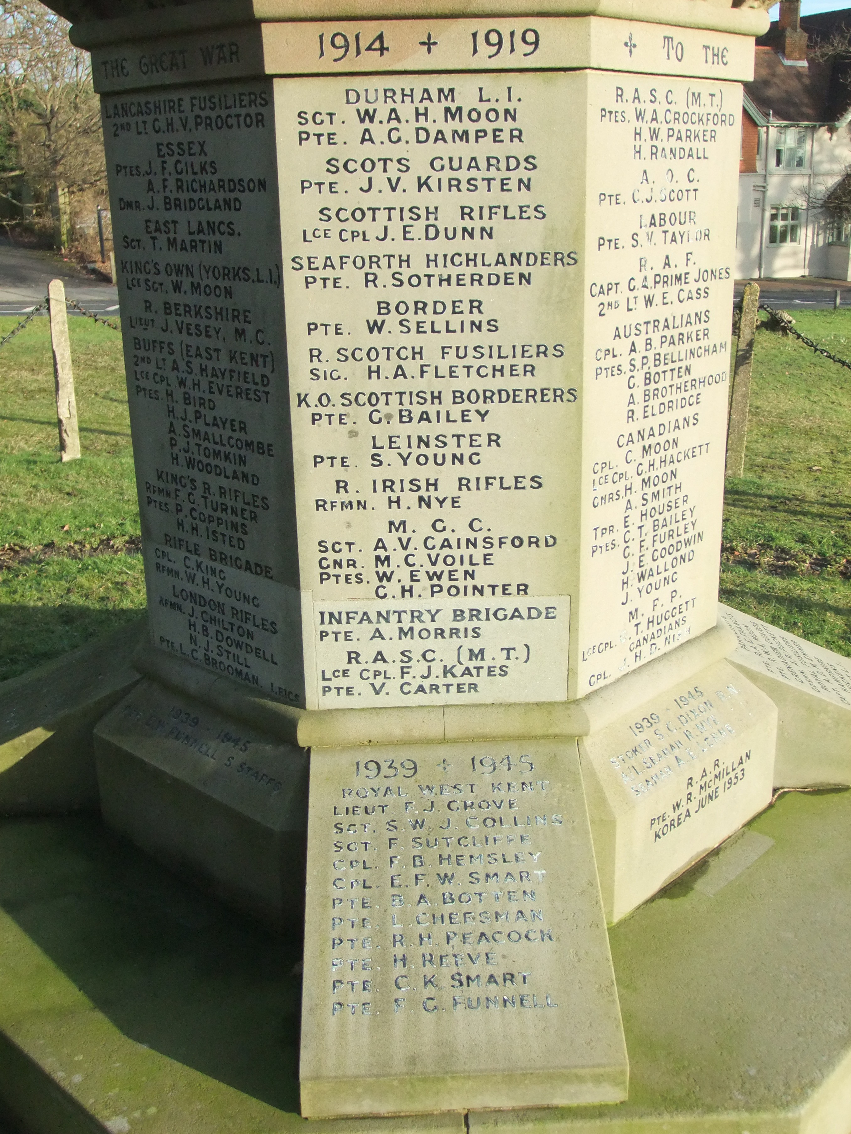
| Memorials | : | 278 |
| Location | : | Southborough, Tunbridge Wells Borough, England |
| Coordinate | : | 51.1639214, 0.2528920 |
frequently asked questions (FAQ):
-
Where is Southborough War Memorial?
Southborough War Memorial is located at Southborough, Tunbridge Wells Borough ,Kent ,England.
-
Southborough War Memorial cemetery's updated grave count on graveviews.com?
278 memorials
-
Where are the coordinates of the Southborough War Memorial?
Latitude: 51.1639214
Longitude: 0.2528920
Nearby Cemetories:
1. St. Peter's Churchyard
Southborough, Tunbridge Wells Borough, England
Coordinate: 51.1626549, 0.2520690
2. Southborough Cemetery
Southborough, Tunbridge Wells Borough, England
Coordinate: 51.1592860, 0.2420140
3. St. Lawrence Churchyard
Bidborough, Tunbridge Wells Borough, England
Coordinate: 51.1666950, 0.2371870
4. St John's Church
Royal Tunbridge Wells, Tunbridge Wells Borough, England
Coordinate: 51.1402330, 0.2608070
5. St. Mary the Virgin Churchyard
Speldhurst, Tunbridge Wells Borough, England
Coordinate: 51.1510790, 0.2198230
6. Woodbury Park Cemetery
Royal Tunbridge Wells, Tunbridge Wells Borough, England
Coordinate: 51.1389847, 0.2637900
7. St Stephens
Tonbridge, Tonbridge and Malling Borough, England
Coordinate: 51.1893961, 0.2687135
8. Hanover Strict Baptist Chapel
Royal Tunbridge Wells, Tunbridge Wells Borough, England
Coordinate: 51.1356700, 0.2625100
9. St Paul New Churchyard
Rusthall, Tunbridge Wells Borough, England
Coordinate: 51.1401520, 0.2204420
10. Trinity Churchyard
Royal Tunbridge Wells, Tunbridge Wells Borough, England
Coordinate: 51.1328200, 0.2623600
11. St. Paul's Churchyard
Rusthall, Tunbridge Wells Borough, England
Coordinate: 51.1307144, 0.2376710
12. All Souls Churchyard
Poundsbridge, Sevenoaks District, England
Coordinate: 51.1540700, 0.1961470
13. St Peter and St Paul Church
Tonbridge, Tonbridge and Malling Borough, England
Coordinate: 51.1977660, 0.2764630
14. Tonbridge Castle
Tonbridge, Tonbridge and Malling Borough, England
Coordinate: 51.1987000, 0.2764000
15. St. Mary's Churchyard
Leigh, Sevenoaks District, England
Coordinate: 51.1977660, 0.2151510
16. Tonbridge Cemetery
Tonbridge, Tonbridge and Malling Borough, England
Coordinate: 51.2057762, 0.2772440
17. St. John the Baptist Churchyard
Penshurst, Sevenoaks District, England
Coordinate: 51.1735240, 0.1834540
18. Old Churchyard of St Peter
Pembury, Tunbridge Wells Borough, England
Coordinate: 51.1629330, 0.3241620
19. All Saints Churchyard
Langton Green, Tunbridge Wells Borough, England
Coordinate: 51.1309738, 0.2022060
20. All Saints Churchyard
Tudeley, Tunbridge Wells Borough, England
Coordinate: 51.1848510, 0.3186970
21. St Peter's New Churchyard
Pembury, Tunbridge Wells Borough, England
Coordinate: 51.1506200, 0.3269600
22. Kent and Sussex Cemetery and Crematorium
Royal Tunbridge Wells, Tunbridge Wells Borough, England
Coordinate: 51.1173720, 0.2740330
23. Pembury Burial Ground
Pembury, Tunbridge Wells Borough, England
Coordinate: 51.1416270, 0.3229290
24. St. Peter's Churchyard
Fordcombe, Sevenoaks District, England
Coordinate: 51.1422043, 0.1792730