| Memorials | : | 0 |
| Location | : | Tiergarten, Mitte, Germany |
| Phone | : | 0180 5 807737 |
| Coordinate | : | 52.5165994, 13.3719369 |
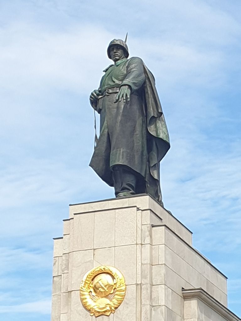
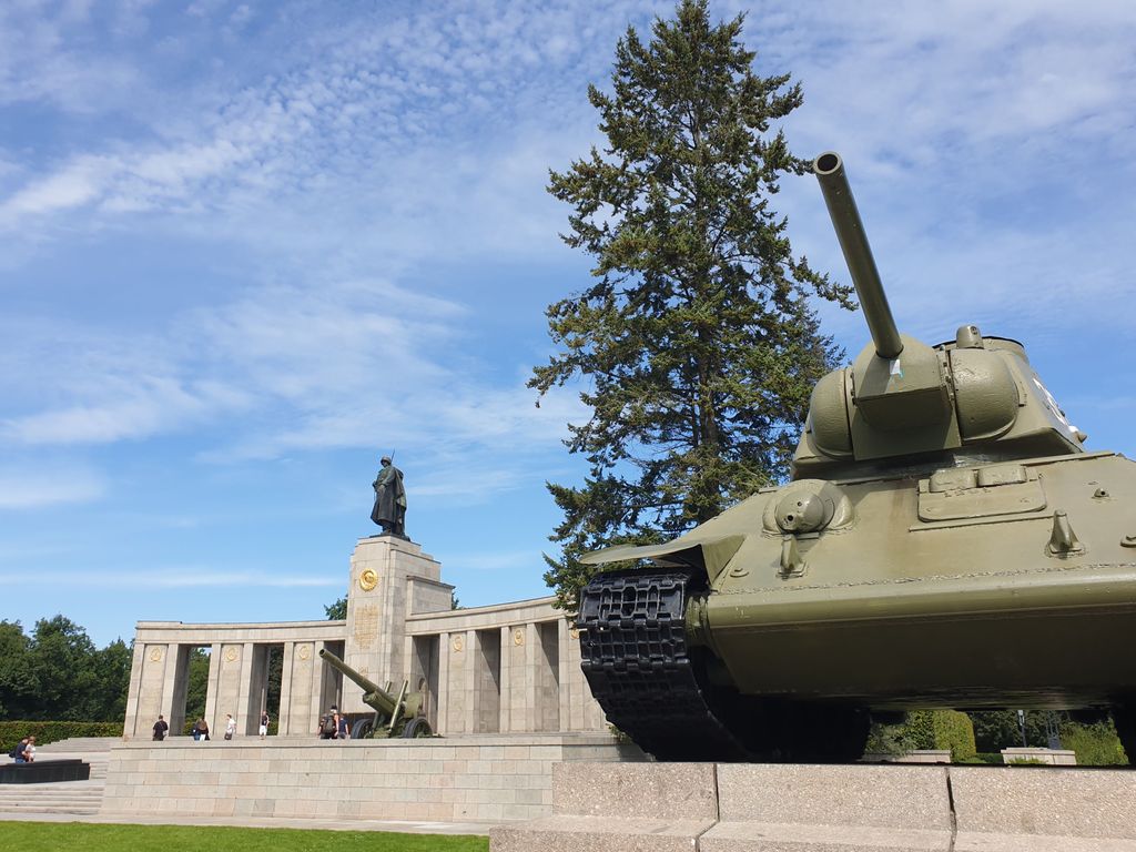
| Description | : | The Soviet memorial in the Tiergarten is the first memorial in Berlin for the Soviet soldiers who died in the fighting for Berlin. It was inaugurated on November 11, 1945 with an Allied military parade The center of the memorial consists of a row of pillars arched inwards towards the street with a central, larger pillar as a base for an eight meter high bronze statue. The sculpture shows a Red Army soldier with a rifle shouldered - an indication of the end of the war. The Russian inscription means: "Eternal glory to the heroes who fell for the freedom and... Read More |
frequently asked questions (FAQ):
-
Where is Sowjetisches Ehrenmal im Tiergarten?
Sowjetisches Ehrenmal im Tiergarten is located at Straße des 17. Juni Tiergarten, Mitte ,Berlin , 10785Germany.
-
Sowjetisches Ehrenmal im Tiergarten cemetery's updated grave count on graveviews.com?
0 memorials
-
Where are the coordinates of the Sowjetisches Ehrenmal im Tiergarten?
Latitude: 52.5165994
Longitude: 13.3719369
Nearby Cemetories:
1. Haurvig Kirke
Norre Havrvig, Ringkøbing-Skjern Kommune, Denmark
Coordinate: 52.5161810, 13.3769350
2. Ehemalige Franziskanerklosterkirche
Berlin-Mitte, Mitte, Germany
Coordinate: 52.5166670, 13.3833330
3. Memorial to the German Resistance
Tiergarten, Mitte, Germany
Coordinate: 52.5067440, 13.3603340
4. Beamtenfriedhof Berlin-Moabit
Moabit, Mitte, Germany
Coordinate: 52.5281527, 13.3653357
5. Französischer Friedhof I
Berlin-Mitte, Mitte, Germany
Coordinate: 52.5274200, 13.3847300
6. Dorotheenstädtisch-Friedrichwerderscher Friedhof I
Berlin-Mitte, Mitte, Germany
Coordinate: 52.5284110, 13.3837040
7. Sankt-Hedwigs-Kathedrale
Berlin-Mitte, Mitte, Germany
Coordinate: 52.5158330, 13.3947220
8. Invalidenfriedhof
Berlin-Mitte, Mitte, Germany
Coordinate: 52.5319440, 13.3711110
9. Friedhof Wilnsnacker Straße
Mitte, Germany
Coordinate: 52.5250190, 13.3506060
10. Sankt Johannis-Friedhof I
Moabit, Mitte, Germany
Coordinate: 52.5253600, 13.3498050
11. Berliner Dom
Berlin-Mitte, Mitte, Germany
Coordinate: 52.5190900, 13.4009200
12. Dominikanerkirche (Defunct)
Berlin-Mitte, Mitte, Germany
Coordinate: 52.5163800, 13.4024700
13. Alter Jüdischer Friedhof
Berlin-Mitte, Mitte, Germany
Coordinate: 52.5241670, 13.4002780
14. Friedhof der Sophiengemeinde II
Berlin-Mitte, Mitte, Germany
Coordinate: 52.5333880, 13.3917080
15. Saint Mary's Church Cemetery
Berlin-Mitte, Mitte, Germany
Coordinate: 52.5205700, 13.4066600
16. Domfriedhof I
Berlin-Mitte, Mitte, Germany
Coordinate: 52.5380200, 13.3772390
17. Nikolaikirche
Nikolaiviertel, Mitte, Germany
Coordinate: 52.5168040, 13.4075470
18. Französischer Friedhof II
Berlin-Mitte, Mitte, Germany
Coordinate: 52.5382700, 13.3777100
19. Alter Domfriedhof St. Hedwig
Berlin-Mitte, Mitte, Germany
Coordinate: 52.5384500, 13.3782700
20. St. Elisabeth-Friedhof I
Mitte, Germany
Coordinate: 52.5352287, 13.3926849
21. Alter Garnisonfriedhof
Berlin-Mitte, Mitte, Germany
Coordinate: 52.5284900, 13.4041400
22. Luisenstädtischer Kirchhof (Defunct)
Kreuzberg, Friedrichshain-Kreuzberg, Germany
Coordinate: 52.5091300, 13.4075900
23. Dorotheenstädtischer Friedhof II
Mitte, Germany
Coordinate: 52.5401230, 13.3782990
24. Friedhof der Bethlehems- oder Böhmischen Gemeinde
Kreuzberg, Friedrichshain-Kreuzberg, Germany
Coordinate: 52.4956474, 13.3918667


