
| Memorials | : | 0 |
| Location | : | Penn Valley, Nevada County, USA |
| Coordinate | : | 39.1226330, -121.2425500 |
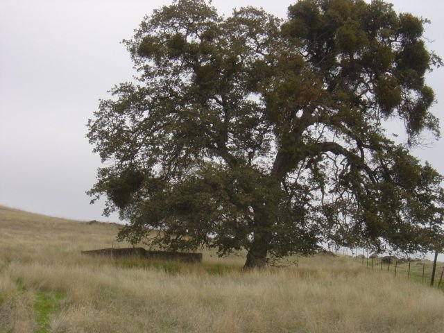
| Description | : | The Spenceville ranch was located in now extinct Spenceville, close to Penn Valley and Bridgeport. The Kneebone's Spenceville ranch of 12,600 acres was 'bought' by the US Government through eminent domain for one dollar in 1945 during World War II, which became Camp Beale, and later Beale Air Force Base. The area where the graves were located was used for bombing practice, so to protect the graves, a large concrete slab was laid over them. The section of land was later deemed unnecessary and deeded to the Spenceville Wildlife Commission. |
frequently asked questions (FAQ):
-
Where is Spenceville Ranch Cemetery?
Spenceville Ranch Cemetery is located at Spenceville Road Penn Valley, Nevada County ,California ,USA.
-
Spenceville Ranch Cemetery cemetery's updated grave count on graveviews.com?
0 memorials
-
Where are the coordinates of the Spenceville Ranch Cemetery?
Latitude: 39.1226330
Longitude: -121.2425500
Nearby Cemetories:
1. Kneebone Cemetery
Nevada County, USA
Coordinate: 39.1226333, -121.2425500
2. Cabbage Patch Cemetery
Waldo Junction, Yuba County, USA
Coordinate: 39.1117300, -121.3066200
3. Church Family Graves Site
Penn Valley, Nevada County, USA
Coordinate: 39.1709400, -121.2017900
4. Indian Springs Cemetery
Penn Valley, Nevada County, USA
Coordinate: 39.1807760, -121.1947130
5. Elster Memorial Cemetery
Grass Valley, Nevada County, USA
Coordinate: 39.1050790, -121.1530230
6. Loney-Sanford Cemetery
Grass Valley, Nevada County, USA
Coordinate: 39.1047050, -121.1525290
7. Vineyard Cemetery
Yuba County, USA
Coordinate: 39.1557900, -121.3281600
8. Clear Creek Cemetery
Grass Valley, Nevada County, USA
Coordinate: 39.1433540, -121.1438480
9. Smartsville Cemetery
Smartsville, Yuba County, USA
Coordinate: 39.1973500, -121.2953500
10. Smartsville Pioneer Cemetery
Smartsville, Yuba County, USA
Coordinate: 39.1993220, -121.2915280
11. Penn Valley Cemetery
Penn Valley, Nevada County, USA
Coordinate: 39.2001100, -121.1849700
12. McGanney Cemetery
Smartsville, Yuba County, USA
Coordinate: 39.2018100, -121.2988310
13. Immaculate Conception Cemetery
Smartsville, Yuba County, USA
Coordinate: 39.2023500, -121.2989300
14. Blue Point Mine Gravesite
Smartsville, Yuba County, USA
Coordinate: 39.2087081, -121.2892876
15. Lofton Cemetery
Yuba County, USA
Coordinate: 39.0783005, -121.3696976
16. Timbuctoo Cemetery
Smartsville, Yuba County, USA
Coordinate: 39.2159925, -121.3175461
17. Lehr Family Cemetery
Grass Valley, Nevada County, USA
Coordinate: 39.1910300, -121.1309100
18. Camp Far West Cemetery
Wheatland, Yuba County, USA
Coordinate: 39.0395500, -121.3431400
19. Cunningham Cemetery
Grass Valley, Nevada County, USA
Coordinate: 39.1105600, -121.0756000
20. Rough And Ready Cemetery
Nevada County, USA
Coordinate: 39.2317009, -121.1343994
21. Pleasant Valley Cemetery
Nevada County, USA
Coordinate: 39.2590890, -121.1970900
22. Long Bar Cemetery
Brownsville, Yuba County, USA
Coordinate: 39.2234900, -121.3860400
23. Methuen Family Cemetery
Browns Valley, Yuba County, USA
Coordinate: 39.2641106, -121.3197076
24. Morgan Oaks Eternal Preserve
Lincoln, Placer County, USA
Coordinate: 38.9629050, -121.2860530