
| Memorials | : | 0 |
| Location | : | Wheatland, Yuba County, USA |
| Coordinate | : | 39.0395500, -121.3431400 |
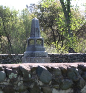
| Description | : | Camp Far West Cemetery AKA - Far West Graveyard or Cantonment Far West Cemetery Directions: In Wheatland, turn east off Highway 65 onto Main Street, which turns into Spencville Road. In 1849 the United States Government established Camp Far West about four miles east of the present-day city of Wheatland. Two companies of soldiers were stationed there for about two years as protection for the earliest settlers. It was abandoned in May of 1852. At that time Lt. Davis and a company of about 40 men of Co. E were ordered to establish a post in Cottonwood to provide protection to the... Read More |
frequently asked questions (FAQ):
-
Where is Camp Far West Cemetery?
Camp Far West Cemetery is located at Wheatland, Yuba County ,California ,USA.
-
Camp Far West Cemetery cemetery's updated grave count on graveviews.com?
0 memorials
-
Where are the coordinates of the Camp Far West Cemetery?
Latitude: 39.0395500
Longitude: -121.3431400

Nearby Cemetories:
1. Lofton Cemetery
Yuba County, USA
Coordinate: 39.0783005, -121.3696976
2. Sheridan Cemetery
Sheridan, Placer County, USA
Coordinate: 38.9741000, -121.3585300
3. Cabbage Patch Cemetery
Waldo Junction, Yuba County, USA
Coordinate: 39.1117300, -121.3066200
4. Wheatland Cemetery
Wheatland, Yuba County, USA
Coordinate: 39.0083008, -121.4360962
5. Morgan Oaks Eternal Preserve
Lincoln, Placer County, USA
Coordinate: 38.9629050, -121.2860530
6. Manzanita Cemetery
Lincoln, Placer County, USA
Coordinate: 38.9444008, -121.3032990
7. Spenceville Ranch Cemetery
Penn Valley, Nevada County, USA
Coordinate: 39.1226330, -121.2425500
8. Kneebone Cemetery
Nevada County, USA
Coordinate: 39.1226333, -121.2425500
9. Vineyard Cemetery
Yuba County, USA
Coordinate: 39.1557900, -121.3281600
10. Santa Clara Memorial Park
Lincoln, Placer County, USA
Coordinate: 38.8894710, -121.3260560
11. Lincoln Cemetery
Lincoln, Placer County, USA
Coordinate: 38.8864310, -121.3020500
12. Sierra View Memorial Park
Olivehurst, Yuba County, USA
Coordinate: 39.0872002, -121.5363998
13. Elster Memorial Cemetery
Grass Valley, Nevada County, USA
Coordinate: 39.1050790, -121.1530230
14. Loney-Sanford Cemetery
Grass Valley, Nevada County, USA
Coordinate: 39.1047050, -121.1525290
15. Smartsville Cemetery
Smartsville, Yuba County, USA
Coordinate: 39.1973500, -121.2953500
16. Smartsville Pioneer Cemetery
Smartsville, Yuba County, USA
Coordinate: 39.1993220, -121.2915280
17. McGanney Cemetery
Smartsville, Yuba County, USA
Coordinate: 39.2018100, -121.2988310
18. Immaculate Conception Cemetery
Smartsville, Yuba County, USA
Coordinate: 39.2023500, -121.2989300
19. Church Family Graves Site
Penn Valley, Nevada County, USA
Coordinate: 39.1709400, -121.2017900
20. Lone Star Cemetery
Placer County, USA
Coordinate: 38.9757996, -121.1380997
21. Fairview Cemetery
Rio Oso, Sutter County, USA
Coordinate: 38.9389000, -121.5250015
22. Blue Point Mine Gravesite
Smartsville, Yuba County, USA
Coordinate: 39.2087081, -121.2892876
23. Timbuctoo Cemetery
Smartsville, Yuba County, USA
Coordinate: 39.2159925, -121.3175461
24. Indian Springs Cemetery
Penn Valley, Nevada County, USA
Coordinate: 39.1807760, -121.1947130