
| Memorials | : | 0 |
| Location | : | Uffculme, Mid Devon District, England |
| Coordinate | : | 50.9186560, -3.3067630 |
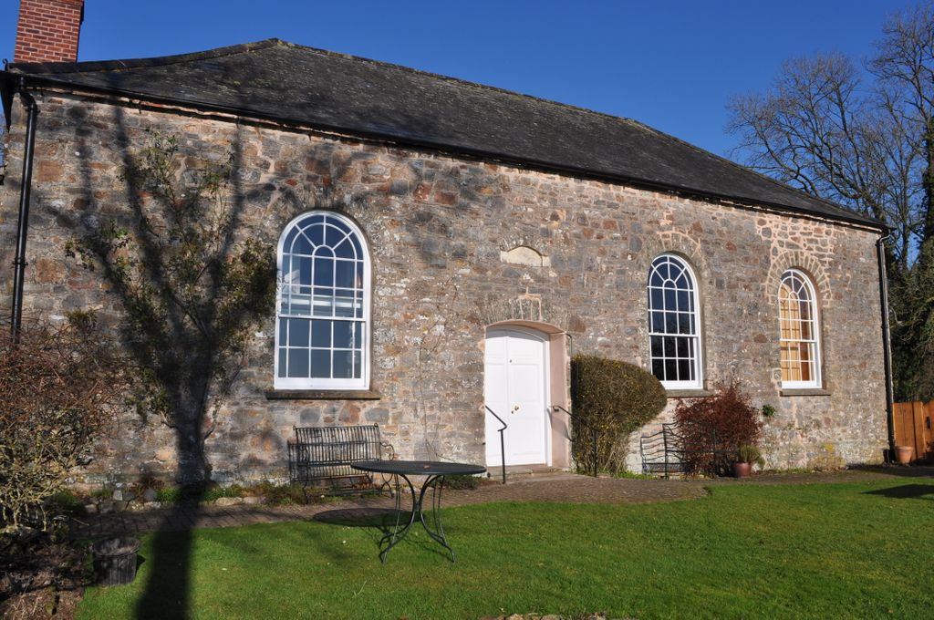
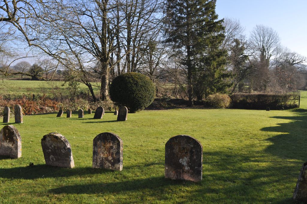
| Description | : | The Quakers purchased the land for this Burial Ground in 1679 when it was illegal to be a Quaker and it was well hidden.The same could be said today. It is quite difficult to find. Leaving the M.5 Motorway at Junction 27 head towards Uffcolme but do not turn towards this village ,continue along the A.38 towards Wellington. Spiceland is signposted as a right turn. This takes you along a very narrow lane, continue for about 1.25 miles. After the 2nd crossroad there is a small sign on your left set back from the road. It is very easy to miss... Read More |
frequently asked questions (FAQ):
-
Where is Spiceland Quaker Burial Ground?
Spiceland Quaker Burial Ground is located at Uffculme, Mid Devon District ,Devon ,England.
-
Spiceland Quaker Burial Ground cemetery's updated grave count on graveviews.com?
0 memorials
-
Where are the coordinates of the Spiceland Quaker Burial Ground?
Latitude: 50.9186560
Longitude: -3.3067630
Nearby Cemetories:
1. Prescott Baptist Chapel
Culmstock, Mid Devon District, England
Coordinate: 50.9212500, -3.2941200
2. St. Mary The Virgin Churchyard
Uffculme, Mid Devon District, England
Coordinate: 50.9062290, -3.3259862
3. Uffculme Cemetery
Uffculme, Mid Devon District, England
Coordinate: 50.9033630, -3.3202260
4. All Saint's Churchyard
Culmstock, Mid Devon District, England
Coordinate: 50.9142907, -3.2783679
5. United Reform Church
Uffculme, Mid Devon District, England
Coordinate: 50.9043090, -3.3341120
6. All Saints Chapelyard
Uffculme, Mid Devon District, England
Coordinate: 50.8803000, -3.3468855
7. St John the Baptist Churchyard
Sampford Peverell, Mid Devon District, England
Coordinate: 50.9200000, -3.3830000
8. Holy Cross Churchyard
Sampford Arundel, Taunton Deane Borough, England
Coordinate: 50.9624184, -3.2722576
9. All Saints Churchyard
Holcombe Rogus, Mid Devon District, England
Coordinate: 50.9630070, -3.3445770
10. St Mary Churchyard
Kentisbeare, Mid Devon District, England
Coordinate: 50.8653700, -3.3233200
11. St. Peter's Churchyard
Wellington, Taunton Deane Borough, England
Coordinate: 50.9736319, -3.3136284
12. Dunkeswell Abbey
Dunkeswell, East Devon District, England
Coordinate: 50.8896955, -3.2203045
13. St. Simon and St. Jude Churchyard
Hockworthy, Mid Devon District, England
Coordinate: 50.9671700, -3.3688400
14. St. Peter's Churchyard
Uplowman, Mid Devon District, England
Coordinate: 50.9305600, -3.4053000
15. St. Margaret's Churchyard
Thorne St Margaret, Taunton Deane Borough, England
Coordinate: 50.9821349, -3.2854411
16. All Saints Churchyard
Wellington, Taunton Deane Borough, England
Coordinate: 50.9727340, -3.2455050
17. Wellington Cemetery
Wellington, Taunton Deane Borough, England
Coordinate: 50.9733000, -3.2403000
18. St. Andrew's Churchyard
Halberton, Mid Devon District, England
Coordinate: 50.9069040, -3.4155350
19. St. John The Baptist Churchyard
Ashbrittle, Taunton Deane Borough, England
Coordinate: 50.9837300, -3.3520800
20. St Nicholas' Church
Kittisford, Taunton Deane Borough, England
Coordinate: 50.9930799, -3.3149354
21. Dunkeswell Methodist Chapel
Dunkeswell, East Devon District, England
Coordinate: 50.8637022, -3.2224202
22. St. Nicholas Churchyard
Dunkeswell, East Devon District, England
Coordinate: 50.8632000, -3.2212900
23. Quaker Burial Ground at Wellington Meeting House
Wellington, Taunton Deane Borough, England
Coordinate: 50.9788260, -3.2263490
24. St John the Baptist Churchyard
Wellington, Taunton Deane Borough, England
Coordinate: 50.9811590, -3.2253540