
| Memorials | : | 0 |
| Location | : | Dunkeswell, East Devon District, England |
| Coordinate | : | 50.8632000, -3.2212900 |
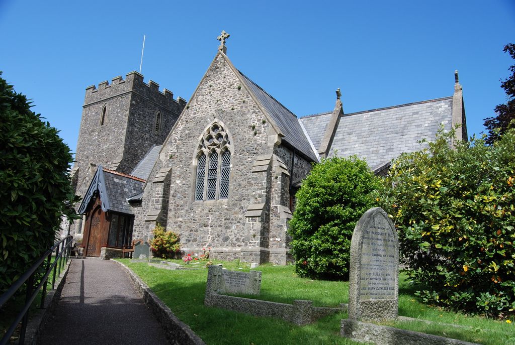
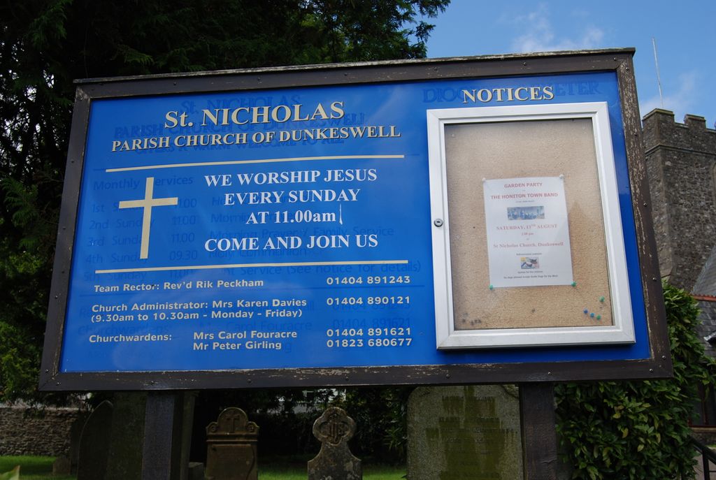
| Description | : | Dunkeswell is a village and civil parish in East Devon, England, located approximately 5 miles north of the town of Honiton. Dunkeswell is notable for having a busy small airfield, now Dunkeswell Aerodrome which was initially established as an American Navy air base during World War II and for Dunkeswell Abbey, founded in 1201 by William Briwere as a Cistercian monastery.This is also now the site of Holy Trinity Church. The church, built in 1868, is of interest for its Norman font from another church. |
frequently asked questions (FAQ):
-
Where is St. Nicholas Churchyard?
St. Nicholas Churchyard is located at Dunkeswell, East Devon District ,Devon , EX14 4QZEngland.
-
St. Nicholas Churchyard cemetery's updated grave count on graveviews.com?
0 memorials
-
Where are the coordinates of the St. Nicholas Churchyard?
Latitude: 50.8632000
Longitude: -3.2212900
Nearby Cemetories:
1. Dunkeswell Methodist Chapel
Dunkeswell, East Devon District, England
Coordinate: 50.8637022, -3.2224202
2. Wolford Chapel
Honiton, East Devon District, England
Coordinate: 50.8395580, -3.2224570
3. Dunkeswell Abbey
Dunkeswell, East Devon District, England
Coordinate: 50.8896955, -3.2203045
4. St Nicholas Churchyard
Combe Raleigh, East Devon District, England
Coordinate: 50.8143800, -3.1957770
5. St. Michael and All Angels Churchyard
Awliscombe, East Devon District, England
Coordinate: 50.8093000, -3.2310200
6. St. Mary's Churchyard
Upottery, East Devon District, England
Coordinate: 50.8619916, -3.1353074
7. All Saint's Churchyard
Culmstock, Mid Devon District, England
Coordinate: 50.9142907, -3.2783679
8. St Mary Churchyard
Kentisbeare, Mid Devon District, England
Coordinate: 50.8653700, -3.3233200
9. St Mary & St Giles Churchyard
Buckerell, East Devon District, England
Coordinate: 50.7960300, -3.2450500
10. Prescott Baptist Chapel
Culmstock, Mid Devon District, England
Coordinate: 50.9212500, -3.2941200
11. Uffculme Cemetery
Uffculme, Mid Devon District, England
Coordinate: 50.9033630, -3.3202260
12. St Michael Churchyard
Honiton, East Devon District, England
Coordinate: 50.7929840, -3.1830800
13. Spiceland Quaker Burial Ground
Uffculme, Mid Devon District, England
Coordinate: 50.9186560, -3.3067630
14. St Peter and St Paul Churchyard
Churchstanton, Taunton Deane Borough, England
Coordinate: 50.9246190, -3.1456810
15. St. Mary The Virgin Churchyard
Uffculme, Mid Devon District, England
Coordinate: 50.9062290, -3.3259862
16. St. Andrew's Churchyard
Feniton, East Devon District, England
Coordinate: 50.7872510, -3.2660760
17. All Saints Chapelyard
Uffculme, Mid Devon District, England
Coordinate: 50.8803000, -3.3468855
18. United Reform Church
Uffculme, Mid Devon District, England
Coordinate: 50.9043090, -3.3341120
19. St. Michael's Churchyard
Gittisham, East Devon District, England
Coordinate: 50.7785700, -3.2301300
20. United Reform Churchyard
Plymtree, East Devon District, England
Coordinate: 50.8240790, -3.3420350
21. St. Mary's Church
Offwell, East Devon District, England
Coordinate: 50.7900391, -3.1435305
22. St. John the Baptist Churchyard
Plymtree, East Devon District, England
Coordinate: 50.8177000, -3.3474880
23. St. John the Baptist Churchyard
Yarcombe, East Devon District, England
Coordinate: 50.8684300, -3.0738200
24. St Leonard
Otterford, Taunton Deane Borough, England
Coordinate: 50.9231330, -3.1077720