
| Memorials | : | 0 |
| Location | : | Radipole, Weymouth and Portland Borough, England |
| Coordinate | : | 50.6309300, -2.4718080 |
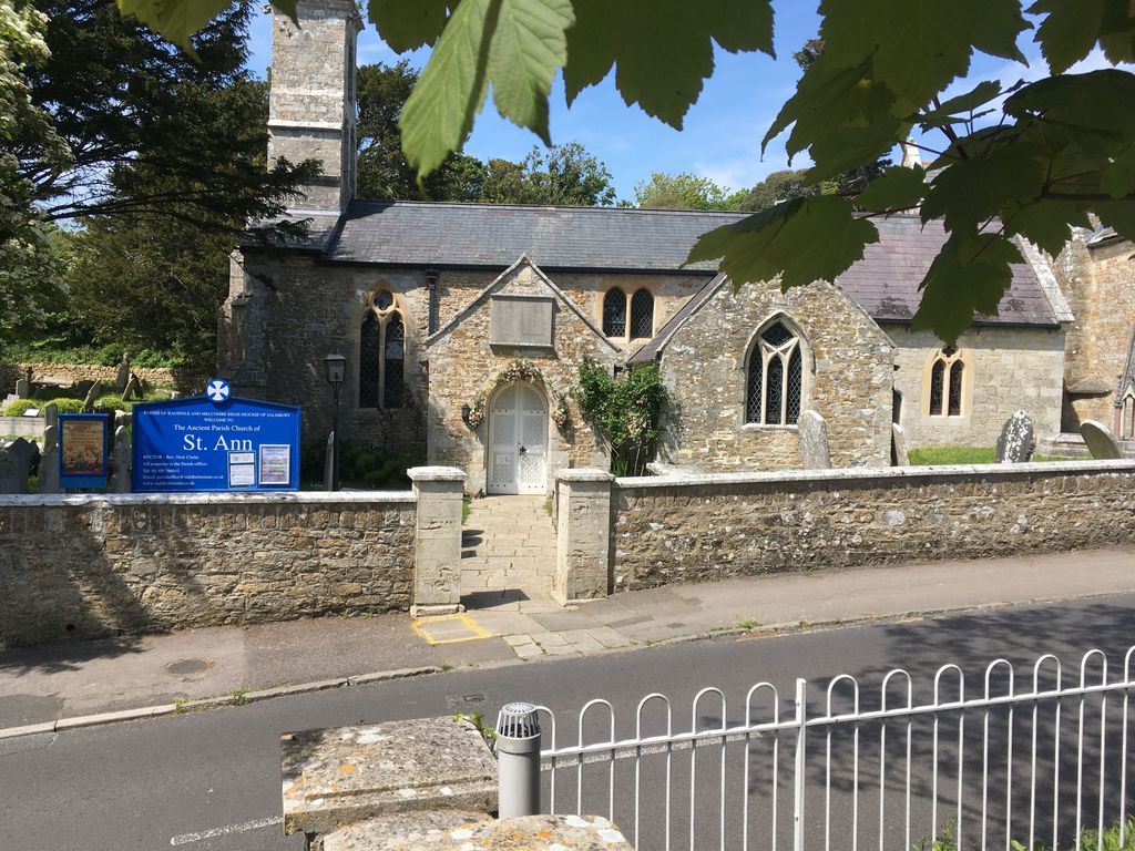
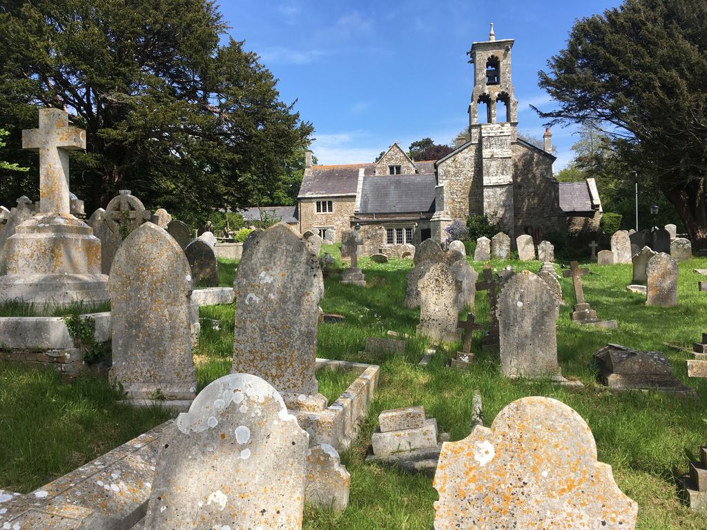
| Description | : | Originally St. Ann's Radipole, the church was built circa 1250 and was called by this name until 1605 when the name was changed to St. Mary's, the mother church of Melcombe Regis. The name was again changed in 1927 to St. Ann's Church. Buried in the churchyard are victims of Weymouth's most famous shipwreck of the EARL OF ABERGAVENNY in 1805. Please distinguish burials in the original churchyard from the extension across the road to the south. |
frequently asked questions (FAQ):
-
Where is St Ann's Churchyard?
St Ann's Churchyard is located at Radipole, Weymouth and Portland Borough ,Dorset ,England.
-
St Ann's Churchyard cemetery's updated grave count on graveviews.com?
0 memorials
-
Where are the coordinates of the St Ann's Churchyard?
Latitude: 50.6309300
Longitude: -2.4718080
Nearby Cemetories:
1. St. Ann Churchyard Extension
Radipole, Weymouth and Portland Borough, England
Coordinate: 50.6307800, -2.4717620
2. Melcombe Regis Cemetery
Melcombe Regis, Weymouth and Portland Borough, England
Coordinate: 50.6139440, -2.4638980
3. Weymouth Crematorium
Weymouth, Weymouth and Portland Borough, England
Coordinate: 50.6120410, -2.4780820
4. St Nicholas Churchyard
Broadwey, Weymouth and Portland Borough, England
Coordinate: 50.6504630, -2.4712110
5. Weymouth Cemetery
Weymouth, Weymouth and Portland Borough, England
Coordinate: 50.6111600, -2.4779300
6. Broadwey New Cemetery
Broadwey, Weymouth and Portland Borough, England
Coordinate: 50.6512040, -2.4702530
7. St Mary Churchyard
Chickerell, West Dorset District, England
Coordinate: 50.6248150, -2.5047940
8. Bury Street
Weymouth, Weymouth and Portland Borough, England
Coordinate: 50.6094140, -2.4564470
9. St Mary's Church
Melcombe Regis, Weymouth and Portland Borough, England
Coordinate: 50.6080830, -2.4542650
10. Friends Burial Ground
Weymouth, Weymouth and Portland Borough, England
Coordinate: 50.6063770, -2.4502930
11. Old Parish Churchyard
Fleet, West Dorset District, England
Coordinate: 50.6189940, -2.5166130
12. Holy Trinity Churchyard
Fleet, West Dorset District, England
Coordinate: 50.6232390, -2.5190020
13. Wyke Regis New Burial Ground
Wyke Regis, Weymouth and Portland Borough, England
Coordinate: 50.5995100, -2.4789800
14. All Saints Churchyard
Wyke Regis, Weymouth and Portland Borough, England
Coordinate: 50.5990390, -2.4789720
15. Holy Trinity
Bincombe, West Dorset District, England
Coordinate: 50.6598000, -2.4449000
16. St Laurence Churchyard
Upwey, Weymouth and Portland Borough, England
Coordinate: 50.6658560, -2.4813840
17. St. Andrew's Churchyard
Preston, West Dorset District, England
Coordinate: 50.6456500, -2.4173900
18. Langton Herring Church Cemetery
Weymouth, Weymouth and Portland Borough, England
Coordinate: 50.6408910, -2.5458540
19. St. Peter's Churchyard
Langton Herring, West Dorset District, England
Coordinate: 50.6406450, -2.5468010
20. St Osmund's Churchyard
Osmington, West Dorset District, England
Coordinate: 50.6459250, -2.3909880
21. Portland Strangers Burial Ground
Portland, Weymouth and Portland Borough, England
Coordinate: 50.5641684, -2.4469886
22. Portland Naval Cemetery
Portland, Weymouth and Portland Borough, England
Coordinate: 50.5653915, -2.4370630
23. St Peters Churchyard
Portesham, West Dorset District, England
Coordinate: 50.6709000, -2.5638000
24. St John the Evangelist Churchyard
Poxwell, West Dorset District, England
Coordinate: 50.6555000, -2.3663000