
| Memorials | : | 0 |
| Location | : | Poxwell, West Dorset District, England |
| Coordinate | : | 50.6555000, -2.3663000 |
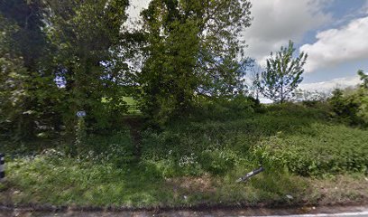
| Description | : | St John's Church was consecrated in 1868, to replace an earlier church at the same location. The church was made redundant when the parish of Poxwell was joined with Osmington, and demolished in 1969 as it was unsafe and too expensive to maintain. The churchyard is still on the site. |
frequently asked questions (FAQ):
-
Where is St John the Evangelist Churchyard?
St John the Evangelist Churchyard is located at Poxwell, West Dorset District ,Dorset ,England.
-
St John the Evangelist Churchyard cemetery's updated grave count on graveviews.com?
0 memorials
-
Where are the coordinates of the St John the Evangelist Churchyard?
Latitude: 50.6555000
Longitude: -2.3663000
Nearby Cemetories:
1. St Osmund's Churchyard
Osmington, West Dorset District, England
Coordinate: 50.6459250, -2.3909880
2. St. Martin's Churchyard
Broadmayne, West Dorset District, England
Coordinate: 50.6787530, -2.3856840
3. St. Michael's Church
Owermoigne, West Dorset District, England
Coordinate: 50.6671120, -2.3284310
4. St Catherine-by-the-Sea
Weymouth, Weymouth and Portland Borough, England
Coordinate: 50.6342230, -2.3370640
5. St. Andrew's Churchyard
Preston, West Dorset District, England
Coordinate: 50.6456500, -2.4173900
6. St Nicholas Churchyard
Chaldon Herring, Purbeck District, England
Coordinate: 50.6473100, -2.2983330
7. Holy Trinity
Bincombe, West Dorset District, England
Coordinate: 50.6598000, -2.4449000
8. West Stafford New Burial Ground
Dorchester, West Dorset District, England
Coordinate: 50.7050192, -2.3872764
9. St. Christopher's Churchyard
Winfrith Newburgh, Purbeck District, England
Coordinate: 50.6585210, -2.2768930
10. Broadwey New Cemetery
Broadwey, Weymouth and Portland Borough, England
Coordinate: 50.6512040, -2.4702530
11. St Nicholas Churchyard
Broadwey, Weymouth and Portland Borough, England
Coordinate: 50.6504630, -2.4712110
12. Fordington Cemetery
Dorchester, West Dorset District, England
Coordinate: 50.7131110, -2.4263720
13. Dorchester Cemetery
Dorchester, West Dorset District, England
Coordinate: 50.7062110, -2.4422800
14. St George's Churchyard
Fordington, West Dorset District, England
Coordinate: 50.7136510, -2.4286550
15. Maumbury Rings Cemetery
Dorchester, West Dorset District, England
Coordinate: 50.7079000, -2.4403900
16. Dorchester Gallows Hill Cemetery
Dorchester, West Dorset District, England
Coordinate: 50.7127930, -2.4315480
17. St Ann's Churchyard
Radipole, Weymouth and Portland Borough, England
Coordinate: 50.6309300, -2.4718080
18. St. Ann Churchyard Extension
Radipole, Weymouth and Portland Borough, England
Coordinate: 50.6307800, -2.4717620
19. Friends Burial Ground
Weymouth, Weymouth and Portland Borough, England
Coordinate: 50.6063770, -2.4502930
20. Moreton Cemetery
Moreton, Purbeck District, England
Coordinate: 50.7024300, -2.2790900
21. St Nicholas Churchyard
Moreton, Purbeck District, England
Coordinate: 50.7023040, -2.2786470
22. St Mary's Church
Melcombe Regis, Weymouth and Portland Borough, England
Coordinate: 50.6080830, -2.4542650
23. Bury Street
Weymouth, Weymouth and Portland Borough, England
Coordinate: 50.6094140, -2.4564470
24. St Laurence Churchyard
Upwey, Weymouth and Portland Borough, England
Coordinate: 50.6658560, -2.4813840