
| Memorials | : | 0 |
| Location | : | Bischofsmais, Landkreis Regen, Germany |
| Coordinate | : | 48.9191000, 13.0728000 |
frequently asked questions (FAQ):
-
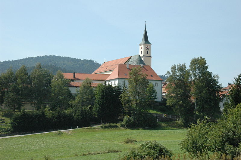
Where is St. Jakobus der Ältere Church Cemetery?
St. Jakobus der Ältere Church Cemetery is located at Bischofsmais, Landkreis Regen ,Bavaria (Bayern) ,Germany.
-
St. Jakobus der Ältere Church Cemetery cemetery's updated grave count on graveviews.com?
0 memorials
-
Where are the coordinates of the St. Jakobus der Ältere Church Cemetery?
Latitude: 48.9191000
Longitude: 13.0728000
Nearby Cemetories:
1. Kirche St. Michael
Regen, Landkreis Regen, Germany
Coordinate: 48.9701352, 13.1276074
2. Pfarrfriedhof Regen
Regen, Landkreis Regen, Germany
Coordinate: 48.9736679, 13.1289484
3. Friedhof Grafling
Grafling, Landkreis Deggendorf, Germany
Coordinate: 48.8974923, 12.9750320
4. Friedhof Schaufling
Schaufling, Landkreis Deggendorf, Germany
Coordinate: 48.8453672, 13.0643871
5. Friedhof Ruhmannsfelden
Ruhmannsfelden, Landkreis Regen, Germany
Coordinate: 48.9855501, 12.9893085
6. Friedhof Langdorf-Regen
Langdorf, Landkreis Regen, Germany
Coordinate: 49.0113590, 13.1504620
7. Friedhof Patersdorf
Patersdorf, Landkreis Regen, Germany
Coordinate: 49.0133615, 12.9868946
8. Waldfriedhof Deggendorf
Deggendorf, Landkreis Deggendorf, Germany
Coordinate: 48.8293482, 12.9658251
9. Pfarrkirche Mariä Himmelfahrt
Deggendorf, Landkreis Deggendorf, Germany
Coordinate: 48.8286100, 12.9639310
10. Auerbach Cemetery
Auerbach, Landkreis Deggendorf, Germany
Coordinate: 48.8029604, 13.0986468
11. Klosterkirche St. Michael
Metten, Landkreis Deggendorf, Germany
Coordinate: 48.8553690, 12.9178250
12. Friedhof Schöfweg
Schöfweg, Landkreis Freyung-Grafenau, Germany
Coordinate: 48.8392757, 13.2264352
13. Friedhof Teisnach
Teisnach, Landkreis Regen, Germany
Coordinate: 49.0371363, 12.9911311
14. Friedhof Zwiesel
Zwiesel, Landkreis Regen, Germany
Coordinate: 49.0153700, 13.2367100
15. Bodenmais Friedhof
Bodenmais, Landkreis Regen, Germany
Coordinate: 49.0691810, 13.0951600
16. Niederaltaich Abbey
Passau, Stadtkreis Passau, Germany
Coordinate: 48.7661110, 13.0277780
17. Pfarrkirche Mariä Himmelfahrt
Frauenau, Landkreis Regen, Germany
Coordinate: 48.9894210, 13.2997940
18. Friedhof Kirchaitnach
Kirchaitnach, Landkreis Regen, Germany
Coordinate: 49.0353843, 12.8885559
19. Friedhof St. Laurentius und St. Gotthard
Schwanenkirchen, Landkreis Deggendorf, Germany
Coordinate: 48.7485527, 13.1035322
20. Friedhof Sankt Johannes der Täufer, Schöllnach
Schöllnach, Landkreis Deggendorf, Germany
Coordinate: 48.7574438, 13.1849557
21. Katholischer Friedhof
Plattling, Landkreis Deggendorf, Germany
Coordinate: 48.7725900, 12.8912400
22. Friedhof St. Simon und Judas Thaddäus, Kurzenisar
Kurzenisarhofen, Landkreis Deggendorf, Germany
Coordinate: 48.7449710, 12.9509345
23. Friedhof Viechtach
Viechtach, Landkreis Regen, Germany
Coordinate: 49.0764789, 12.8849695
24. Friedhof Außernzell
Außernzell, Landkreis Deggendorf, Germany
Coordinate: 48.7222433, 13.2019709