
| Memorials | : | 0 |
| Location | : | Crowden, High Peak Borough, England |
| Coordinate | : | 53.4921410, 1.8811550 |
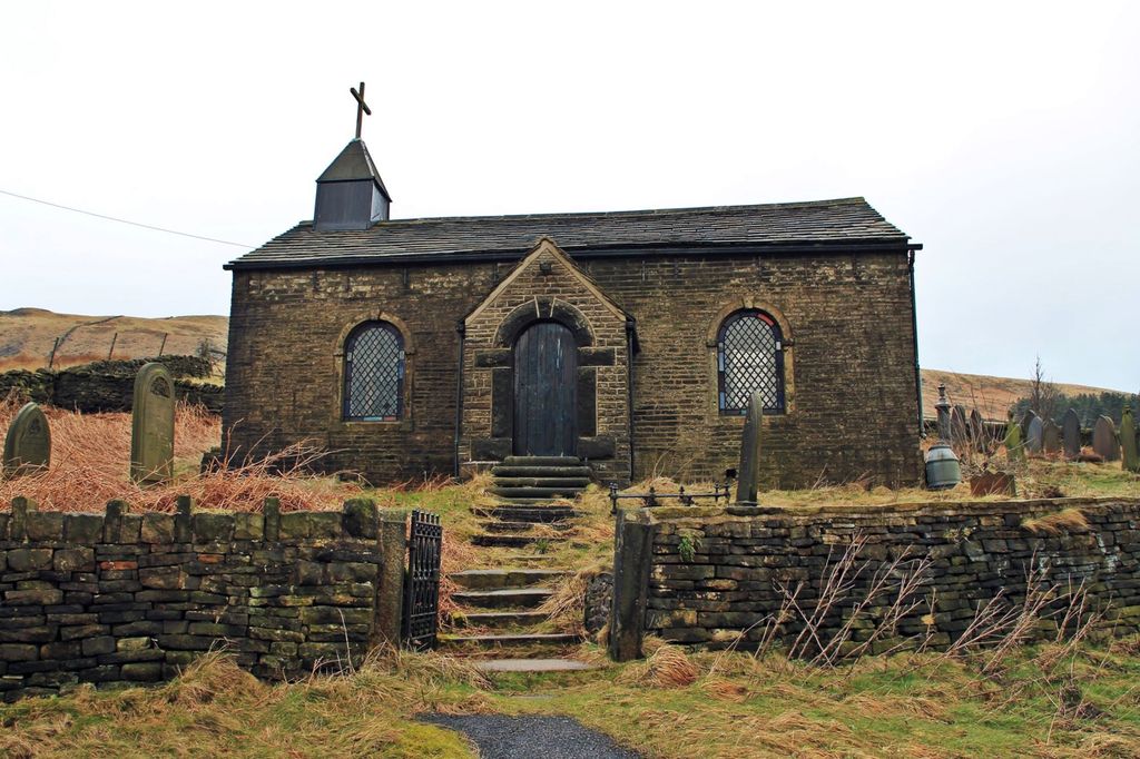
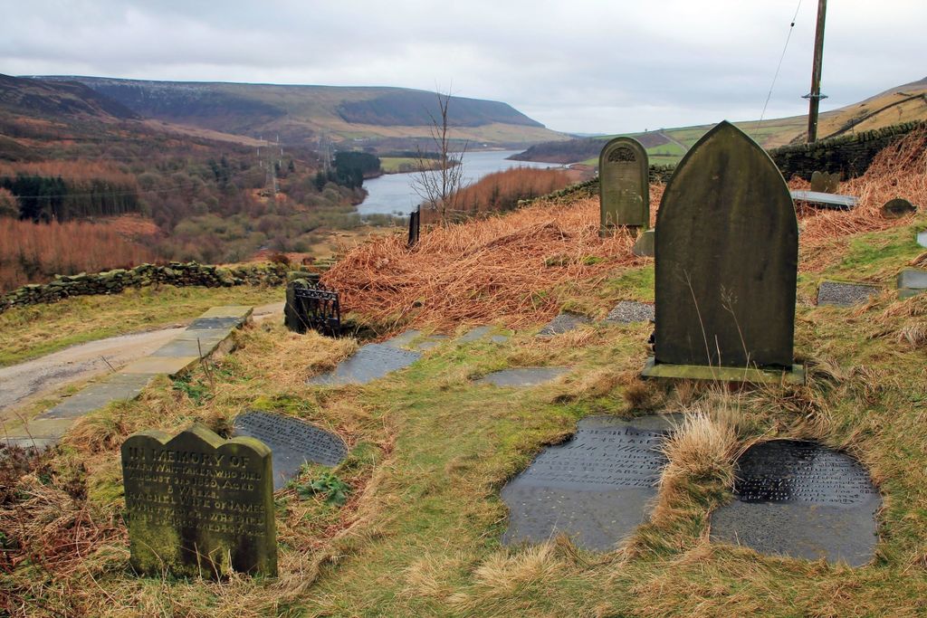
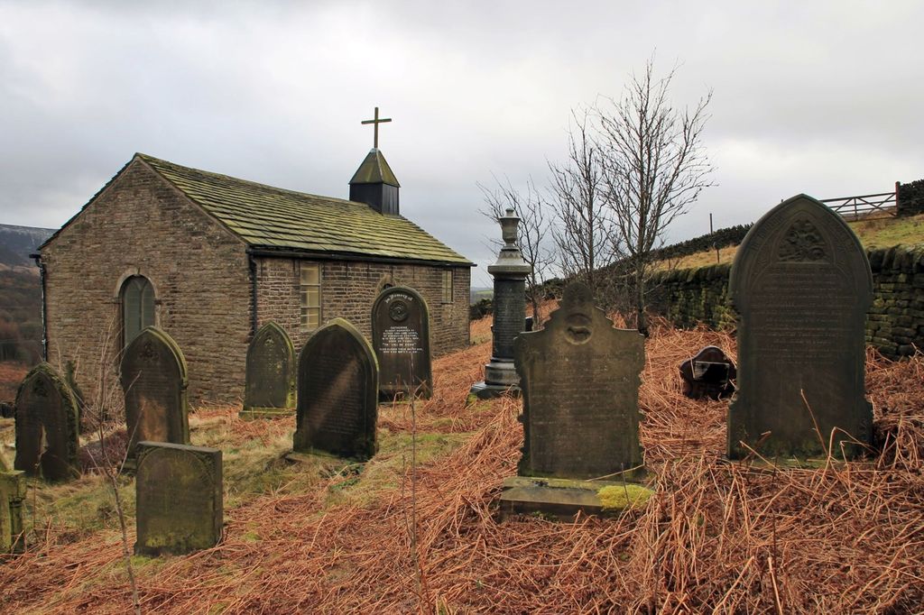
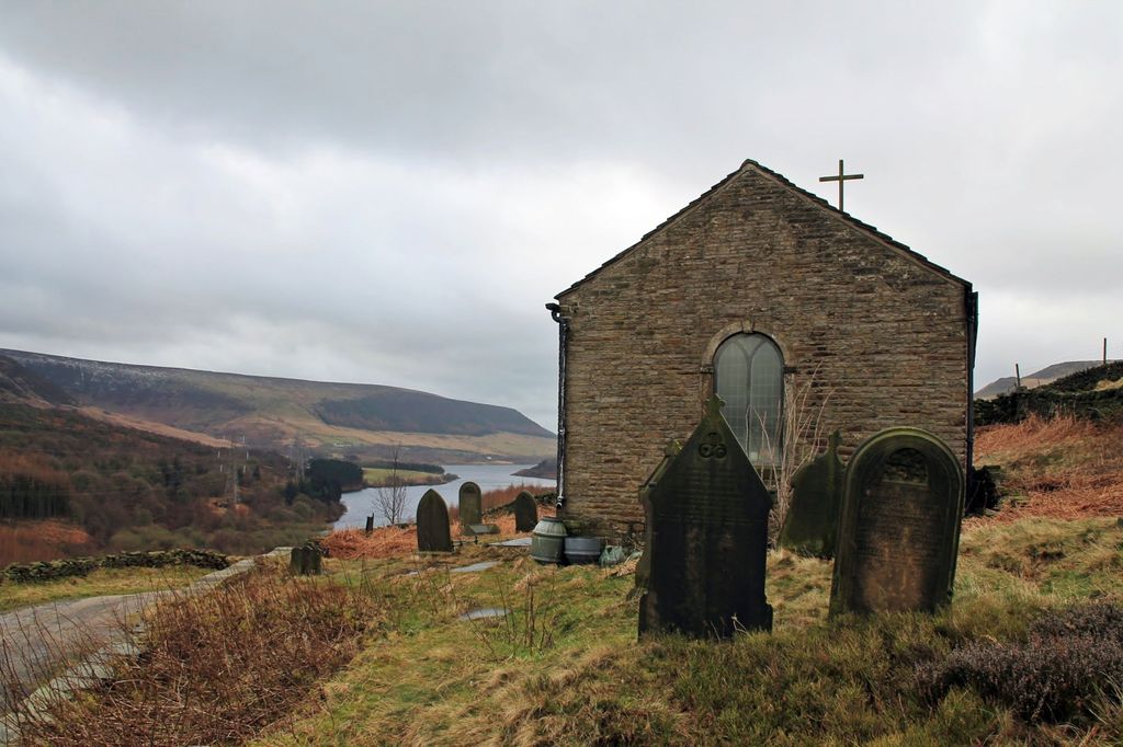
| Description | : | St James Chapel Woodhead, Crowden-in-Longdendale Grade-II-listed mid-18th-century chapel. Among Victorian slate gravestones in the churchyard are the unmarked graves of navvies who died working on the Woodhead Tunnels. A simple and affecting building (interior usually locked) in an atmospheric spot, with a well-preserved cobbled quarrymen's track leading up the hill behind the church to Loftend Quarry. Occasional Anglican services. |
frequently asked questions (FAQ):
-
Where is St. James Chapelyard?
St. James Chapelyard is located at Crowden, High Peak Borough ,Derbyshire ,England.
-
St. James Chapelyard cemetery's updated grave count on graveviews.com?
0 memorials
-
Where are the coordinates of the St. James Chapelyard?
Latitude: 53.4921410
Longitude: 1.8811550
Nearby Cemetories:
1. St Mary the Virgin
Manchester, Metropolitan Borough of Manchester, England
Coordinate: 53.4839000, 2.3334000
2. Church of St. Mary the Virgin
Beighton, Metropolitan Borough of Sheffield, England
Coordinate: 53.3446000, 1.3356000
3. St Mary's Church
Bolsover, Bolsover District, England
Coordinate: 53.2310000, 1.2897000
4. Addingham Church Orchard
Addingham, Metropolitan Borough of Bradford, England
Coordinate: 53.9456460, 1.8856610
5. Friends Burial Ground at Farfield
Addingham, Metropolitan Borough of Bradford, England
Coordinate: 53.9621000, 1.8855000
6. St. Peter and St. Paul Churchyard
Cromer, North Norfolk District, England
Coordinate: 52.9312500, 1.3011111
7. St. Martin's Churchyard
Overstrand, North Norfolk District, England
Coordinate: 52.9174550, 1.3314910
8. Cromer Old Cemetery
Cromer, North Norfolk District, England
Coordinate: 52.9292270, 1.2897670
9. All Saints Churchyard
Mundesley, North Norfolk District, England
Coordinate: 52.8803700, 1.4324000
10. All Saints Churchyard
Beeston Regis, North Norfolk District, England
Coordinate: 52.9408700, 1.2340790
11. St. Mary's Churchyard
Northrepps, North Norfolk District, England
Coordinate: 52.9019100, 1.3361300
12. Cromer Cemetery
Cromer, North Norfolk District, England
Coordinate: 52.9204800, 1.2730300
13. All Saints Churchyard
Gimingham, North Norfolk District, England
Coordinate: 52.8790220, 1.3948380
14. St Margaret Churchyard
Paston, North Norfolk District, England
Coordinate: 52.8575930, 1.4491160
15. St. Andrew Churchyard
Bacton, North Norfolk District, England
Coordinate: 52.8500500, 1.4676900
16. Bromholm Priory
Bacton, North Norfolk District, England
Coordinate: 52.8458000, 1.4846000
17. St Peter & St Paul Churchyard
Knapton, North Norfolk District, England
Coordinate: 52.8555000, 1.4260000
18. St. John the Baptist Churchyard
Aylmerton, North Norfolk District, England
Coordinate: 52.9139032, 1.2435925
19. St. Margaret Churchyard
Felbrigg, North Norfolk District, England
Coordinate: 52.9035450, 1.2660760
20. All Saints, Edingthorpe
Bacton, North Norfolk District, England
Coordinate: 52.8454870, 1.4482110
21. Saint Mary Churchyard
Happisburgh, North Norfolk District, England
Coordinate: 52.8250640, 1.5308930
22. St. Mary Churchyard
Roughton, North Norfolk District, England
Coordinate: 52.8801901, 1.2976948
23. St. Andrew's Churchyard
Metton, North Norfolk District, England
Coordinate: 52.8880460, 1.2670590
24. St. Margaret's Churchyard
Witton, Broadland District, England
Coordinate: 52.8313690, 1.4582740