
| Memorials | : | 0 |
| Location | : | Hambuch, Landkreis Cochem-Zell, Germany |
| Website | : | www.hambuch.info/kirche.html |
| Coordinate | : | 50.2258690, 7.1870719 |
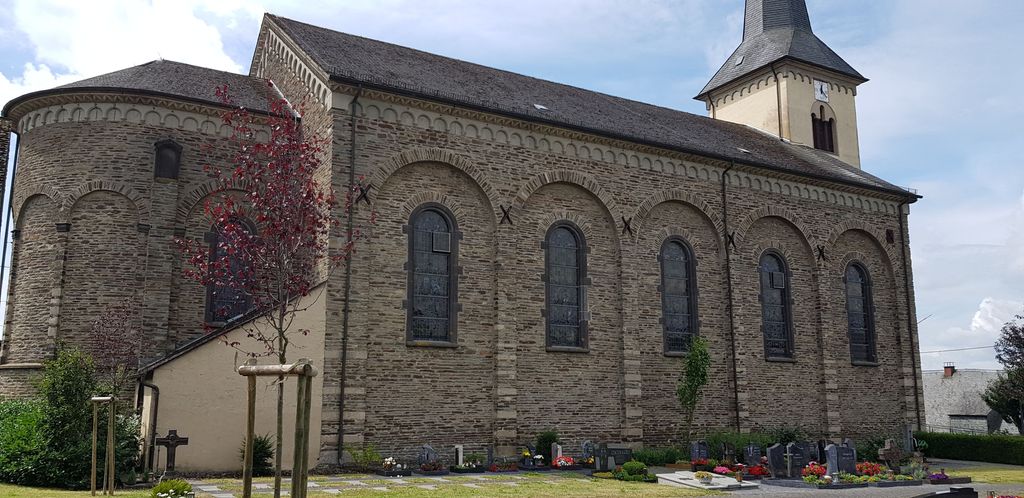
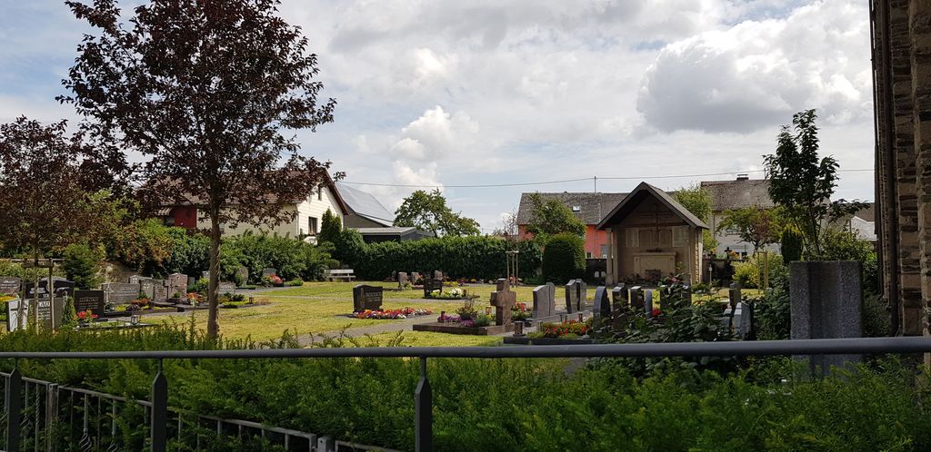
| Description | : | Small catholic church with small churchyard in the middle of a village. The church is also competent for the villages of Eulgem, Gamlen and Zettingen which do have own churches but no graveyard. |
frequently asked questions (FAQ):
-
Where is St. Johannes Church Cemetery?
St. Johannes Church Cemetery is located at Kirchstrasse Hambuch, Landkreis Cochem-Zell ,Rheinland-Pfalz , 56761Germany.
-
St. Johannes Church Cemetery cemetery's updated grave count on graveviews.com?
0 memorials
-
Where are the coordinates of the St. Johannes Church Cemetery?
Latitude: 50.2258690
Longitude: 7.1870719
Nearby Cemetories:
1. Klotten Cemetery
Klotten, Landkreis Cochem-Zell, Germany
Coordinate: 50.1670250, 7.1975975
2. Friedhof Cochem
Cochem, Landkreis Cochem-Zell, Germany
Coordinate: 50.1457712, 7.1640547
3. Friedhof am Katzenberger Weg
Mayen, Landkreis Mayen-Koblenz, Germany
Coordinate: 50.3262048, 7.2344167
4. Friedhof Polch
Andernach, Landkreis Mayen-Koblenz, Germany
Coordinate: 50.2940860, 7.3200680
5. Retterath Catholic Church Cemetery -Pfarrkirche St. Remigius
Retterath, Landkreis Vulkaneifel, Germany
Coordinate: 50.2719100, 7.0202170
6. Beilstein Jewish Cemetery
Beilstein, Landkreis Cochem-Zell, Germany
Coordinate: 50.1057140, 7.2374635
7. Dorweiler Dommershausen Cemetery
Dorweiler, Rhein-Hunsrück-Kreis, Germany
Coordinate: 50.1394803, 7.4226174
8. Friedhof Weibern
Weibern, Landkreis Ahrweiler, Germany
Coordinate: 50.4048060, 7.1473623
9. Jüdischer Friedhof
Gondorf, Landkreis Mayen-Koblenz, Germany
Coordinate: 50.3011078, 7.4580223
10. Friedhof Kobern
Kobern, Landkreis Mayen-Koblenz, Germany
Coordinate: 50.3092374, 7.4545719
11. Friedhof Kruft
Kruft, Landkreis Mayen-Koblenz, Germany
Coordinate: 50.3899272, 7.3427571
12. Friedhof Kempenich
Kempenich, Landkreis Ahrweiler, Germany
Coordinate: 50.4207680, 7.1205952
13. St Jakobus Cemetery
Kaimt, Landkreis Cochem-Zell, Germany
Coordinate: 50.0249600, 7.1770120
14. Weinfelder Friedhof
Schalkenmehren, Landkreis Vulkaneifel, Germany
Coordinate: 50.1789544, 6.8493504
15. Friedhof Miesenheim
Miesenheim, Landkreis Mayen-Koblenz, Germany
Coordinate: 50.3972982, 7.4060814
16. Friedhof Winningen
Winningen, Landkreis Mayen-Koblenz, Germany
Coordinate: 50.3159342, 7.5196703
17. Friedhof
Schwall, Rhein-Hunsrück-Kreis, Germany
Coordinate: 50.1487203, 7.5567384
18. Karmeliterkirche
Boppard, Rhein-Hunsrück-Kreis, Germany
Coordinate: 50.2325000, 7.5884440
19. Wurrich Friedhof
Wurrich, Rhein-Hunsrück-Kreis, Germany
Coordinate: 49.9790076, 7.3017156
20. Kloster Marienberg
Boppard, Rhein-Hunsrück-Kreis, Germany
Coordinate: 50.2291670, 7.5958330
21. Hahn-Hunsrück
Hahn, Rhein-Hunsrück-Kreis, Germany
Coordinate: 49.9638100, 7.2712330
22. St. Laurentius Cemetery
Koblenz, Stadtkreis Koblenz, Germany
Coordinate: 50.3505819, 7.5605990
23. Alter Friedhof Neuwied
Neuwied, Landkreis Neuwied, Germany
Coordinate: 50.4271479, 7.4692204
24. Friedhof Feldkirchen
Neuwied, Landkreis Neuwied, Germany
Coordinate: 50.4512190, 7.4320662