
| Memorials | : | 1 |
| Location | : | North East Derbyshire District, England |
| Website | : | derbyshirechurches.org/church/ridgeway-st-john-evangelist |
| Coordinate | : | 53.3262300, -1.3987400 |
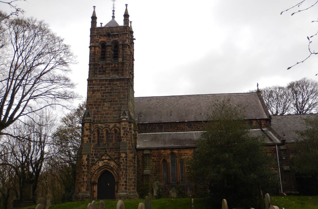
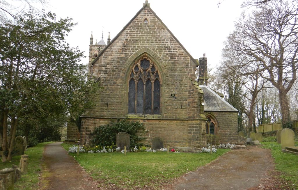
| Description | : | A Gothic style church built between 1838-1840 with the tower being added in 1883-4. |
frequently asked questions (FAQ):
-
Where is St. John the Evangelist Churchyard?
St. John the Evangelist Churchyard is located at Ridgeway North East Derbyshire District ,Derbyshire , S12 3XXEngland.
-
St. John the Evangelist Churchyard cemetery's updated grave count on graveviews.com?
1 memorials
-
Where are the coordinates of the St. John the Evangelist Churchyard?
Latitude: 53.3262300
Longitude: -1.3987400
Nearby Cemetories:
1. Ridgeway Methodist Church Cemetery
Sheffield, Metropolitan Borough of Sheffield, England
Coordinate: 53.3248360, -1.3979360
2. Christ Churchyard
Hackenthorpe, Metropolitan Borough of Sheffield, England
Coordinate: 53.3431600, -1.3788200
3. Gleadless Christ Church
Sheffield, Metropolitan Borough of Sheffield, England
Coordinate: 53.3513350, -1.4234520
4. Eckington Cemetery
Eckington, North East Derbyshire District, England
Coordinate: 53.3159630, -1.3517140
5. St Peter and St Paul Churchyard
Eckington, North East Derbyshire District, England
Coordinate: 53.3132130, -1.3530820
6. Intake Village Cemetery
Sheffield, Metropolitan Borough of Sheffield, England
Coordinate: 53.3569900, -1.4151300
7. Woodhouse Cemetery
Sheffield, Metropolitan Borough of Sheffield, England
Coordinate: 53.3591540, -1.3779410
8. Woodhouse Wesleyan
Woodhouse, Metropolitan Borough of Sheffield, England
Coordinate: 53.3589580, -1.3734300
9. St. James' Churchyard
Metropolitan Borough of Sheffield, England
Coordinate: 53.3355370, -1.4623400
10. Revill Lane Cemetery
Sheffield, Metropolitan Borough of Sheffield, England
Coordinate: 53.3605835, -1.3673935
11. St James Churchyard
Metropolitan Borough of Sheffield, England
Coordinate: 53.3351755, -1.4627557
12. Beighton Cemetery
Beighton, Metropolitan Borough of Sheffield, England
Coordinate: 53.3427760, -1.3376390
13. Cinder Hill Quaker Burial Ground
Sheffield, Metropolitan Borough of Sheffield, England
Coordinate: 53.3666700, -1.3744500
14. Old Burial Ground
Handsworth, Metropolitan Borough of Sheffield, England
Coordinate: 53.3711700, -1.3847900
15. Saint Marys Old Burial Ground
Sheffield, Metropolitan Borough of Sheffield, England
Coordinate: 53.3712600, -1.3845600
16. St Joseph Roman Catholic Churchyard
Handsworth, Metropolitan Borough of Sheffield, England
Coordinate: 53.3722000, -1.3852900
17. Ballifield Hall Cemetery
Handsworth, Metropolitan Borough of Sheffield, England
Coordinate: 53.3708850, -1.3747270
18. Dronfield Cemetery
Dronfield, North East Derbyshire District, England
Coordinate: 53.2968660, -1.4626160
19. Handsworth Old Cemetery
Sheffield, Metropolitan Borough of Sheffield, England
Coordinate: 53.3733495, -1.3776688
20. Handsworth New Cemetery
Sheffield, Metropolitan Borough of Sheffield, England
Coordinate: 53.3733800, -1.3776200
21. Norton Cemetery
Sheffield, Metropolitan Borough of Sheffield, England
Coordinate: 53.3467600, -1.4748720
22. City Road Cemetery and Crematorium
Sheffield, Metropolitan Borough of Sheffield, England
Coordinate: 53.3694760, -1.4406940
23. St. Giles Parish Church
Killamarsh, North East Derbyshire District, England
Coordinate: 53.3236200, -1.3092600
24. Christ Church
Heeley, Metropolitan Borough of Sheffield, England
Coordinate: 53.3604900, -1.4678980