
| Memorials | : | 0 |
| Location | : | Sheffield, Metropolitan Borough of Sheffield, England |
| Coordinate | : | 53.3569900, -1.4151300 |
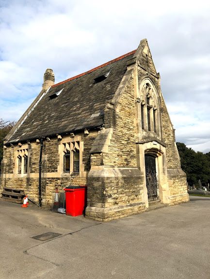
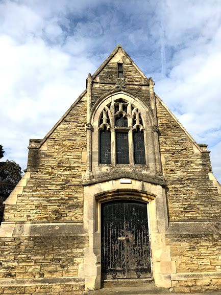
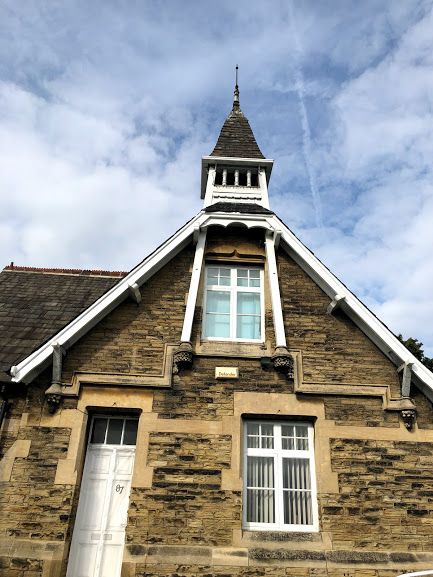
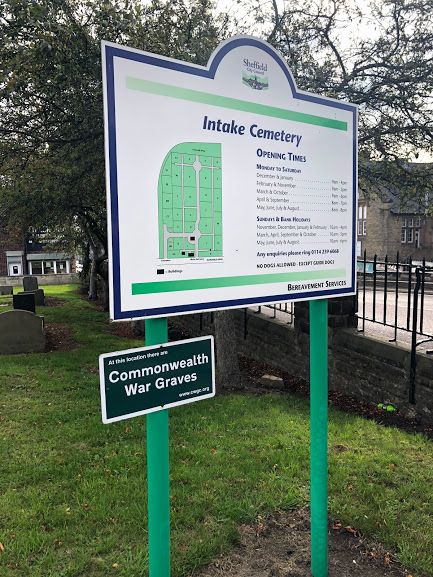
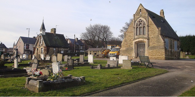
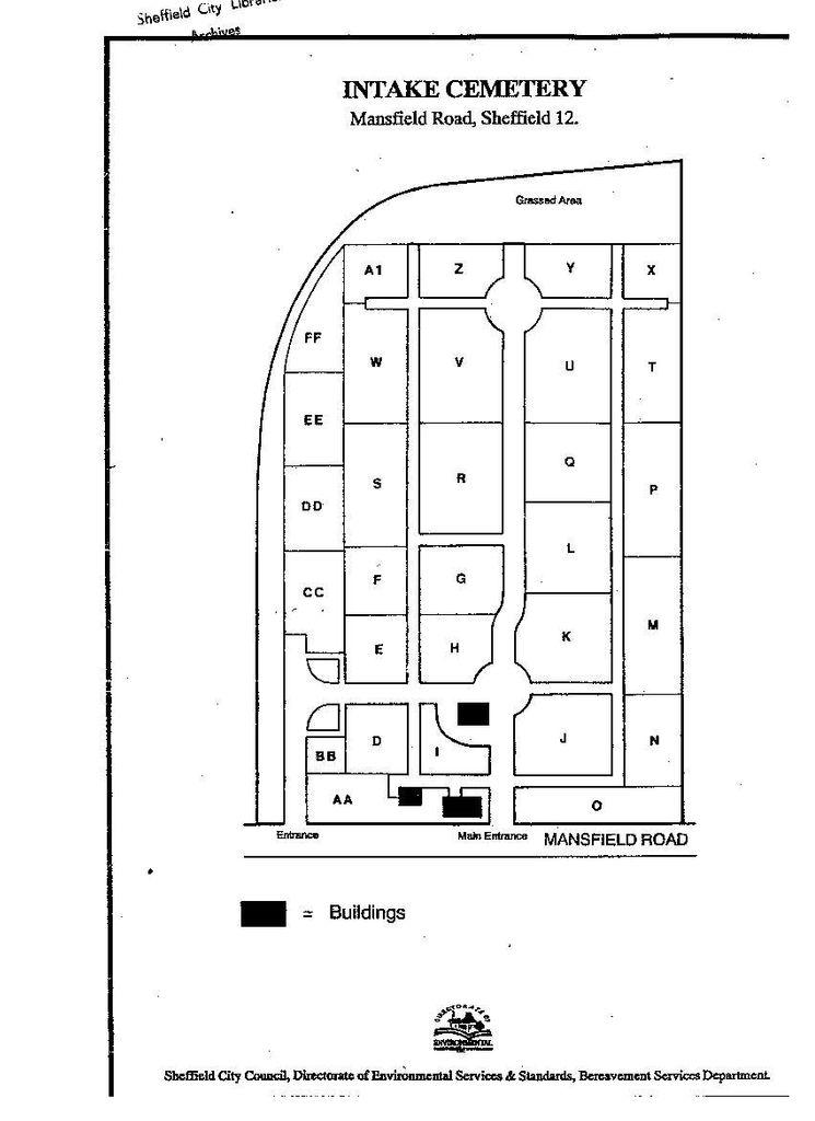
| Description | : | Intake Cemetery not to be confused with Sheffield Intake Cemetery, later renamed City Road Cemetery. It was opened in 1880, the first interment taking place on 16 February. The cemetery covers 12 acres and has a chapel that is a grade II listed building.[Date Listed: 12 December 1995] The cemetery chapel is of coursed squared stone with ashlar dressings and stone slate roof gothic Revival style, Plinth, sillband, eaves corbels, coped gables, the east one shouldered, the west one with gable stack. Single storey; 2 window range. East gable has deeper plinth and flanking buttresses. Projecting centre has a traceried 3-light... Read More |
frequently asked questions (FAQ):
-
Where is Intake Village Cemetery?
Intake Village Cemetery is located at Mansfield Road Sheffield, Metropolitan Borough of Sheffield ,South Yorkshire , S12 2AJEngland.
-
Intake Village Cemetery cemetery's updated grave count on graveviews.com?
0 memorials
-
Where are the coordinates of the Intake Village Cemetery?
Latitude: 53.3569900
Longitude: -1.4151300
Nearby Cemetories:
1. Gleadless Christ Church
Sheffield, Metropolitan Borough of Sheffield, England
Coordinate: 53.3513350, -1.4234520
2. City Road Cemetery and Crematorium
Sheffield, Metropolitan Borough of Sheffield, England
Coordinate: 53.3694760, -1.4406940
3. Woodhouse Cemetery
Sheffield, Metropolitan Borough of Sheffield, England
Coordinate: 53.3591540, -1.3779410
4. Old Burial Ground
Handsworth, Metropolitan Borough of Sheffield, England
Coordinate: 53.3711700, -1.3847900
5. Saint Marys Old Burial Ground
Sheffield, Metropolitan Borough of Sheffield, England
Coordinate: 53.3712600, -1.3845600
6. St Joseph Roman Catholic Churchyard
Handsworth, Metropolitan Borough of Sheffield, England
Coordinate: 53.3722000, -1.3852900
7. Woodhouse Wesleyan
Woodhouse, Metropolitan Borough of Sheffield, England
Coordinate: 53.3589580, -1.3734300
8. Christ Churchyard
Hackenthorpe, Metropolitan Borough of Sheffield, England
Coordinate: 53.3431600, -1.3788200
9. Cinder Hill Quaker Burial Ground
Sheffield, Metropolitan Borough of Sheffield, England
Coordinate: 53.3666700, -1.3744500
10. Handsworth Old Cemetery
Sheffield, Metropolitan Borough of Sheffield, England
Coordinate: 53.3733495, -1.3776688
11. Handsworth New Cemetery
Sheffield, Metropolitan Borough of Sheffield, England
Coordinate: 53.3733800, -1.3776200
12. Ballifield Hall Cemetery
Handsworth, Metropolitan Borough of Sheffield, England
Coordinate: 53.3708850, -1.3747270
13. Revill Lane Cemetery
Sheffield, Metropolitan Borough of Sheffield, England
Coordinate: 53.3605835, -1.3673935
14. Holy Trinity
Sheffield, Metropolitan Borough of Sheffield, England
Coordinate: 53.3857487, -1.4101372
15. Christ Church
Heeley, Metropolitan Borough of Sheffield, England
Coordinate: 53.3604900, -1.4678980
16. Cholera Monument
Sheffield, Metropolitan Borough of Sheffield, England
Coordinate: 53.3761350, -1.4580820
17. Darnall Cemetery
Sheffield, Metropolitan Borough of Sheffield, England
Coordinate: 53.3892200, -1.4135700
18. St. John the Evangelist Churchyard
North East Derbyshire District, England
Coordinate: 53.3262300, -1.3987400
19. Ridgeway Methodist Church Cemetery
Sheffield, Metropolitan Borough of Sheffield, England
Coordinate: 53.3248360, -1.3979360
20. St. James' Churchyard
Metropolitan Borough of Sheffield, England
Coordinate: 53.3355370, -1.4623400
21. Saint Johns Church Park Churchyard
Sheffield, Metropolitan Borough of Sheffield, England
Coordinate: 53.3839792, -1.4538831
22. St James Churchyard
Metropolitan Borough of Sheffield, England
Coordinate: 53.3351755, -1.4627557
23. Tinsley Park Cemetery
Sheffield, Metropolitan Borough of Sheffield, England
Coordinate: 53.3932810, -1.4077840
24. Norton Cemetery
Sheffield, Metropolitan Borough of Sheffield, England
Coordinate: 53.3467600, -1.4748720