
| Memorials | : | 368 |
| Location | : | Cheetham Hill, Metropolitan Borough of Manchester, England |
| Coordinate | : | 53.5113780, -2.2462660 |
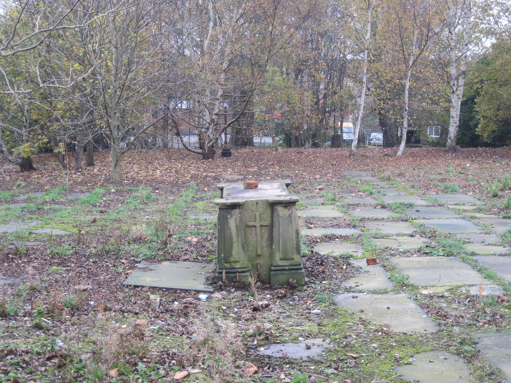
| Description | : | St. Marks Cemetery was founded in 1794 and closed in 1982. 'As early as 1790 the enterprising Charles Ethelston, the founder Minister of St Paul's ,Turner Street, obtained a concession from the Warden and Fellows to erect, at his own expense, a Chapel of Ease to serve the large area of no-man's land between the ancient Parish Churches of Manchester and Prestwich. This chapel, which became St Mark's, Cheetham was built amongst the cotton merchants' houses which formed that desirable hamlet. The chapel was consecrated on 24th July 1794. Founded in 1794 and closed in 1982. |
frequently asked questions (FAQ):
-
Where is St. Marks' Churchyard?
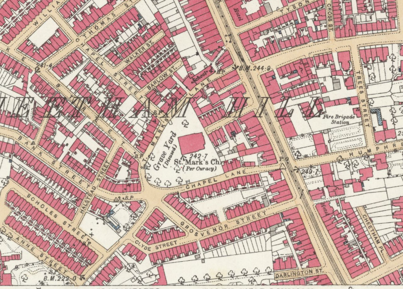
St. Marks' Churchyard is located at St. Marks Lane Cheetham Hill, Metropolitan Borough of Manchester ,Greater Manchester , M7 4FEEngland.
-
St. Marks' Churchyard cemetery's updated grave count on graveviews.com?
368 memorials
-
Where are the coordinates of the St. Marks' Churchyard?
Latitude: 53.5113780
Longitude: -2.2462660
Nearby Cemetories:
1. Wesleyan Methodist Cemetery
Crumpsall, Metropolitan Borough of Manchester, England
Coordinate: 53.5142870, -2.2447610
2. St Luke's Churchyard
Cheetham Hill, Metropolitan Borough of Manchester, England
Coordinate: 53.5041660, -2.2354680
3. Crumpsall Jewish Cemetery
Crumpsall, Metropolitan Borough of Manchester, England
Coordinate: 53.5124250, -2.2280270
4. St Paul's Churchyard
Salford, Metropolitan Borough of Salford, England
Coordinate: 53.5148800, -2.2725500
5. Blackley Presbyterian Chapel Chapelyard
Blackley, Metropolitan Borough of Manchester, England
Coordinate: 53.5233100, -2.2248110
6. Manchester General Cemetery
Manchester, Metropolitan Borough of Manchester, England
Coordinate: 53.5062710, -2.2179570
7. Strangeways Prison Cemetery (Defunct)
Manchester, Metropolitan Borough of Manchester, England
Coordinate: 53.4925000, -2.2463890
8. Christchurch Harpurhey Churchyard
Harpurhey, Metropolitan Borough of Manchester, England
Coordinate: 53.5115100, -2.2134800
9. St Chad's Churchyard
Cheetham Hill, Metropolitan Borough of Manchester, England
Coordinate: 53.4922100, -2.2400500
10. St. Peter's Churchyard
Blackley, Metropolitan Borough of Manchester, England
Coordinate: 53.5231200, -2.2188900
11. Blackley Cemetery and Crematorium
Blackley, Metropolitan Borough of Manchester, England
Coordinate: 53.5333176, -2.2394190
12. Christ Church
Salford, Metropolitan Borough of Salford, England
Coordinate: 53.4864284, -2.2497653
13. Manchester Cathedral
Manchester, Metropolitan Borough of Manchester, England
Coordinate: 53.4852760, -2.2446010
14. Rainsough Jewish Cemetery
Prestwich, Metropolitan Borough of Bury, England
Coordinate: 53.5185530, -2.2906950
15. Agecroft Cemetery and Crematorium
Salford, Metropolitan Borough of Salford, England
Coordinate: 53.5100250, -2.2940500
16. Blackley Jewish Cemetery
Blackley, Metropolitan Borough of Manchester, England
Coordinate: 53.5299377, -2.2097650
17. St. Mary's Churchyard (Defunct)
Manchester, Metropolitan Borough of Manchester, England
Coordinate: 53.4825726, -2.2483873
18. New Jerusalem Temple Cemetery
Salford, Metropolitan Borough of Salford, England
Coordinate: 53.4827720, -2.2571250
19. Agecroft Jewish Cemetery
Pendlebury, Metropolitan Borough of Salford, England
Coordinate: 53.5110302, -2.2955830
20. Irwell Street Wesleyan Chapel Cemetery
Salford, Metropolitan Borough of Salford, England
Coordinate: 53.4829750, -2.2587540
21. Saint Ann's Churchyard
Manchester, Metropolitan Borough of Manchester, England
Coordinate: 53.4817542, -2.2457527
22. St. Mary the Virgin Churchyard
Prestwich, Metropolitan Borough of Bury, England
Coordinate: 53.5294033, -2.2864891
23. St. Thomas' Churchyard
Salford, Metropolitan Borough of Salford, England
Coordinate: 53.4921430, -2.2856130
24. Great Synagogue Cemetery
Prestwich, Metropolitan Borough of Bury, England
Coordinate: 53.5315510, -2.2845730