
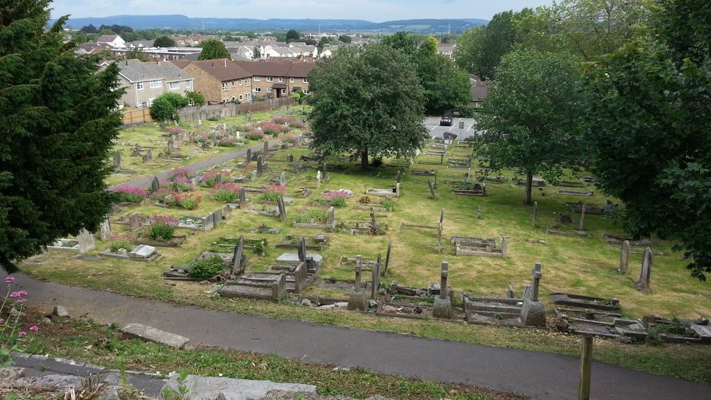
| Memorials | : | 5 |
| Location | : | Worle, North Somerset Unitary Authority, England |
| Coordinate | : | 51.3609960, -2.9301250 |
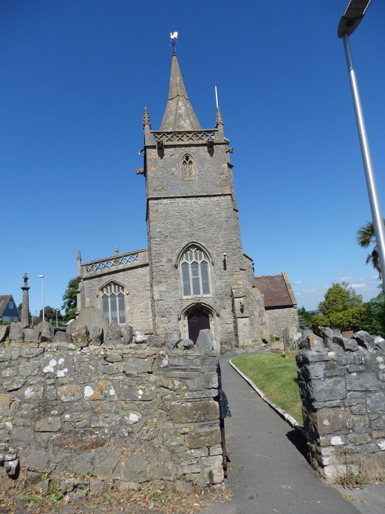
| Description | : | St Martin's Church was built in 1125 and rebuilt during the 14th and 15th centuries, with major restoration and extension work in 1870. The Church is now ecumenical, with Methodist as well as Church of England ministers. It is a Grade II* listed building. |
frequently asked questions (FAQ):
-
Where is St. Martin's Churchyard?
St. Martin's Churchyard is located at Church Road Worle, North Somerset Unitary Authority ,Somerset , BS22 9ELEngland.
-
St. Martin's Churchyard cemetery's updated grave count on graveviews.com?
5 memorials
-
Where are the coordinates of the St. Martin's Churchyard?
Latitude: 51.3609960
Longitude: -2.9301250
Nearby Cemetories:
1. St Mark Churchyard
Weston-super-Mare, North Somerset Unitary Authority, England
Coordinate: 51.3640650, -2.9195540
2. Ebdon Road Crematorium and Cemetery
Weston-super-Mare, North Somerset Unitary Authority, England
Coordinate: 51.3707090, -2.9254530
3. St Paul's Churchyard
Kewstoke, North Somerset Unitary Authority, England
Coordinate: 51.3655390, -2.9566120
4. Saint Pauls Churchyard
Kewstoke, North Somerset Unitary Authority, England
Coordinate: 51.3655500, -2.9568900
5. Weston-Super-Mare Cemetery
Weston-super-Mare, North Somerset Unitary Authority, England
Coordinate: 51.3541300, -2.9676900
6. Wick St. Lawrence Churchyard
Wick St Lawrence, North Somerset Unitary Authority, England
Coordinate: 51.3844000, -2.9117000
7. St. Augustine's Parish Churchyard
Locking, North Somerset Unitary Authority, England
Coordinate: 51.3322900, -2.9147683
8. St. John the Baptist Churchyard
Weston-super-Mare, North Somerset Unitary Authority, England
Coordinate: 51.3523010, -2.9813260
9. Weston-super-Mare Emmanuel Churchyard
Weston-super-Mare, North Somerset Unitary Authority, England
Coordinate: 51.3458940, -2.9773860
10. St Mary the Virgin Churchyard
Hutton, North Somerset Unitary Authority, England
Coordinate: 51.3228030, -2.9306350
11. St Anne's Church Hewish
Weston-super-Mare, North Somerset Unitary Authority, England
Coordinate: 51.3740520, -2.8666300
12. St Nicholas Churchyard (New)
Uphill, North Somerset Unitary Authority, England
Coordinate: 51.3246210, -2.9778420
13. Holy Saviour Churchyard
Puxton, North Somerset Unitary Authority, England
Coordinate: 51.3652680, -2.8536510
14. Old St Nicholas Churchyard
Uphill, North Somerset Unitary Authority, England
Coordinate: 51.3203480, -2.9828110
15. Banwell War Memorial
Banwell, North Somerset Unitary Authority, England
Coordinate: 51.3278233, -2.8648124
16. St. Andrew's Churchyard
Banwell, North Somerset Unitary Authority, England
Coordinate: 51.3280700, -2.8637000
17. Saint Peter and St. Paul Churchyard
Bleadon, North Somerset Unitary Authority, England
Coordinate: 51.3074000, -2.9458300
18. The Blessed Virgin Mary
Axbridge, Sedgemoor District, England
Coordinate: 51.3112017, -2.8913443
19. All Saints Churchyard
Kingston Seymour, North Somerset Unitary Authority, England
Coordinate: 51.3974392, -2.8627201
20. St Andrew's Church
Loxton, North Somerset Unitary Authority, England
Coordinate: 51.2981560, -2.8962140
21. Winscombe and Sandford Cemetery
Winscombe, North Somerset Unitary Authority, England
Coordinate: 51.3223861, -2.8386889
22. Yatton Parish Council Burial Grounds
Yatton, North Somerset Unitary Authority, England
Coordinate: 51.3840541, -2.8182519
23. St. Mary's Churchyard
Yatton, North Somerset Unitary Authority, England
Coordinate: 51.3847720, -2.8185510
24. St Andrew Churchyard
Congresbury, North Somerset Unitary Authority, England
Coordinate: 51.3701100, -2.8121320