| Memorials | : | 5 |
| Location | : | Wick St Lawrence, North Somerset Unitary Authority, England |
| Coordinate | : | 51.3844000, -2.9117000 |
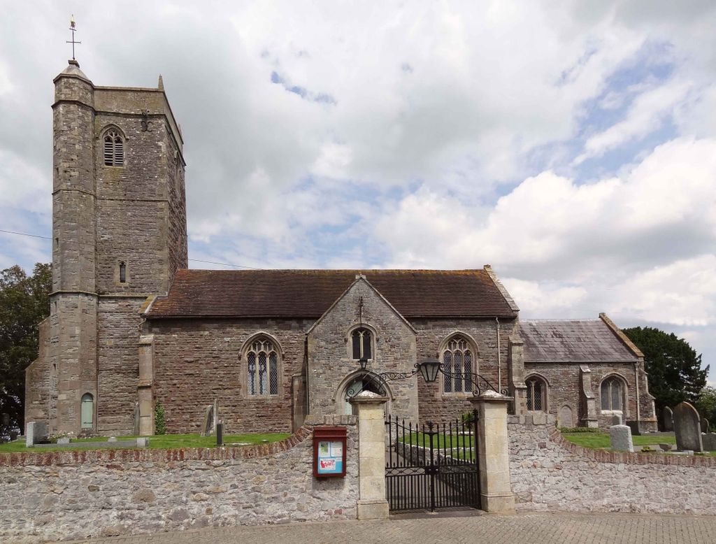
| Description | : | The parish Church of Saint Lawrence dates mainly from the 15th century. It is built largely of pink or grey Lias limestone combined with other local limestones and sandstones. These were used during a major restoration in 1864–1865 by Foster and Wood of Bristol, made necessary after the church was struck by lightning in 1791. This caused cracks to open in the tower which was then reinforced with iron bands. However over the next 60 years the church began to fall apart, prompting the restoration. It has been designated as a Grade II* listed building. [source: - wiki] |
frequently asked questions (FAQ):
-
Where is Wick St. Lawrence Churchyard?
Wick St. Lawrence Churchyard is located at Wick St Lawrence, North Somerset Unitary Authority ,Somerset ,England.
-
Wick St. Lawrence Churchyard cemetery's updated grave count on graveviews.com?
5 memorials
-
Where are the coordinates of the Wick St. Lawrence Churchyard?
Latitude: 51.3844000
Longitude: -2.9117000
Nearby Cemetories:
1. Ebdon Road Crematorium and Cemetery
Weston-super-Mare, North Somerset Unitary Authority, England
Coordinate: 51.3707090, -2.9254530
2. St Mark Churchyard
Weston-super-Mare, North Somerset Unitary Authority, England
Coordinate: 51.3640650, -2.9195540
3. St. Martin's Churchyard
Worle, North Somerset Unitary Authority, England
Coordinate: 51.3609960, -2.9301250
4. St Anne's Church Hewish
Weston-super-Mare, North Somerset Unitary Authority, England
Coordinate: 51.3740520, -2.8666300
5. All Saints Churchyard
Kingston Seymour, North Somerset Unitary Authority, England
Coordinate: 51.3974392, -2.8627201
6. St Paul's Churchyard
Kewstoke, North Somerset Unitary Authority, England
Coordinate: 51.3655390, -2.9566120
7. Saint Pauls Churchyard
Kewstoke, North Somerset Unitary Authority, England
Coordinate: 51.3655500, -2.9568900
8. Holy Saviour Churchyard
Puxton, North Somerset Unitary Authority, England
Coordinate: 51.3652680, -2.8536510
9. Weston-Super-Mare Cemetery
Weston-super-Mare, North Somerset Unitary Authority, England
Coordinate: 51.3541300, -2.9676900
10. St. Augustine's Parish Churchyard
Locking, North Somerset Unitary Authority, England
Coordinate: 51.3322900, -2.9147683
11. Clevedon Cemetery
Clevedon, North Somerset Unitary Authority, England
Coordinate: 51.4322600, -2.8747270
12. St. John the Baptist Churchyard
Weston-super-Mare, North Somerset Unitary Authority, England
Coordinate: 51.3523010, -2.9813260
13. St Andrew Churchyard
Clevedon, North Somerset Unitary Authority, England
Coordinate: 51.4331670, -2.8735760
14. Saint John the Evangelist Churchyard
Kenn, North Somerset Unitary Authority, England
Coordinate: 51.4168000, -2.8413000
15. Weston-super-Mare Emmanuel Churchyard
Weston-super-Mare, North Somerset Unitary Authority, England
Coordinate: 51.3458940, -2.9773860
16. St. Mary's Churchyard
Yatton, North Somerset Unitary Authority, England
Coordinate: 51.3847720, -2.8185510
17. Yatton Parish Council Burial Grounds
Yatton, North Somerset Unitary Authority, England
Coordinate: 51.3840541, -2.8182519
18. St Mary the Virgin Churchyard
Hutton, North Somerset Unitary Authority, England
Coordinate: 51.3228030, -2.9306350
19. Banwell War Memorial
Banwell, North Somerset Unitary Authority, England
Coordinate: 51.3278233, -2.8648124
20. St Andrew Churchyard
Congresbury, North Somerset Unitary Authority, England
Coordinate: 51.3701100, -2.8121320
21. St. Andrew's Churchyard
Banwell, North Somerset Unitary Authority, England
Coordinate: 51.3280700, -2.8637000
22. St Nicholas Churchyard (New)
Uphill, North Somerset Unitary Authority, England
Coordinate: 51.3246210, -2.9778420
23. All Saints Churchyard
Clevedon, North Somerset Unitary Authority, England
Coordinate: 51.4427000, -2.8406000
24. The Blessed Virgin Mary
Axbridge, Sedgemoor District, England
Coordinate: 51.3112017, -2.8913443


