
| Memorials | : | 63 |
| Location | : | Ellisfield, Basingstoke and Deane Borough, England |
| Coordinate | : | 51.2084970, -1.0868310 |
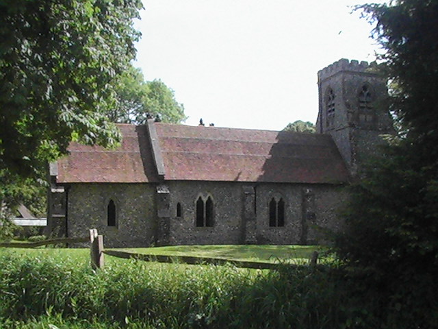
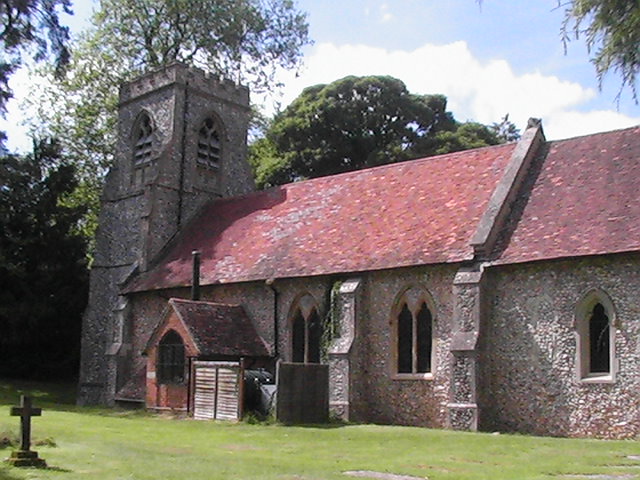
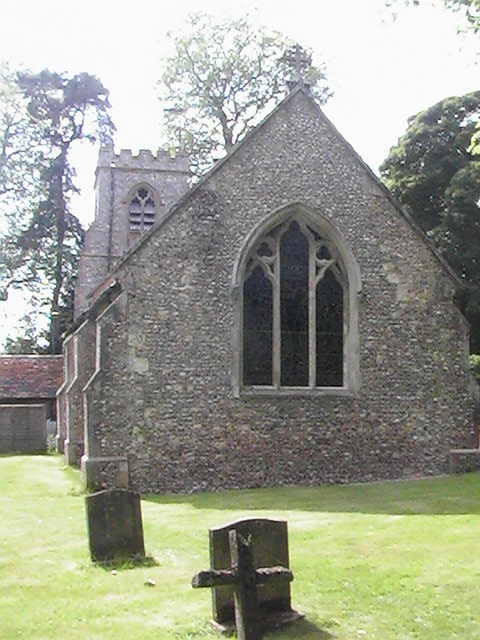
| Description | : | Ellisfield is a village of just under 2,350 acres, tucked away within Hampshire farmland and woodland. It is situated six miles south of Basingstoke centre and two miles west of the A339, the Basingstoke to Alton road. St. Martin's Church is mediaeval in origin though there are some Saxon remnants. It was extensively rebuilt in the 19th century. The Memorial Hall was built in 1920 to commemorate those villagers killed in WW1. There is a plaque contained therein recording their names and one more killed in World War 2. |
frequently asked questions (FAQ):
-
Where is St Martin Churchyard?
St Martin Churchyard is located at Church Lane Ellisfield, Basingstoke and Deane Borough ,Hampshire , RG25England.
-
St Martin Churchyard cemetery's updated grave count on graveviews.com?
63 memorials
-
Where are the coordinates of the St Martin Churchyard?
Latitude: 51.2084970
Longitude: -1.0868310
Nearby Cemetories:
1. St. Andrew's Churchyard
Farleigh Wallop, Basingstoke and Deane Borough, England
Coordinate: 51.2234400, -1.1064200
2. St Mary Churchyard
Herriard, Basingstoke and Deane Borough, England
Coordinate: 51.2093000, -1.0515700
3. St. Mary's Churchyard
Nutley, Basingstoke and Deane Borough, England
Coordinate: 51.1965110, -1.1291030
4. St. Leonard's Churchyard
Cliddesden, Basingstoke and Deane Borough, England
Coordinate: 51.2373200, -1.0948700
5. All Saints Churchyard
Bradley, Basingstoke and Deane Borough, England
Coordinate: 51.1719500, -1.0923600
6. All Saints Churchyard
Tunworth, Basingstoke and Deane Borough, England
Coordinate: 51.2312600, -1.0367400
7. St Mary Churchyard
Lasham, East Hampshire District, England
Coordinate: 51.1778500, -1.0346000
8. All Saints Churchyard
Dummer, Basingstoke and Deane Borough, England
Coordinate: 51.2103290, -1.1588850
9. St Lawrence Churchyard
Weston Patrick, Basingstoke and Deane Borough, England
Coordinate: 51.2170740, -1.0121040
10. St. Mary the Virgin Churchyard
Preston Candover, Basingstoke and Deane Borough, England
Coordinate: 51.1699530, -1.1336090
11. St. Mary the Virgin Old Churchyard
Preston Candover, Basingstoke and Deane Borough, England
Coordinate: 51.1688476, -1.1380713
12. Worting Road Cemetery
Basingstoke, Basingstoke and Deane Borough, England
Coordinate: 51.2623970, -1.1049700
13. St Mary Churchyard
Bentworth, East Hampshire District, England
Coordinate: 51.1579900, -1.0499460
14. St Mary Churchyard
Bentworth, East Hampshire District, England
Coordinate: 51.1579100, -1.0500600
15. St. Michael's Churchyard
Basingstoke, Basingstoke and Deane Borough, England
Coordinate: 51.2652400, -1.0885200
16. St Mary Churchyard
Basingstoke, Basingstoke and Deane Borough, England
Coordinate: 51.2652010, -1.0818960
17. St. Mary's Churchyard
Upton Grey, Basingstoke and Deane Borough, England
Coordinate: 51.2307800, -1.0025200
18. South View Cemetery
Basingstoke, Basingstoke and Deane Borough, England
Coordinate: 51.2693510, -1.0911620
19. St Peter and St Paul Churchyard
Shalden, East Hampshire District, England
Coordinate: 51.1703300, -1.0097400
20. St. Thomas of Canterbury Churchyard
Worting, Basingstoke and Deane Borough, England
Coordinate: 51.2621430, -1.1405070
21. St Mary Churchyard
Mapledurwell, Basingstoke and Deane Borough, England
Coordinate: 51.2538100, -1.0161300
22. St. John's Churchyard
Wootton St Lawrence, Basingstoke and Deane Borough, England
Coordinate: 51.2467406, -1.1687444
23. St John Churchyard and Garden of Remembrance
Oakley, Basingstoke and Deane Borough, England
Coordinate: 51.2468300, -1.1689700
24. St. James' Churchyard
Wield, East Hampshire District, England
Coordinate: 51.1446800, -1.1027700