
| Memorials | : | 0 |
| Location | : | Easington Village, Durham Unitary Authority, England |
| Coordinate | : | 54.7842000, -1.3573000 |
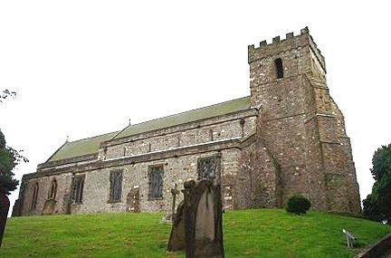
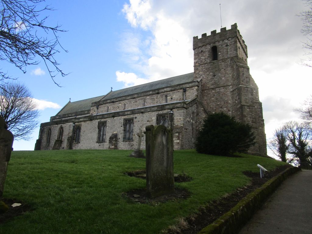
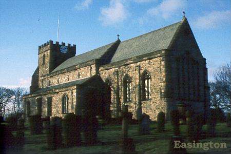
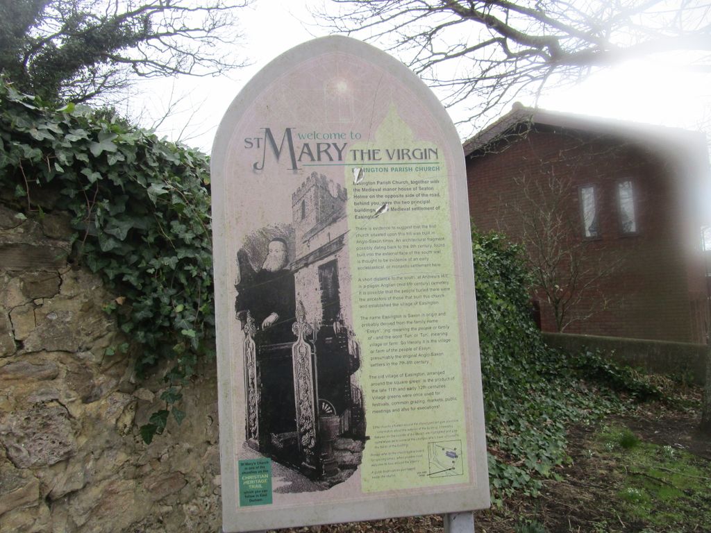
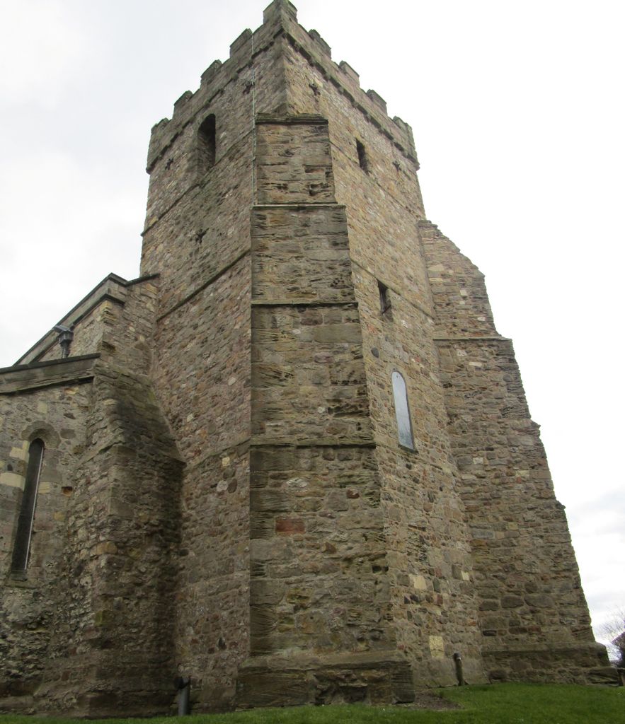
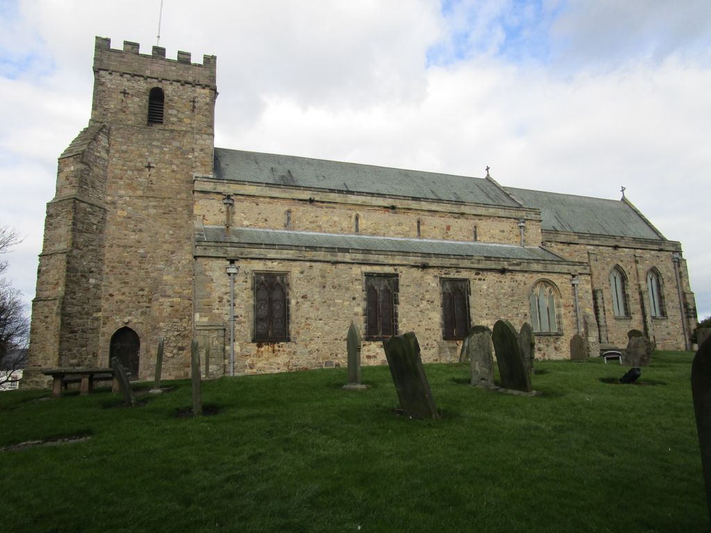
| Description | : | Parish church. Romanesque tower, remainder of church early C13. Extensive restoration in 1853 by P.C. Hardwick. Sandstone and limestone rubble masonry. Steeply-pitched green slate roof. Square west tower, aisled nave, chancel and north chapel. "The Church, dedicated to St. Mary the Virgin, is of ancient date, and, previous to its restoration, in 1853, was one of the most interesting edifices in the country, the few remaining portions of which are of the Norman period. The church is said to have been rebuilt in the early part of the thirteenth century; the existing tower, of Norman date, probably belonged to the original structure.... Read More |
frequently asked questions (FAQ):
-
Where is St Mary's Churchyard?
St Mary's Churchyard is located at B1283 Easington Village, Durham Unitary Authority ,County Durham , SR8 3BPEngland.
-
St Mary's Churchyard cemetery's updated grave count on graveviews.com?
0 memorials
-
Where are the coordinates of the St Mary's Churchyard?
Latitude: 54.7842000
Longitude: -1.3573000
Nearby Cemetories:
1. Easington Durham Lane Cemetery
Easington Village, Durham Unitary Authority, England
Coordinate: 54.7823800, -1.3601500
2. Horden Cemetery
Horden, Durham Unitary Authority, England
Coordinate: 54.7735900, -1.3374800
3. Easington Colliery Cemetery
Easington Colliery, Durham Unitary Authority, England
Coordinate: 54.7892830, -1.3300550
4. St Michael and All Angels Churchyard
Hawthorn, Durham Unitary Authority, England
Coordinate: 54.8034950, -1.3503550
5. St Saviour Churchyard
Shotton Colliery, Durham Unitary Authority, England
Coordinate: 54.7638950, -1.3891300
6. St Mary's Churchyard
Horden, Durham Unitary Authority, England
Coordinate: 54.7629930, -1.3144310
7. St Joseph's Roman Catholic Churchyard
Murton, Durham Unitary Authority, England
Coordinate: 54.8155960, -1.3888230
8. Holy Trinity Churchyard
South Hetton, Durham Unitary Authority, England
Coordinate: 54.8006610, -1.4135640
9. Murton Cemetery
Murton, Durham Unitary Authority, England
Coordinate: 54.8153330, -1.3916320
10. Holy Trinity Churchyard
Murton, Durham Unitary Authority, England
Coordinate: 54.8159880, -1.3899430
11. St Andrew's Church
Dalton-le-Dale, Durham Unitary Authority, England
Coordinate: 54.8255000, -1.3665000
12. St James Churchyard
Castle Eden, Durham Unitary Authority, England
Coordinate: 54.7392370, -1.3367390
13. Easington Lane Cemetery
Easington Lane, Metropolitan Borough of Sunderland, England
Coordinate: 54.8103877, -1.4295255
14. Princess Road Cemetery
Seaham, Durham Unitary Authority, England
Coordinate: 54.8334800, -1.3394080
15. Monk Hesleden Cemetery
Monk Hesledon, Durham Unitary Authority, England
Coordinate: 54.7367750, -1.3156100
16. St Mary's Church
Monk Hesledon, Durham Unitary Authority, England
Coordinate: 54.7367130, -1.3154060
17. St. John the Evangelist Churchyard
Seaham, Durham Unitary Authority, England
Coordinate: 54.8362792, -1.3363791
18. Christchurch Graveyard
Seaham, Durham Unitary Authority, England
Coordinate: 54.8414660, -1.3614550
19. Blackhall Cemetery
Blackhall, Durham Unitary Authority, England
Coordinate: 54.7435640, -1.2841120
20. St Mary's Churchyard
Seaham, Durham Unitary Authority, England
Coordinate: 54.8475590, -1.3435800
21. Hutton House Roman Catholic Burial Ground
Hutton Henry, Durham Unitary Authority, England
Coordinate: 54.7217300, -1.3337000
22. St. Nicholas Churchyard
Hetton-le-Hole, Metropolitan Borough of Sunderland, England
Coordinate: 54.8201690, -1.4518480
23. Seaham Cemetery
Seaham, Durham Unitary Authority, England
Coordinate: 54.8493205, -1.3414431
24. Hutton Henry Cemetery
Hutton Henry, Durham Unitary Authority, England
Coordinate: 54.7171700, -1.3607100