
| Memorials | : | 0 |
| Location | : | Lidgate, St Edmundsbury Borough, England |
| Coordinate | : | 52.1944600, 0.5160100 |
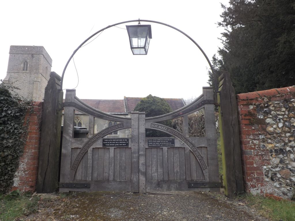
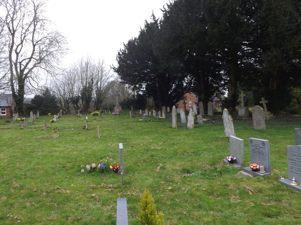
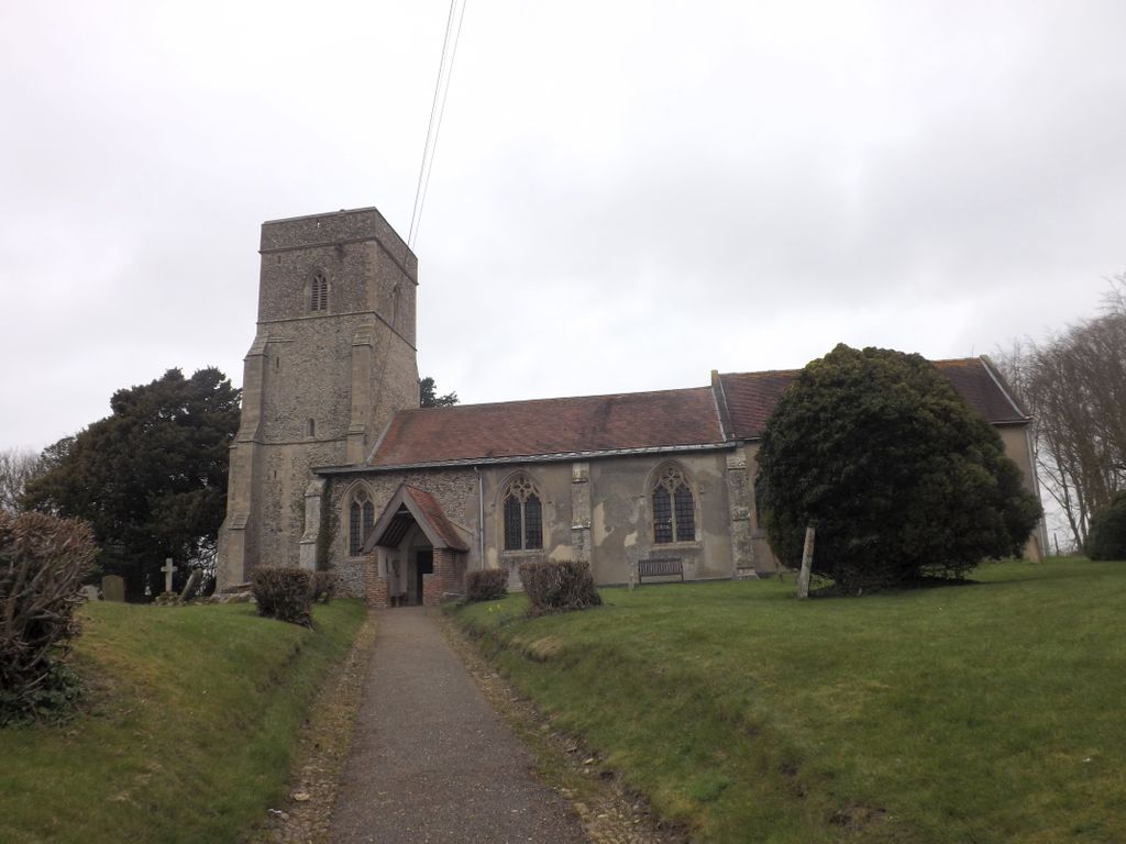
| Description | : | St Mary's church sits on a high mound overlooking the village of Lydgate in Suffolk. The church originally stood within the outer bailey of Lidgate Castle. This is said to have been raised during the civil war of 1138-53, but the site may have been previously fortified. The churchyard contains a section of the old castle wall. The church is famous for its medieval graffiti and a signature almost certainly that of the medieval poet, John Lydgate (c1370 – c1451). Lydgate church was probably built in the 12th century and the nave has Norman proportions. The earliest visible fabric... Read More |
frequently asked questions (FAQ):
-
Where is St Mary Churchyard?
St Mary Churchyard is located at Lidgate, St Edmundsbury Borough ,Suffolk , CB8 9PTEngland.
-
St Mary Churchyard cemetery's updated grave count on graveviews.com?
0 memorials
-
Where are the coordinates of the St Mary Churchyard?
Latitude: 52.1944600
Longitude: 0.5160100
Nearby Cemetories:
1. St Peter's Churchyard
Ousden, St Edmundsbury Borough, England
Coordinate: 52.2074469, 0.5393223
2. St Barnabas Churchyard
Ousden, St Edmundsbury Borough, England
Coordinate: 52.2040730, 0.5538260
3. St Margaret Antioch Parish Churchyard
Cowlinge, St Edmundsbury Borough, England
Coordinate: 52.1658530, 0.5112440
4. All Saints Churchyard
Kirtling, East Cambridgeshire District, England
Coordinate: 52.1909900, 0.4663280
5. Banstead Manor Stud Equine Cemetery
Cheveley, East Cambridgeshire District, England
Coordinate: 52.2114800, 0.4719900
6. St Mary Churchyard
Ashley, East Cambridgeshire District, England
Coordinate: 52.2270430, 0.4876430
7. Dalham Cemetery
Dalham, Forest Heath District, England
Coordinate: 52.2340230, 0.5242530
8. Saint Mary Churchyard
Dalham, Forest Heath District, England
Coordinate: 52.2341640, 0.5236290
9. St Mary Churchyard
Cheveley, East Cambridgeshire District, England
Coordinate: 52.2199960, 0.4648940
10. All Saints Churchyard
Wickhambrook, St Edmundsbury Borough, England
Coordinate: 52.1604060, 0.5620550
11. St Mary's Churchyard
Denham, Mid Suffolk District, England
Coordinate: 52.2266100, 0.5693100
12. St Edmund's Churchyard
Hargrave, St Edmundsbury Borough, England
Coordinate: 52.2174280, 0.5851170
13. St. Mary The Virgin Churchyard
Depden, St Edmundsbury Borough, England
Coordinate: 52.1791650, 0.5989290
14. All Saints Churchyard
Gazeley, Forest Heath District, England
Coordinate: 52.2479000, 0.5182000
15. Wood Ditton Cemetery
Woodditton, East Cambridgeshire District, England
Coordinate: 52.2056250, 0.4273720
16. St. Margaret of Antioch Churchyard
Stradishall, St Edmundsbury Borough, England
Coordinate: 52.1434400, 0.5529300
17. Beech House Stud
Newmarket, Forest Heath District, England
Coordinate: 52.2318930, 0.4475510
18. St. Peter's Churchyard
Moulton, Forest Heath District, England
Coordinate: 52.2492360, 0.4879740
19. Dalham Hall Stud
Newmarket, Forest Heath District, England
Coordinate: 52.2242200, 0.4349510
20. Saint Nicholas Church
Denston, St Edmundsbury Borough, England
Coordinate: 52.1468120, 0.5711170
21. St Mary the Virgin Churchyard
Great Bradley, St Edmundsbury Borough, England
Coordinate: 52.1516228, 0.4457830
22. All Saints Churchyard
Chevington, St Edmundsbury Borough, England
Coordinate: 52.2102370, 0.6166500
23. All Saints Churchyard
Little Bradley, St Edmundsbury Borough, England
Coordinate: 52.1417700, 0.4562500
24. All Saints Churchyard
Chedburgh, St Edmundsbury Borough, England
Coordinate: 52.1864480, 0.6260630