
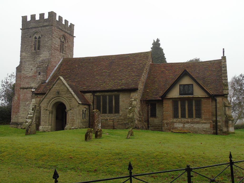
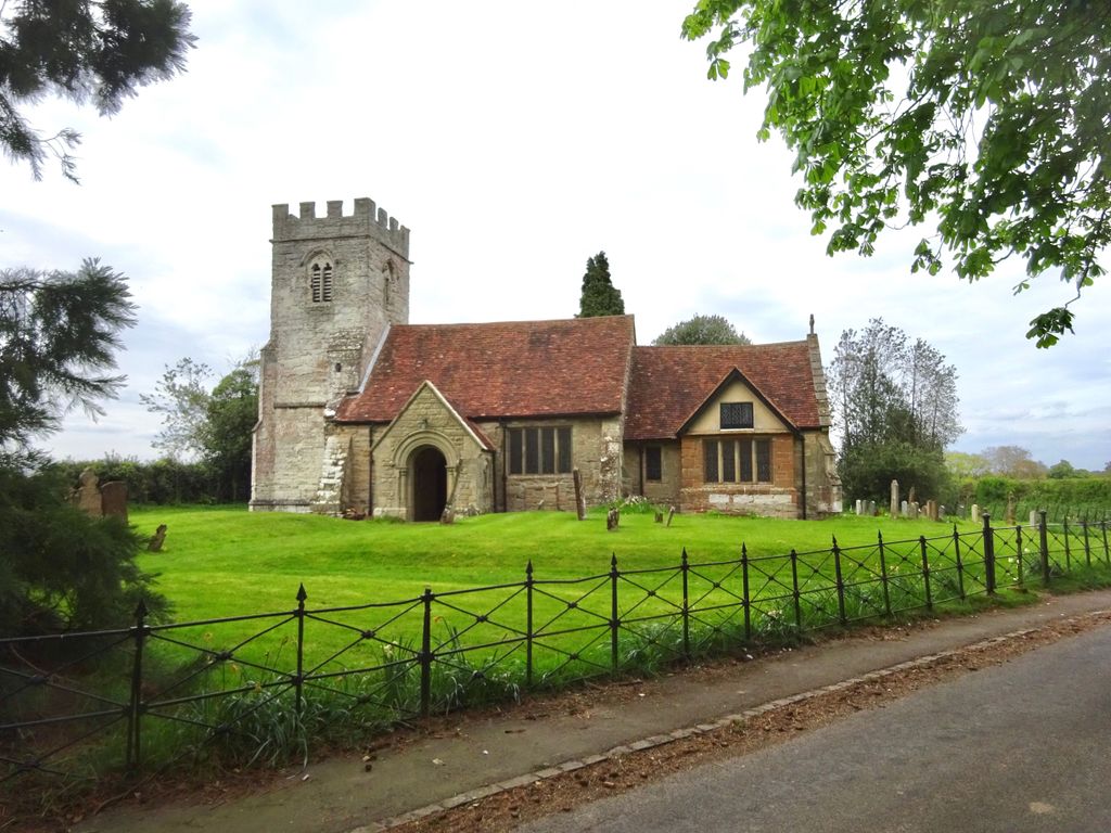
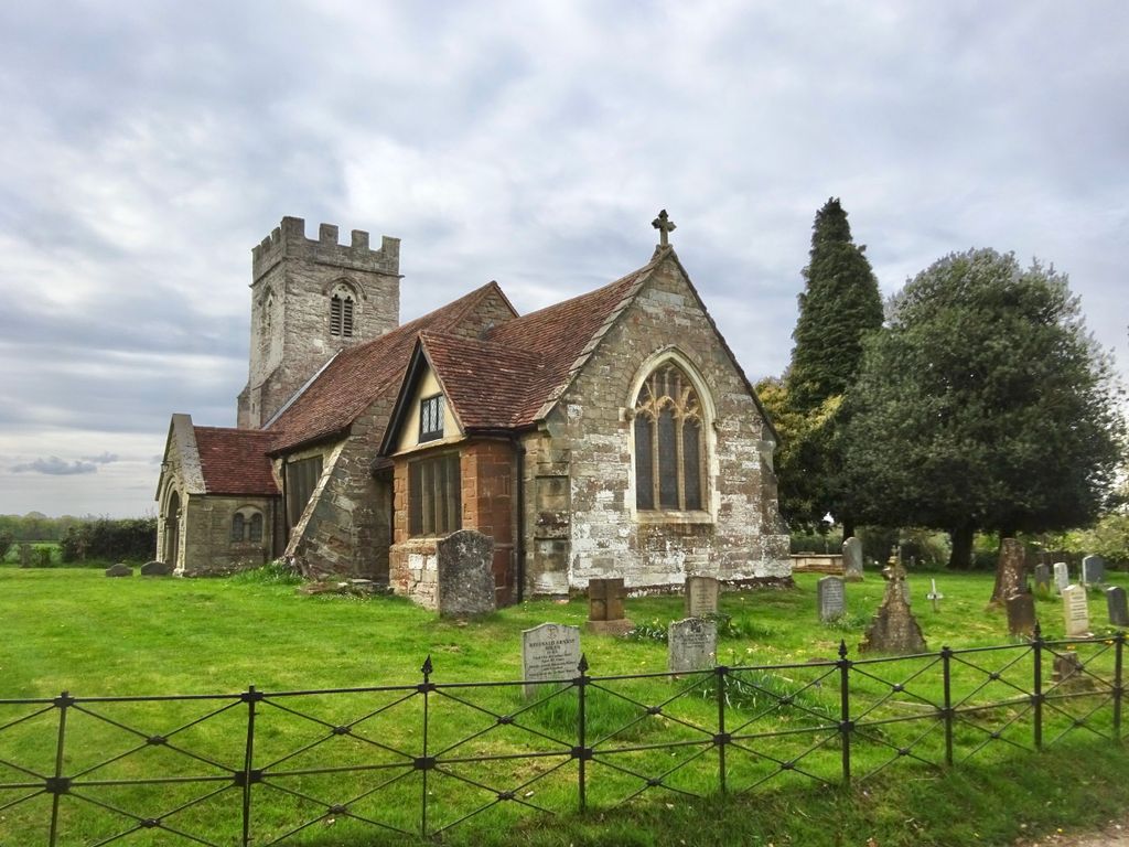
| Memorials | : | 0 |
| Location | : | Haseley Knob, Warwick District, England |
| Coordinate | : | 52.3099770, -1.6577910 |
frequently asked questions (FAQ):
-
Where is St Mary Haseley?
St Mary Haseley is located at Haseley Knob, Warwick District ,Warwickshire ,England.
-
St Mary Haseley cemetery's updated grave count on graveviews.com?
0 memorials
-
Where are the coordinates of the St Mary Haseley?
Latitude: 52.3099770
Longitude: -1.6577910
Nearby Cemetories:
1. St Marys
Honiley, Warwick District, England
Coordinate: 52.3099290, -1.6578010
2. Holy Trinity Churchyard
Hatton, Warwick District, England
Coordinate: 52.3039830, -1.6554970
3. St Leonard's Churchyard
Wroxall, Warwick District, England
Coordinate: 52.3341850, -1.6757560
4. St. Laurence Cemetery
Rowington, Warwick District, England
Coordinate: 52.3211370, -1.7024200
5. St Michael's Churchyard
Budbrooke, Warwick District, England
Coordinate: 52.2877300, -1.6226000
6. Warwick Cemetery
Warwick, Warwick District, England
Coordinate: 52.2882590, -1.6056010
7. St John Baptist Churchyard
Honiley, Warwick District, England
Coordinate: 52.3475810, -1.6421840
8. St Michael Churchyard
Baddesley Clinton, Warwick District, England
Coordinate: 52.3399620, -1.7042510
9. St. Michael and All Angels Churchyard
Claverdon, Stratford-on-Avon District, England
Coordinate: 52.2790000, -1.7107860
10. Holy Trinity Churchyard
Norton Lindsey, Warwick District, England
Coordinate: 52.2653900, -1.6655100
11. St Francis of Assisi RC Churchyard
Baddesley Clinton, Warwick District, England
Coordinate: 52.3495140, -1.6962400
12. All Saints Churchyard
Leek Wootton, Warwick District, England
Coordinate: 52.3163100, -1.5779700
13. St. Paul's Churchyard
Warwick, Warwick District, England
Coordinate: 52.2799200, -1.5938100
14. Black Friars Priory
Warwick, Warwick District, England
Coordinate: 52.2791160, -1.5932106
15. St. Mary's Collegiate Church
Warwick, Warwick District, England
Coordinate: 52.2822710, -1.5879780
16. Friends Burial Ground in Warwickshire
Warwick District, England
Coordinate: 52.2798890, -1.5894430
17. Oaks Road Cemetery
Kenilworth, Warwick District, England
Coordinate: 52.3372150, -1.5829420
18. St Nicholas Churchyard
Warwick, Warwick District, England
Coordinate: 52.2818150, -1.5819300
19. All Saints Churchyard
Preston Bagot, Stratford-on-Avon District, England
Coordinate: 52.2924100, -1.7454500
20. St James the Great Churchyard
Old Milverton, Warwick District, England
Coordinate: 52.3037540, -1.5660450
21. St. Mary Churchyard
Wolverton, Stratford-on-Avon District, England
Coordinate: 52.2586600, -1.6994200
22. All Saints
Old Milverton, Warwick District, England
Coordinate: 52.2889960, -1.5673440
23. St. Nicholas Church
Kenilworth, Warwick District, England
Coordinate: 52.3493100, -1.5821600
24. St Augustine Churchyard
Kenilworth, Warwick District, England
Coordinate: 52.3552230, -1.5842470