
| Memorials | : | 0 |
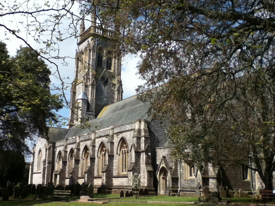
| Location | : | Torquay, Torbay Unitary Authority, England |
| Coordinate | : | 50.4837470, -3.5249540 |
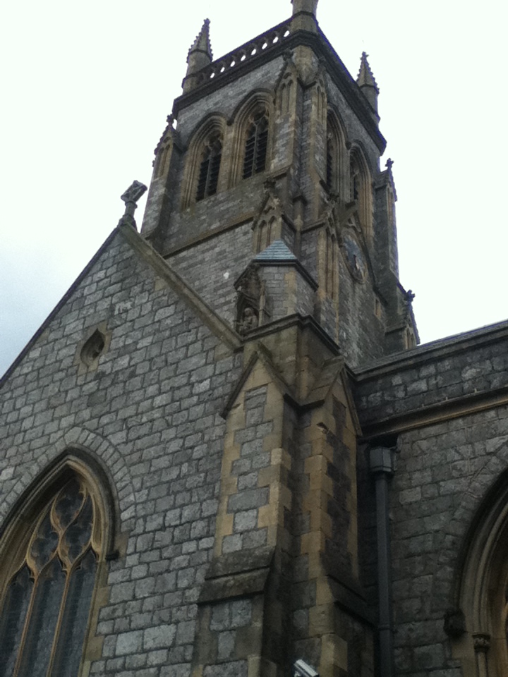
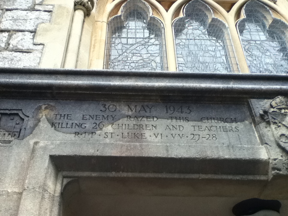
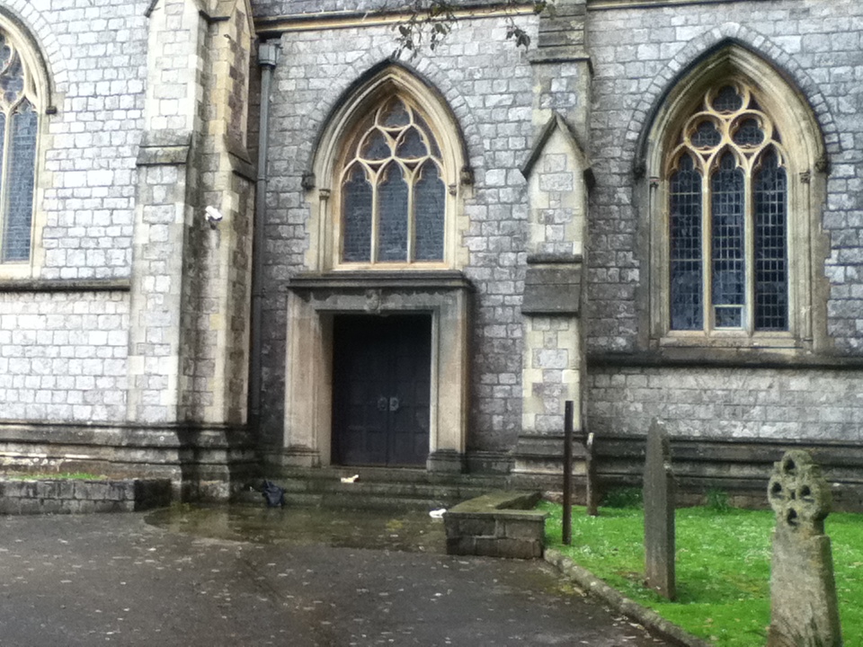
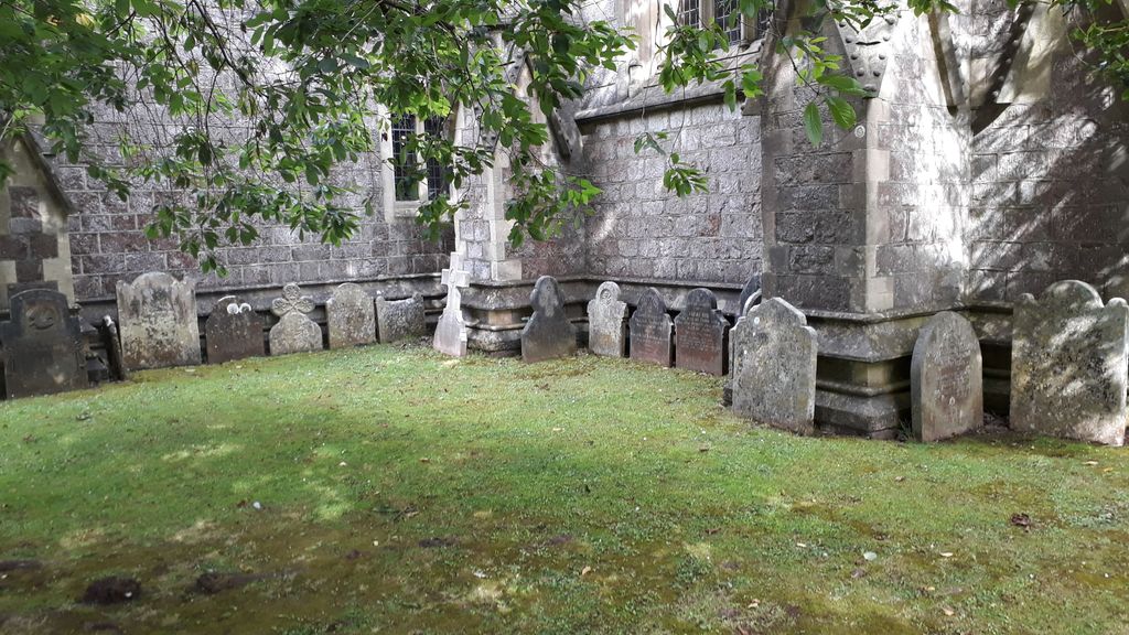
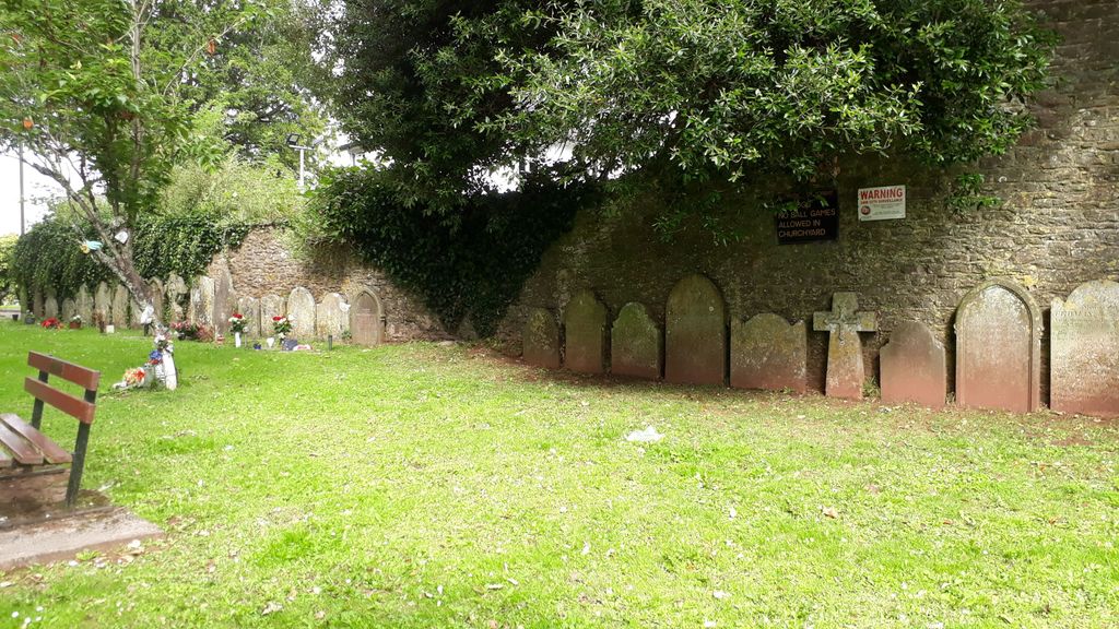
| Description | : | For Find a Grave purposes it is useful to know that the church was bombed 30th May 1943, this resulted in the death of 26 children attending Sunday School. The Church itself was seriously damaged, the central nave and aisles were completely demolished. At the east end by the alter the roof was brought down and the west tower survived. Post war restoration now means there are no graves, markers or memorial plaques visible inside the church. They may have been destroyed, removed or covered over. There may be cenotaphs inside EG. Lists of dead from WWII. Churchyard. Grave markers exist in... Read More |
frequently asked questions (FAQ):
-
Where is St. Mary the Virgin Churchyard?
St. Mary the Virgin Churchyard is located at Fore Street Torquay, Torbay Unitary Authority ,Devon , TQ1 4QYEngland.
-
St. Mary the Virgin Churchyard cemetery's updated grave count on graveviews.com?
0 memorials
-
Where are the coordinates of the St. Mary the Virgin Churchyard?
Latitude: 50.4837470
Longitude: -3.5249540

Nearby Cemetories:
1. All Saints Churchyard
Babbacombe, Torbay Unitary Authority, England
Coordinate: 50.4774330, -3.5171470
2. Torquay Cemetery
Torquay, Torbay Unitary Authority, England
Coordinate: 50.4834300, -3.5443600
3. Torquay Crematorium
Torquay, Torbay Unitary Authority, England
Coordinate: 50.4859900, -3.5469900
4. Torre Churchyard
Torquay, Torbay Unitary Authority, England
Coordinate: 50.4685963, -3.5382016
5. St Bartholomew's Churchyard
Coffinswell, Teignbridge District, England
Coordinate: 50.5052300, -3.5649700
6. Parish Church of St Andrew Churchyard
Stokeinteignhead, Teignbridge District, England
Coordinate: 50.5238500, -3.5312800
7. St. Mary's Churchyard
Kingskerswell, Torbay Unitary Authority, England
Coordinate: 50.4992800, -3.5862190
8. Saint Blaise Churchyard
Haccombe, Teignbridge District, England
Coordinate: 50.5207594, -3.5569565
9. St. John the Baptist Churchyard
Marldon, South Hams District, England
Coordinate: 50.4608700, -3.5984100
10. All Saints Churchyard
Combeinteignhead, Teignbridge District, England
Coordinate: 50.5334460, -3.5506900
11. St. John The Baptist Churchyard
Paignton, Torbay Unitary Authority, England
Coordinate: 50.4368000, -3.5693300
12. St Nicholas Churchyard Ringmore
Shaldon, Teignbridge District, England
Coordinate: 50.5406080, -3.5196630
13. Paignton Cemetery
Paignton, Torbay Unitary Authority, England
Coordinate: 50.4360560, -3.5821130
14. St Mary the Virgin Churchyard
Abbotskerswell, Teignbridge District, England
Coordinate: 50.5073360, -3.6147140
15. Saint James Parish Church
Teignmouth, Teignbridge District, England
Coordinate: 50.5480450, -3.4985447
16. St. Michael the Archangel Churchyard
Teignmouth, Teignbridge District, England
Coordinate: 50.5474910, -3.4922043
17. St John the Baptist Churchyard
Bishopsteignton, Teignbridge District, England
Coordinate: 50.5510800, -3.5385100
18. St Mary the Virgin Churchyard
Newton Abbot, Teignbridge District, England
Coordinate: 50.5219160, -3.6171470
19. Newton Abbot Cemetery
Newton Abbot, Teignbridge District, England
Coordinate: 50.5201180, -3.6200730
20. St Mary the Virgin Churchyard
Collaton St Mary, Torbay Unitary Authority, England
Coordinate: 50.4304300, -3.6005090
21. Teignmouth Cemetery
Teignmouth, Teignbridge District, England
Coordinate: 50.5578180, -3.5039850
22. St Michael's Churchyard
Kingsteignton, Teignbridge District, England
Coordinate: 50.5448300, -3.5946480
23. St. Andrew Churchyard
Ipplepen, Teignbridge District, England
Coordinate: 50.4872610, -3.6443980
24. St Bartholomew Parish Churchyard
Ogwell, Teignbridge District, England
Coordinate: 50.5188100, -3.6401400