
| Memorials | : | 32 |
| Location | : | Aldeby, South Norfolk District, England |
| Coordinate | : | 52.4826360, 1.6075660 |
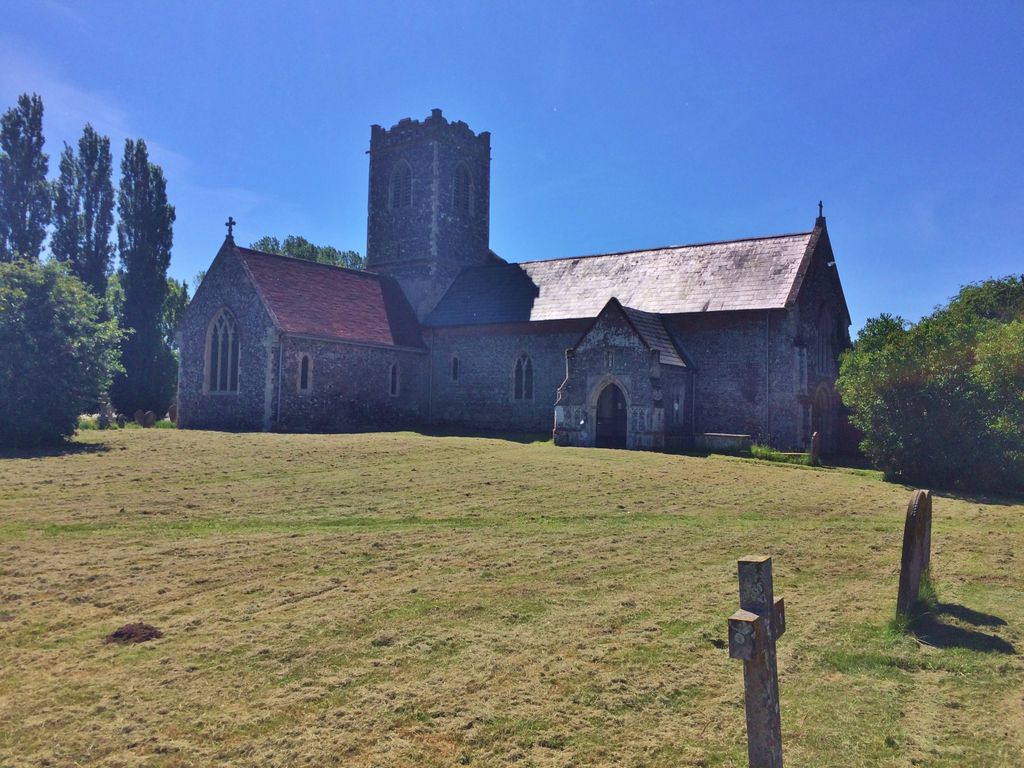
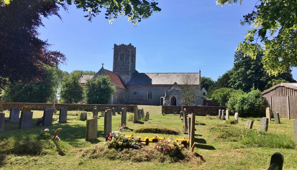
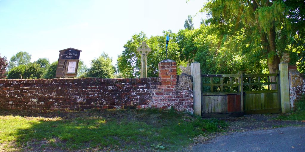
| Description | : | Aldeby is a village and civil parish in the English county of Norfolk. It is bounded to the south by the River Waveney, on the other side of which is Suffolk. The village is about five miles by road from Beccles. For the purposes of local government, the parish falls within the area of the district of South Norfolk. The church is dedicated to St Mary the Virgin and although entirely rural in character, St Mary has something of the proportions of a large priory church, and that is in fact precisely what it was - indeed, some ruins survive... Read More |
frequently asked questions (FAQ):
-
Where is St Mary the Virgin Churchyard?
St Mary the Virgin Churchyard is located at St. Mary Aldeby, South Norfolk District ,Norfolk ,England.
-
St Mary the Virgin Churchyard cemetery's updated grave count on graveviews.com?
32 memorials
-
Where are the coordinates of the St Mary the Virgin Churchyard?
Latitude: 52.4826360
Longitude: 1.6075660
Nearby Cemetories:
1. All Saints Churchyard
Worlingham, Waveney District, England
Coordinate: 52.4517300, 1.5969000
2. St. Mary's Churchyard
Haddiscoe, South Norfolk District, England
Coordinate: 52.5153200, 1.5939300
3. St. Botolph Churchyard
North Cove, Waveney District, England
Coordinate: 52.4474411, 1.6227847
4. St Mary's Churchyard
Gillingham, South Norfolk District, England
Coordinate: 52.4750343, 1.5489500
5. St. Michael's Churchyard
Beccles, Waveney District, England
Coordinate: 52.4585640, 1.5621960
6. All Saints Churchyard
Gillingham, South Norfolk District, England
Coordinate: 52.4753720, 1.5479546
7. Kilbrack Cemetery
Beccles, Waveney District, England
Coordinate: 52.4535653, 1.5686063
8. St Mary's Churchyard
Burgh St Peter, South Norfolk District, England
Coordinate: 52.4840860, 1.6710830
9. Saint John the Baptist Churchyard
Barnby, Waveney District, England
Coordinate: 52.4510410, 1.6494740
10. St. Benet Churchyard
Beccles, Waveney District, England
Coordinate: 52.4540391, 1.5592873
11. Beccles Cemetery
Beccles, Waveney District, England
Coordinate: 52.4486092, 1.5604172
12. Thorpe-next-Haddiscoe St Mathias Churchyard
Haddiscoe, South Norfolk District, England
Coordinate: 52.5261880, 1.5896380
13. St Margaret's Churchyard
Herringfleet, Waveney District, England
Coordinate: 52.5218820, 1.6493630
14. St Michael Churchyard
Geldeston, South Norfolk District, England
Coordinate: 52.4759460, 1.5246070
15. Waveney Memorial Park and Crematorium
Ellough, Waveney District, England
Coordinate: 52.4314090, 1.6151750
16. St Mary Churchyard
Somerleyton, Waveney District, England
Coordinate: 52.5157800, 1.6730900
17. St. Andrew's Churchyard
Mutford, Waveney District, England
Coordinate: 52.4387060, 1.6566540
18. St. Michael's Churchyard
Oulton, Waveney District, England
Coordinate: 52.4823570, 1.6952900
19. St Andrews Churchyard
Raveningham, South Norfolk District, England
Coordinate: 52.5126430, 1.5323570
20. St Olave's Priory
Herringfleet, Waveney District, England
Coordinate: 52.5381200, 1.6240290
21. Holy Trinity Churchyard
Barsham, Waveney District, England
Coordinate: 52.4520000, 1.5263000
22. Methodist Churchyard
Norton Subcourse, North Norfolk District, England
Coordinate: 52.5317630, 1.5557020
23. St. Peter's Churchyard
Weston, Waveney District, England
Coordinate: 52.4281030, 1.5714350
24. St. Andrew's Church Cemetery
Weston, Waveney District, England
Coordinate: 52.4279400, 1.5714900