| Memorials | : | 5 |
| Location | : | Bodenham, Herefordshire Unitary Authority, England |
| Phone | : | 01568-797129 |
| Website | : | bodenhamparishcouncil.gov.uk/local-services-and-amenities/st-michaels-and-all-angels-church/ |
| Coordinate | : | 52.1552320, -2.6884330 |
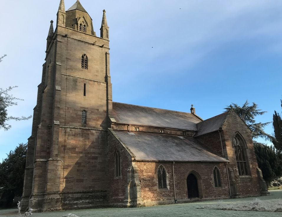
| Description | : | Location: On a minor road off the A417 about 7 miles north of Hereford. The parish church of St Michael and All Angels at Bodenham is set in a beautiful location beside the peaceful River Lugg. The church is primarily a 14th-century building in Decorated Gothic style, with a striking recessed octagonal spire. The church consists of a chancel, a 3-bay nave with clerestory, south and north aisles, and a solid west tower on a square plan topped by a truncated lantern spire. The nave and tower were built between 1280 and 1400. About two centuries later the nave roof was raised... Read More |
frequently asked questions (FAQ):
-
Where is St Michael and All Angels?
St Michael and All Angels is located at Bodenham, Herefordshire, England Bodenham, Herefordshire Unitary Authority ,Herefordshire , HR1 3JUEngland.
-
St Michael and All Angels cemetery's updated grave count on graveviews.com?
5 memorials
-
Where are the coordinates of the St Michael and All Angels?
Latitude: 52.1552320
Longitude: -2.6884330
Nearby Cemetories:
1. St. Margaret Church Cemetery
Wellington, Telford and Wrekin Unitary Authority, England
Coordinate: 52.1289570, -2.7320440
2. Leominster Cemetery
Leominster, Herefordshire Unitary Authority, England
Coordinate: 52.2144280, -2.7380940
3. St. John's Churchyard
Ivington, Herefordshire Unitary Authority, England
Coordinate: 52.2054890, -2.7700320
4. Leominster Moravian Burial Ground
Leominster, Herefordshire Unitary Authority, England
Coordinate: 52.2230890, -2.7394685
5. Leominster Nunnery (Defunct)
Leominster, Herefordshire Unitary Authority, England
Coordinate: 52.2294090, -2.7343900
6. Priory Churchyard
Leominster, Herefordshire Unitary Authority, England
Coordinate: 52.2293470, -2.7357830
7. St. Mary the Virgin
Kings Pyon, Herefordshire Unitary Authority, England
Coordinate: 52.1510000, -2.8218000
8. Credenhill Military Cemetery
Credenhill, Herefordshire Unitary Authority, England
Coordinate: 52.0869980, -2.7899910
9. St. James the Less Churchyard
Kimbolton, Herefordshire Unitary Authority, England
Coordinate: 52.2507757, -2.6957349
10. St. Mary's Churchyard
Credenhill, Herefordshire Unitary Authority, England
Coordinate: 52.0905490, -2.8037610
11. St Peter with St Owen Churchyard
Hereford, Herefordshire Unitary Authority, England
Coordinate: 52.0561280, -2.7126470
12. Hereford Cemetery and Crematorium
Hereford, Herefordshire Unitary Authority, England
Coordinate: 52.0579510, -2.7389730
13. Hereford Cathedral
Hereford, Herefordshire Unitary Authority, England
Coordinate: 52.0541810, -2.7162690
14. St. Nicholas' Churchyard
Hereford, Herefordshire Unitary Authority, England
Coordinate: 52.0542540, -2.7207160
15. Barton Hall Cemetery
Hereford, Herefordshire Unitary Authority, England
Coordinate: 52.0541484, -2.7227701
16. Church of the Grey Friars
Hereford, Herefordshire Unitary Authority, England
Coordinate: 52.0528480, -2.7209559
17. All Saint's Churchyard
Leominster, Herefordshire Unitary Authority, England
Coordinate: 52.2496430, -2.7703330
18. St Peter's Churchyard
Dormington, Herefordshire Unitary Authority, England
Coordinate: 52.0586605, -2.6094343
19. St Martin Churchyard
Hereford, Herefordshire Unitary Authority, England
Coordinate: 52.0450100, -2.7202700
20. Edwyn Ralph Churchyard
Bromyard, Herefordshire Unitary Authority, England
Coordinate: 52.2145540, -2.5207470
21. St Michael and All Angels Churchyard
Kingsland, Herefordshire Unitary Authority, England
Coordinate: 52.2469640, -2.8117000
22. St. Peter and St. Paul
Leominster, Herefordshire Unitary Authority, England
Coordinate: 52.2704100, -2.7398260
23. St. Andrew's Churchyard
Hampton Bishop, Herefordshire Unitary Authority, England
Coordinate: 52.0387800, -2.6440900
24. St Marys Churchyard
Bishops Frome, Herefordshire Unitary Authority, England
Coordinate: 52.1321100, -2.4931300

