
| Memorials | : | 2 |
| Location | : | Bromyard, Herefordshire Unitary Authority, England |
| Coordinate | : | 52.2145540, -2.5207470 |
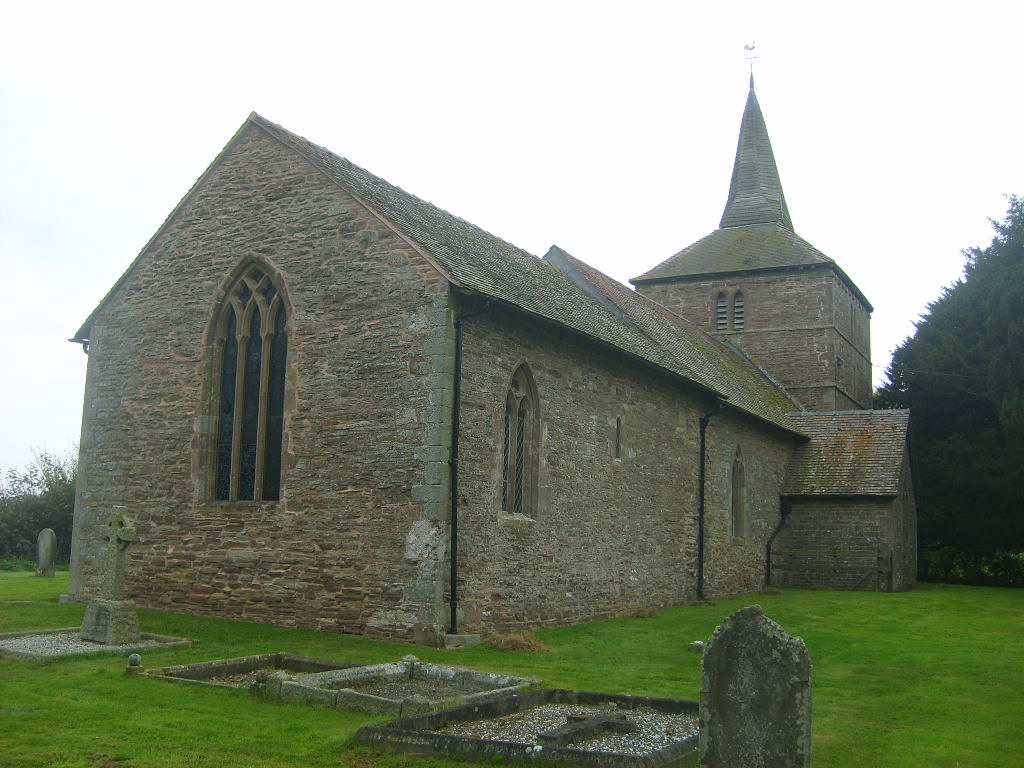
| Description | : | The correct name is: Edwyn Ralph Churchyard standing close to moat and the site of a Saxon village until the Black Death. The church is a Grade II listed building, c 1170, and contains a significant collection of midiaeval stone effigies. Dedication: St Michael & All Angels OS Grid Reference: SO 645 575 Road Reference: Off B4214 |
frequently asked questions (FAQ):
-
Where is Edwyn Ralph Churchyard?
Edwyn Ralph Churchyard is located at Bromyard, Herefordshire Unitary Authority ,Herefordshire ,England.
-
Edwyn Ralph Churchyard cemetery's updated grave count on graveviews.com?
2 memorials
-
Where are the coordinates of the Edwyn Ralph Churchyard?
Latitude: 52.2145540
Longitude: -2.5207470
Nearby Cemetories:
1. St. Mary's Church at Edvin Loach Old Church
Bromyard, Herefordshire Unitary Authority, England
Coordinate: 52.2230907, -2.4953840
2. St. Peter's Churchyard
Stoke Bliss, Malvern Hills District, England
Coordinate: 52.2627200, -2.5121300
3. St Bartholomew's Church
Lower Sapey, Malvern Hills District, England
Coordinate: 52.2484400, -2.4599300
4. St Marys Churchyard
Kyre, Malvern Hills District, England
Coordinate: 52.2685140, -2.5488360
5. St Giles Churchyard
Acton Beauchamp, Herefordshire Unitary Authority, England
Coordinate: 52.1500729, -2.4699471
6. St Kenelms Churchyard
Clifton upon Teme, Malvern Hills District, England
Coordinate: 52.2519700, -2.4189900
7. Knightwick Chapel
Knightwick, Malvern Hills District, England
Coordinate: 52.1946400, -2.3989800
8. St Marys Churchyard
Bishops Frome, Herefordshire Unitary Authority, England
Coordinate: 52.1321100, -2.4931300
9. St. Andrew's Churchyard
Shelsley Walsh, Malvern Hills District, England
Coordinate: 52.2641700, -2.4093500
10. St. John the Baptist Churchyard
Suckley, Malvern Hills District, England
Coordinate: 52.1622900, -2.4093700
11. St. Mary's Churchyard
Stanford-on-Teme, Malvern Hills District, England
Coordinate: 52.2887100, -2.4379200
12. All Saints Churchyard
Shelsley Beauchamp, Malvern Hills District, England
Coordinate: 52.2632200, -2.3953800
13. All Saints Churchyard Extension
Shelsley Beauchamp, Malvern Hills District, England
Coordinate: 52.2634662, -2.3949512
14. St Michael and All Angels Churchyard
Tenbury Wells, Malvern Hills District, England
Coordinate: 52.2882600, -2.6137900
15. St Michael's Churchyard Extension
Tenbury Wells, Malvern Hills District, England
Coordinate: 52.2941032, -2.6183906
16. St Michael and All Angels Churchyard
Rochford, Malvern Hills District, England
Coordinate: 52.3134240, -2.5454090
17. St. Mary Magdalene Churchyard
Broadwas, Malvern Hills District, England
Coordinate: 52.1938300, -2.3598200
18. St Mary Magdalene Churchyard
Alfrick, Malvern Hills District, England
Coordinate: 52.1744230, -2.3693070
19. St Peter & St Paul Churchyard
Eastham, Malvern Hills District, England
Coordinate: 52.3156100, -2.5046000
20. St. Peter's Churchyard
Martley, Malvern Hills District, England
Coordinate: 52.2359520, -2.3582940
21. St Michaels & All Angels Churchyard
Castle Frome, Herefordshire Unitary Authority, England
Coordinate: 52.1098604, -2.4871622
22. St Lawrence Churchyard
Lindridge, Malvern Hills District, England
Coordinate: 52.3180700, -2.4779300
23. St. Mary's Churchyard
Tenbury Wells, Malvern Hills District, England
Coordinate: 52.3120500, -2.5962400
24. St Mary's Churchyard
Burford, Shropshire Unitary Authority, England
Coordinate: 52.3087670, -2.6126000