
| Memorials | : | 0 |
| Location | : | Boulge, Suffolk Coastal District, England |
| Coordinate | : | 52.1280920, 1.2918290 |
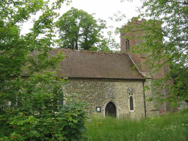
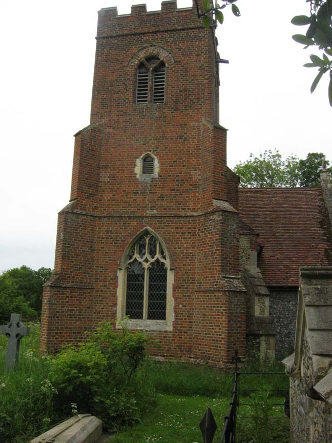
| Description | : | St Michael and All Angels Church is a Church of England, serving the almost inactive hamlet parish of Boulge in East Suffolk. The building is hidden in a thick grove of trees, yet there are signs to direct visitors. The 16th century Tudor brick tower can be seen through the trees from the Debach Road. "St Michael," as it is called by the locals, was an estate church, which was located on the grounds of Boulge Hall, a large three-story resident built in the late 18th century but demolished in 1955. The oldest most significant part of the... Read More |
frequently asked questions (FAQ):
-
Where is St Michael Churchyard?
St Michael Churchyard is located at Boulge, Suffolk Coastal District ,Suffolk ,England.
-
St Michael Churchyard cemetery's updated grave count on graveviews.com?
0 memorials
-
Where are the coordinates of the St Michael Churchyard?
Latitude: 52.1280920
Longitude: 1.2918290
Nearby Cemetories:
1. St Andrew's Churchyard
Bredfield, Suffolk Coastal District, England
Coordinate: 52.1288710, 1.3129440
2. All Saints Church Cemetery
Debach, Suffolk Coastal District, England
Coordinate: 52.1421030, 1.2760230
3. Saint Mary Churchyard
Dallinghoo, Suffolk Coastal District, England
Coordinate: 52.1465220, 1.3109100
4. St Andrew Churchyard
Hasketon, Suffolk Coastal District, England
Coordinate: 52.1063910, 1.2845520
5. St Audry's Hospital Chapel Burial Grounds
Melton, Suffolk Coastal District, England
Coordinate: 52.1169050, 1.3321920
6. St Botolph Churchyard
Burgh, Suffolk Coastal District, England
Coordinate: 52.1239800, 1.2470740
7. St Mary Churchyard
Clopton, Suffolk Coastal District, England
Coordinate: 52.1269860, 1.2431221
8. Charsfield Baptist Church
Charsfield, Suffolk Coastal District, England
Coordinate: 52.1590750, 1.3005590
9. St Mary the Virgin
Grundisburgh, Suffolk Coastal District, England
Coordinate: 52.1130840, 1.2460330
10. St Peter Churchyard
Charsfield, Suffolk Coastal District, England
Coordinate: 52.1614360, 1.2945540
11. St Andrew the Apostle Churchyard
Melton, Suffolk Coastal District, England
Coordinate: 52.1065910, 1.3336210
12. Baptist Chapelyard
Grundisburgh, Suffolk Coastal District, England
Coordinate: 52.1058380, 1.2499810
13. Melton Old Churchyard
Melton, Suffolk Coastal District, England
Coordinate: 52.1125150, 1.3505240
14. St. Peter and St. Paul Churchyard
Pettistree, Suffolk Coastal District, England
Coordinate: 52.1410880, 1.3525270
15. St. Mary's Churchyard
Great Bealings, Suffolk Coastal District, England
Coordinate: 52.0930240, 1.2554220
16. St Edmund's Churchyard
Bromeswell, Suffolk Coastal District, England
Coordinate: 52.1064300, 1.3617740
17. St Mary's Churchyard
Otley, Suffolk Coastal District, England
Coordinate: 52.1488464, 1.2202631
18. All Saints Churchyard
Little Bealings, Suffolk Coastal District, England
Coordinate: 52.0854520, 1.2525230
19. All Saints
Little Bealings, Suffolk Coastal District, England
Coordinate: 52.0854660, 1.2522380
20. Otley Baptist Church Cemetery
Otley, Suffolk Coastal District, England
Coordinate: 52.1559032, 1.2254881
21. St Botolph's Churchyard
Culpho, Suffolk Coastal District, England
Coordinate: 52.0963570, 1.2253710
22. Saint Mary Churchyard
Monewden, Suffolk Coastal District, England
Coordinate: 52.1794650, 1.2736850
23. Monewden War Memorial
Monewden, Suffolk Coastal District, England
Coordinate: 52.1795900, 1.2734090
24. Priory Church of St Mary Churchyard
Letheringham, Suffolk Coastal District, England
Coordinate: 52.1789530, 1.3164620