
| Memorials | : | 0 |
| Location | : | Liverpool, Metropolitan Borough of Liverpool, England |
| Coordinate | : | 53.3976599, -2.9789353 |
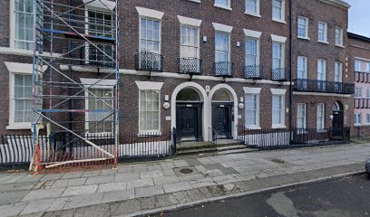
| Description | : | In 1814, authority to build a church was granted under the St Michael's Church Act, 17 June 1814. The church was to stand "on a certain piece of land lying between Kent Street, Cornwallis Street, Upper Pitt Street and Granville Street". The Commissioners named in the Act raised the sum of money stated and began building the church. However, by 1823 the money had been spent and the church remained unfinished. A further Act was passed stating that the Corporation was to finish building the church within three years at its own expense. The new church of St Michael's Church... Read More |
frequently asked questions (FAQ):
-
Where is St. Michaels Churchyard?
St. Michaels Churchyard is located at Upper Pitt Street Liverpool, Metropolitan Borough of Liverpool ,Merseyside ,England.
-
St. Michaels Churchyard cemetery's updated grave count on graveviews.com?
0 memorials
-
Where are the coordinates of the St. Michaels Churchyard?
Latitude: 53.3976599
Longitude: -2.9789353
Nearby Cemetories:
1. Liverpool Cathedral
Liverpool, Metropolitan Borough of Liverpool, England
Coordinate: 53.3974310, -2.9731610
2. St. James Churchyard
Toxteth, Metropolitan Borough of Liverpool, England
Coordinate: 53.3943720, -2.9750688
3. St James Garden Cemetery
Liverpool, Metropolitan Borough of Liverpool, England
Coordinate: 53.3960744, -2.9715005
4. St. Thomas Churchyard
Liverpool, Metropolitan Borough of Liverpool, England
Coordinate: 53.4010330, -2.9861190
5. Wesleyan Methodist Chapel Graveyard
Liverpool, Metropolitan Borough of Liverpool, England
Coordinate: 53.3940590, -2.9719160
6. St Philip Graveyard
Liverpool, Metropolitan Borough of Liverpool, England
Coordinate: 53.4019240, -2.9719920
7. St. Andrew’s Churchyard
Liverpool, Metropolitan Borough of Liverpool, England
Coordinate: 53.4029730, -2.9726820
8. Roscoe Memorial Gardens
Liverpool, Metropolitan Borough of Liverpool, England
Coordinate: 53.4044040, -2.9762180
9. St. Peter's Churchyard
Liverpool, Metropolitan Borough of Liverpool, England
Coordinate: 53.4051290, -2.9844200
10. St Mary’s Parochial Cemetery
Liverpool, Metropolitan Borough of Liverpool, England
Coordinate: 53.4024370, -2.9672760
11. Metropolitan Cathedral of Christ the King
Liverpool, Metropolitan Borough of Liverpool, England
Coordinate: 53.4052820, -2.9685940
12. St. George's Churchyard
Liverpool, Metropolitan Borough of Liverpool, England
Coordinate: 53.4049700, -2.9901030
13. St. John's Garden
Liverpool, Metropolitan Borough of Liverpool, England
Coordinate: 53.4087890, -2.9810070
14. St. Nicholas' Churchyard
Liverpool, Metropolitan Borough of Liverpool, England
Coordinate: 53.4069350, -2.9951480
15. Friends Burial Ground (Defunct)
Liverpool, Metropolitan Borough of Liverpool, England
Coordinate: 53.4111670, -2.9795830
16. Holy Trinity Churchyard
Liverpool, Metropolitan Borough of Liverpool, England
Coordinate: 53.4117490, -2.9759560
17. Liverpool Naval Memorial
Liverpool, Metropolitan Borough of Liverpool, England
Coordinate: 53.4061220, -2.9981050
18. St. Paul's Churchyard
Liverpool, Metropolitan Borough of Liverpool, England
Coordinate: 53.4099460, -2.9919370
19. Brunswick Chapel
Liverpool, Metropolitan Borough of Liverpool, England
Coordinate: 53.4111280, -2.9675500
20. St. Mary's Churchyard
Edge Hill, Metropolitan Borough of Liverpool, England
Coordinate: 53.4065000, -2.9561600
21. St. Anne's Churchyard
Liverpool, Metropolitan Borough of Liverpool, England
Coordinate: 53.4149050, -2.9782840
22. Liverpool Necropolis
Everton, Metropolitan Borough of Liverpool, England
Coordinate: 53.4146670, -2.9621830
23. Ancient Chapel Of Toxteth Park
Liverpool, Metropolitan Borough of Liverpool, England
Coordinate: 53.3811568, -2.9575849
24. St. Mary's Churchyard
Birkenhead, Metropolitan Borough of Wirral, England
Coordinate: 53.3895930, -3.0112520