
| Memorials | : | 1 |
| Location | : | Budleigh Salterton, East Devon District, England |
| Coordinate | : | 50.6342750, -3.3336640 |
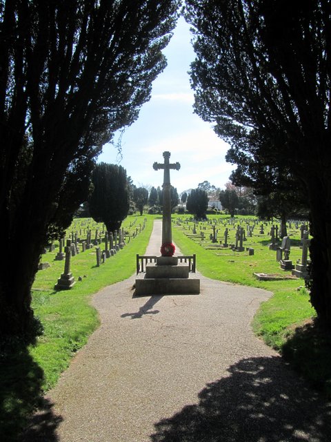
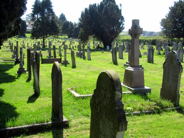
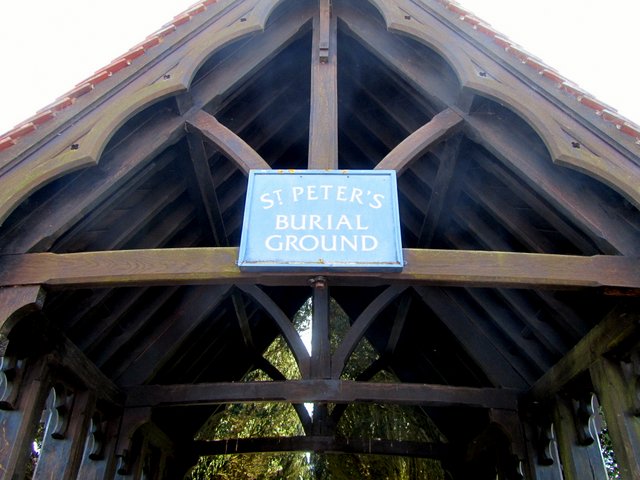
| Description | : | St Peter’s burial ground in Budleigh Salterton is accessed from Moor Lane and lies a half mile distant from St Peter’s CofE church, although much closer to St Peter’s catholic church. |
frequently asked questions (FAQ):
-
Where is St. Peter's Burial Ground?
St. Peter's Burial Ground is located at Budleigh Salterton, East Devon District ,Devon , EX9 6QFEngland.
-
St. Peter's Burial Ground cemetery's updated grave count on graveviews.com?
1 memorials
-
Where are the coordinates of the St. Peter's Burial Ground?
Latitude: 50.6342750
Longitude: -3.3336640
Nearby Cemetories:
1. All Saints Churchyard
East Budleigh, East Devon District, England
Coordinate: 50.6565500, -3.3224900
2. St John in the Wilderness Churchyard
Exmouth, East Devon District, England
Coordinate: 50.6419000, -3.3758000
3. St. Margaret and St. Andrew Churchyard
Littleham, East Devon District, England
Coordinate: 50.6229200, -3.3744500
4. St Michaels Churchyard
Otterton, East Devon District, England
Coordinate: 50.6588750, -3.3029790
5. Bicton, St Mary's Church
Budleigh Salterton, East Devon District, England
Coordinate: 50.6639870, -3.3130370
6. Pound Lane Cemetery
Exmouth, East Devon District, England
Coordinate: 50.6302830, -3.3957290
7. Point in View Chapel
Exmouth, East Devon District, England
Coordinate: 50.6427390, -3.4044760
8. St John the Baptist Churchyard
Colaton Raleigh, East Devon District, England
Coordinate: 50.6771200, -3.3010200
9. Gulliford Burial Ground
Woodbury, East Devon District, England
Coordinate: 50.6539830, -3.4204550
10. St Swithun's Church Burial Ground
Woodbury, East Devon District, England
Coordinate: 50.6786900, -3.4014000
11. Holy Trinity Churchyard
Woodbury Salterton, East Devon District, England
Coordinate: 50.6928900, -3.3997900
12. Convent of the Assumption
Sidmouth, East Devon District, England
Coordinate: 50.6851600, -3.2507840
13. St. Paul's Churchyard
Starcross, Teignbridge District, England
Coordinate: 50.6252000, -3.4497800
14. St Giles and St Nicholas Churchyard
Sidmouth, East Devon District, England
Coordinate: 50.6793390, -3.2391480
15. St Clement's Churchyard
Powderham, Teignbridge District, England
Coordinate: 50.6504400, -3.4543420
16. Powderham Castle
Powderham, Teignbridge District, England
Coordinate: 50.6430930, -3.4620230
17. Sidmouth Cemetery
Sidmouth, East Devon District, England
Coordinate: 50.6892010, -3.2371800
18. St. Mary's Churchyard
Cofton, Teignbridge District, England
Coordinate: 50.6133000, -3.4596500
19. Church of St Petrock and St Barnabus
Farringdon, East Devon District, England
Coordinate: 50.7120900, -3.3926240
20. St. Mary's Churchyard
Aylesbeare, East Devon District, England
Coordinate: 50.7189744, -3.3644634
21. Clyst St George
Clyst St George, East Devon District, England
Coordinate: 50.6910550, -3.4397400
22. All Saints Church
Kenton, Teignbridge District, England
Coordinate: 50.6400926, -3.4747531
23. Kenton Cemetery
Kenton, Teignbridge District, England
Coordinate: 50.6353408, -3.4797942
24. Topsham Cemetery
Topsham, City of Exeter, England
Coordinate: 50.6878870, -3.4650390