
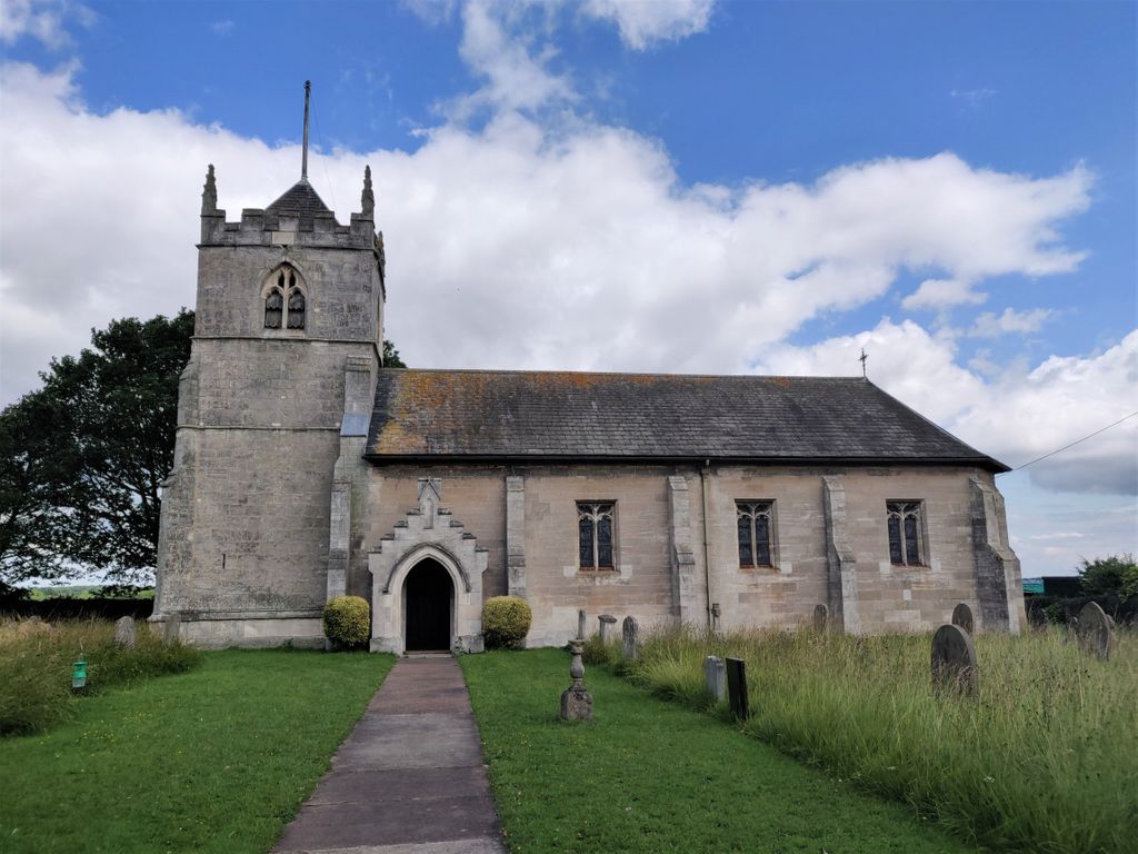
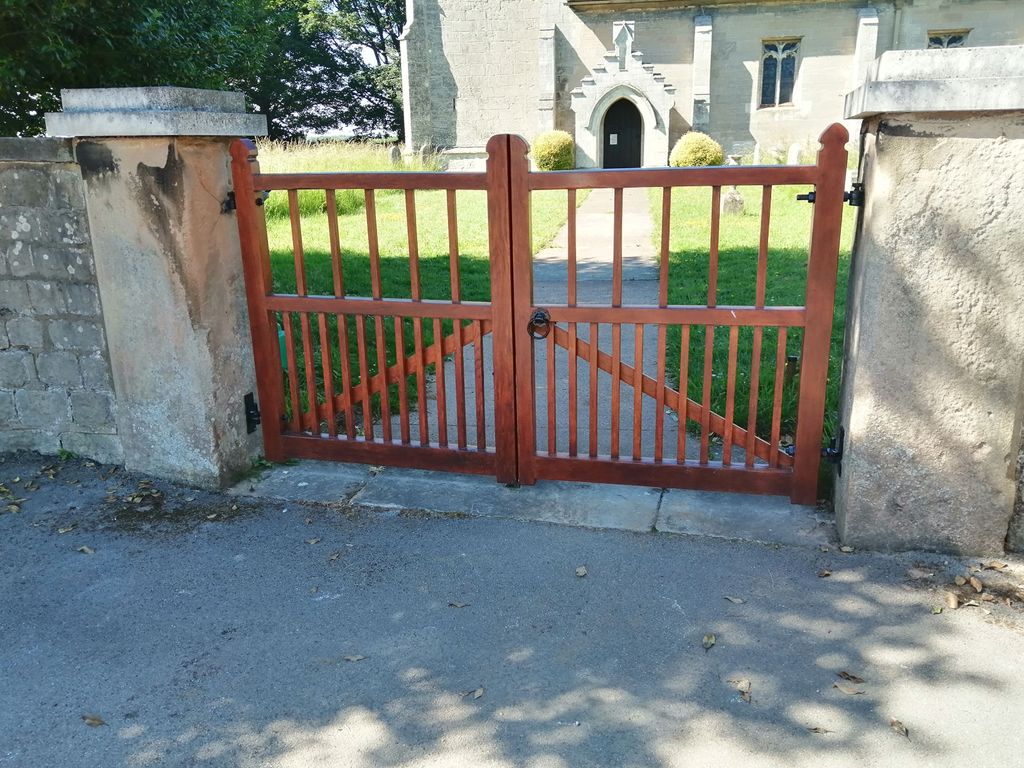
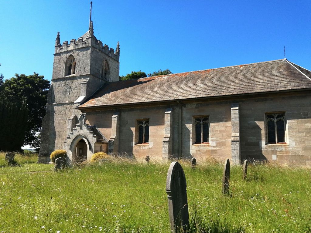
| Memorials | : | 0 |
| Location | : | Letwell, Metropolitan Borough of Rotherham, England |
| Coordinate | : | 53.3773774, -1.1606489 |
frequently asked questions (FAQ):
-
Where is St. Peter's Churchyard?
St. Peter's Churchyard is located at Church Lane, Letwell Letwell, Metropolitan Borough of Rotherham ,South Yorkshire , S81 8DEEngland.
-
St. Peter's Churchyard cemetery's updated grave count on graveviews.com?
0 memorials
-
Where are the coordinates of the St. Peter's Churchyard?
Latitude: 53.3773774
Longitude: -1.1606489


Nearby Cemetories:
1. St. Martin Churchyard
Firbeck, Metropolitan Borough of Rotherham, England
Coordinate: 53.3900080, -1.1561770
2. Langold Cemetery
Worksop, Bassetlaw District, England
Coordinate: 53.3777600, -1.1170100
3. Roche Abbey
Maltby, Metropolitan Borough of Rotherham, England
Coordinate: 53.4025000, -1.1834000
4. Sandbeck Park
Maltby, Metropolitan Borough of Rotherham, England
Coordinate: 53.4061450, -1.1460050
5. St. George's Churchyard
Woodsetts, Metropolitan Borough of Rotherham, England
Coordinate: 53.3476000, -1.1729800
6. St Helen's Roman Catholic Churchyard
Nottingham, Nottingham Unitary Authority, England
Coordinate: 53.3903220, -1.1131860
7. Dinnington Church Cemetery
Dinnington St John's, Metropolitan Borough of Rotherham, England
Coordinate: 53.3699557, -1.2117994
8. St John's Church Cemetery
Dinnington St John's, Metropolitan Borough of Rotherham, England
Coordinate: 53.3818248, -1.2135210
9. St John's Churchyard
Throapham, Metropolitan Borough of Rotherham, England
Coordinate: 53.3823850, -1.2147036
10. Park Avenue Cemetery
Dinnington St John's, Metropolitan Borough of Rotherham, England
Coordinate: 53.3633710, -1.2100700
11. Saint John the Evangelist Churchyard
Carlton-in-Lindrick, Bassetlaw District, England
Coordinate: 53.3486389, -1.1180278
12. All Saints Churchyard
Laughton-en-le-Morthen, Metropolitan Borough of Rotherham, England
Coordinate: 53.3882454, -1.2243221
13. Anston Burial Ground
Anston, Metropolitan Borough of Rotherham, England
Coordinate: 53.3452140, -1.2139500
14. St. James' Churchyard
Anston, Metropolitan Borough of Rotherham, England
Coordinate: 53.3476690, -1.2208800
15. St. Bartholomew’s Churchyard
Maltby, Metropolitan Borough of Rotherham, England
Coordinate: 53.4211340, -1.2074580
16. Maltby Cemetery
Maltby, Metropolitan Borough of Rotherham, England
Coordinate: 53.4255480, -1.1960280
17. Thurcroft Cemetery
Thurcroft, Metropolitan Borough of Rotherham, England
Coordinate: 53.3862010, -1.2525060
18. Tickhill Friary
Tickhill, Metropolitan Borough of Doncaster, England
Coordinate: 53.4283330, -1.1195830
19. Austin Friars Churchyard
Tickhill, Metropolitan Borough of Doncaster, England
Coordinate: 53.4283270, -1.1194740
20. St. Mary & St. Martin Churchyard
Blyth, Bassetlaw District, England
Coordinate: 53.3785000, -1.0642000
21. St. Simon & St. Jude Churchyard
Thurcroft, Metropolitan Borough of Rotherham, England
Coordinate: 53.3943010, -1.2552430
22. St Winifred Churchyard
Stainton, Metropolitan Borough of Doncaster, England
Coordinate: 53.4367385, -1.1657988
23. Blyth City Cemetery
Blyth, Bassetlaw District, England
Coordinate: 53.3729000, -1.0592000
24. Styrrup Road Cemetery
Harworth, Bassetlaw District, England
Coordinate: 53.4160400, -1.0816770