
| Memorials | : | 0 |
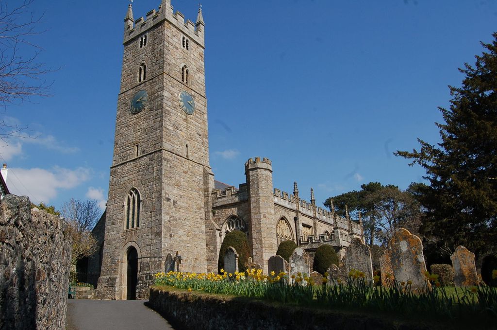
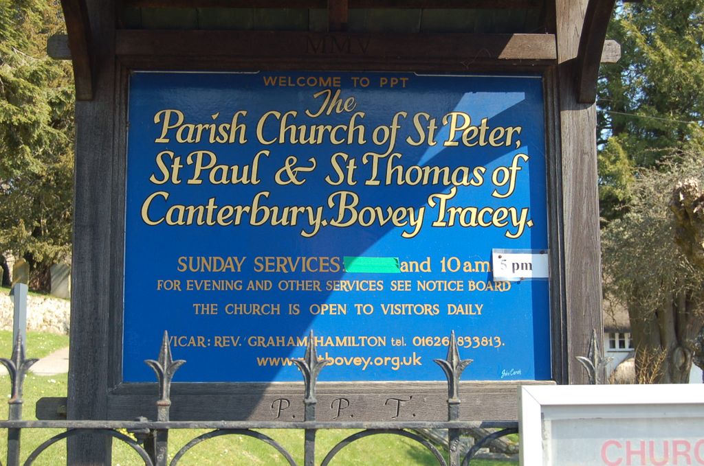
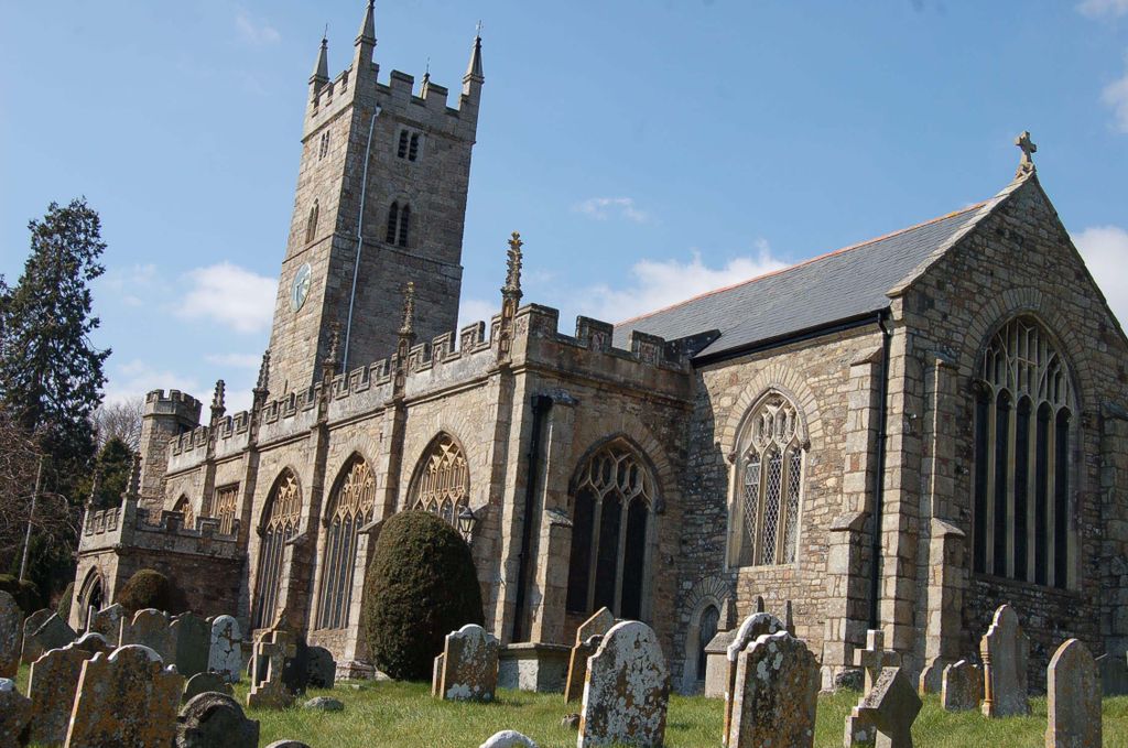
| Location | : | Bovey Tracey, Teignbridge District, England |
| Coordinate | : | 50.5950903, -3.6673713 |
frequently asked questions (FAQ):
-
Where is St Peter, St Paul & St Thomas of Canterbury?
St Peter, St Paul & St Thomas of Canterbury is located at Bovey Tracey, Teignbridge District ,Devon ,England.
-
St Peter, St Paul & St Thomas of Canterbury cemetery's updated grave count on graveviews.com?
0 memorials
-
Where are the coordinates of the St Peter, St Paul & St Thomas of Canterbury?
Latitude: 50.5950903
Longitude: -3.6673713
Nearby Cemetories:
1. Bovey Tracey Cemetery
Bovey Tracey, Teignbridge District, England
Coordinate: 50.5937100, -3.6618700
2. St Mary's Church
Hennock, Teignbridge District, England
Coordinate: 50.6162400, -3.6550200
3. St Paul's Churchyard
Chudleigh, Teignbridge District, England
Coordinate: 50.5848300, -3.6324800
4. Lustleigh Cemetery
Lustleigh, Teignbridge District, England
Coordinate: 50.6148900, -3.7172400
5. St. John the Baptist Churchyard
Lustleigh, Teignbridge District, England
Coordinate: 50.6183700, -3.7188600
6. Ss Martin and Mary Churchyard
Chudleigh, Teignbridge District, England
Coordinate: 50.6033400, -3.6021500
7. Tower Hill Cemetery
Chudleigh, Teignbridge District, England
Coordinate: 50.6049295, -3.5931153
8. St Cyprian Chapel
Chudleigh, Teignbridge District, England
Coordinate: 50.5906820, -3.5891920
9. Kingsteignton Cemetery
Kingsteignton, Teignbridge District, England
Coordinate: 50.5557300, -3.6032400
10. St James Churchyard
Christow, Teignbridge District, England
Coordinate: 50.6532970, -3.6477180
11. St John The Baptist
Ashton, Teignbridge District, England
Coordinate: 50.6505730, -3.6193410
12. All Saints Churchyard
Highweek, Teignbridge District, England
Coordinate: 50.5372570, -3.6224880
13. Christow Cemetery
Christow, Teignbridge District, England
Coordinate: 50.6581500, -3.6436800
14. St Michael's Churchyard
Kingsteignton, Teignbridge District, England
Coordinate: 50.5448300, -3.5946480
15. St Bartholomew Parish Churchyard
Ogwell, Teignbridge District, England
Coordinate: 50.5188100, -3.6401400
16. St Michaels Church
Doddiscombsleigh, Teignbridge District, England
Coordinate: 50.6674490, -3.6179080
17. St Mary the Virgin Churchyard
Newton Abbot, Teignbridge District, England
Coordinate: 50.5219160, -3.6171470
18. Newton Abbot Cemetery
Newton Abbot, Teignbridge District, England
Coordinate: 50.5201180, -3.6200730
19. St Nectan Churchyard
Ashcombe, Teignbridge District, England
Coordinate: 50.6056500, -3.5377500
20. St John the Baptist Churchyard
North Bovey, West Devon Borough, England
Coordinate: 50.6407600, -3.7835500
21. St Mary the Virgin Churchyard
Denbury, Teignbridge District, England
Coordinate: 50.5075930, -3.6602590
22. St. Andrew's Churchyard
Moretonhampstead, Teignbridge District, England
Coordinate: 50.6611600, -3.7625000
23. St John the Baptist Churchyard
Bishopsteignton, Teignbridge District, England
Coordinate: 50.5510800, -3.5385100
24. St. Pancras Churchyard
Widecombe-in-the-Moor, Teignbridge District, England
Coordinate: 50.5767810, -3.8109650