
| Memorials | : | 0 |
| Location | : | Bad Kohlgrub, Landkreis Garmisch-Partenkirchen, Germany |
| Website | : | www.ammergauer-alpen.de/oberammergau/en/Media/Attraktionen/Rochuskapelle-Bad-Kohlgrub |
| Coordinate | : | 47.6658499, 11.0505612 |
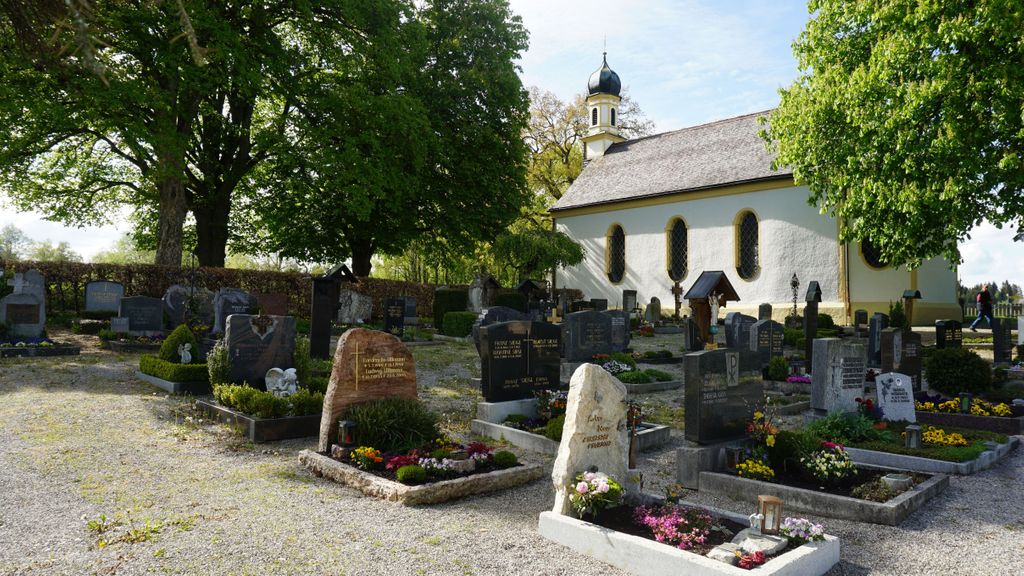
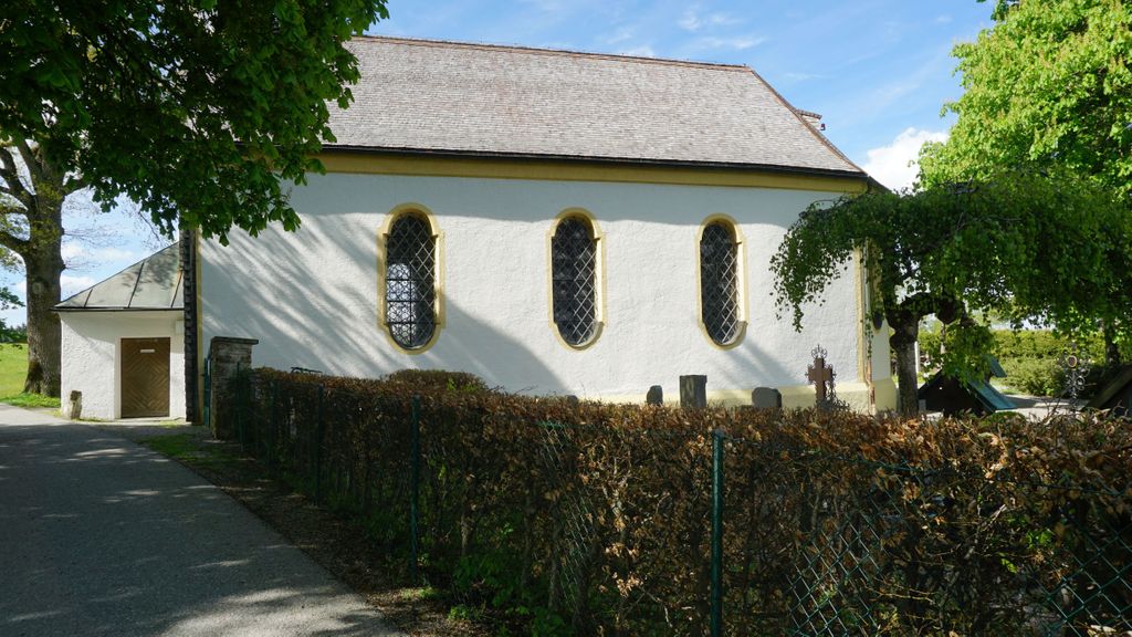
| Description | : | n 1633/1634 the plague hit Bad Kohlgrub. After the epidemic was over, the small votive chapel was built on the plague cemetery. Votive church built by the community after the devastating plague epidemic in 1633/1634 on what was then the plague cemetery; consecrated to the plague saint St. Rochus. In 1733 it was expanded by Josef Schmutzer on behalf of the community, as it had become too small for the many pilgrims and was equipped with delicate lattice, bandwork and flower garland stucco in the flat clay vault. The high altar, erected in 1733, in the figure of Immaculate, with statues of... Read More |
frequently asked questions (FAQ):
-
Where is St. Rochus Cemetery?
St. Rochus Cemetery is located at Bad Kohlgrub, Landkreis Garmisch-Partenkirchen ,Bavaria (Bayern) ,Germany.
-
St. Rochus Cemetery cemetery's updated grave count on graveviews.com?
0 memorials
-
Where are the coordinates of the St. Rochus Cemetery?
Latitude: 47.6658499
Longitude: 11.0505612
Nearby Cemetories:
1. Kirchfriedhof Bad Bayersoien
Bayersoien, Landkreis Garmisch-Partenkirchen, Germany
Coordinate: 47.6913400, 10.9955800
2. Friedhof Unterammergau
Unterammergau, Landkreis Garmisch-Partenkirchen, Germany
Coordinate: 47.6137300, 11.0280800
3. St. Peter and Paul Cemetery
Oberammergau, Landkreis Garmisch-Partenkirchen, Germany
Coordinate: 47.5956700, 11.0689900
4. Friedhof Wildsteig
Wildsteig, Landkreis Weilheim-Schongau, Germany
Coordinate: 47.7017096, 10.9363596
5. Pestfriedhof
Rottenbuch, Landkreis Weilheim-Schongau, Germany
Coordinate: 47.7324500, 10.9459800
6. Ettal War Memorial
Ettal, Landkreis Garmisch-Partenkirchen, Germany
Coordinate: 47.5692200, 11.0924300
7. Kloster Ettal
Ettal, Landkreis Garmisch-Partenkirchen, Germany
Coordinate: 47.5695900, 11.0945000
8. Friedhof Murnau
Murnau am Staffelsee, Landkreis Garmisch-Partenkirchen, Germany
Coordinate: 47.6762500, 11.2029600
9. Bergfriedhof Oberau
Oberau, Landkreis Garmisch-Partenkirchen, Germany
Coordinate: 47.5587111, 11.1341443
10. Neuer Friedhof Oberau
Oberau, Landkreis Garmisch-Partenkirchen, Germany
Coordinate: 47.5574273, 11.1346397
11. Friedhof Untersöchering
Untersochering, Landkreis Weilheim-Schongau, Germany
Coordinate: 47.7430952, 11.2065270
12. Steingaden
Steingaden, Landkreis Weilheim-Schongau, Germany
Coordinate: 47.7016670, 10.8624720
13. Stadtfriedhof Partenkirchen
Garmisch-Partenkirchen, Landkreis Garmisch-Partenkirchen, Germany
Coordinate: 47.5018700, 11.0836100
14. Friedhof Garmisch
Garmisch-Partenkirchen, Landkreis Garmisch-Partenkirchen, Germany
Coordinate: 47.5018450, 11.0836960
15. Friedhof Bayerniederhofen
Halblech, Landkreis Ostallgäu, Germany
Coordinate: 47.6249014, 10.8006797
16. City Cemetery
Schongau, Landkreis Weilheim-Schongau, Germany
Coordinate: 47.8145903, 10.8983352
17. Waldfriedhof Schongau
Schongau, Landkreis Weilheim-Schongau, Germany
Coordinate: 47.8098248, 10.8876269
18. St. Salvator and Sebastian Churchyard
Weilheim in Oberbayern, Landkreis Weilheim-Schongau, Germany
Coordinate: 47.8413490, 11.1485280
19. Friedhof Antdorf
Antdorf, Landkreis Weilheim-Schongau, Germany
Coordinate: 47.7509894, 11.3069886
20. Friedhof Grainau
Grainau, Landkreis Garmisch-Partenkirchen, Germany
Coordinate: 47.4709980, 11.0253050
21. friedhof kochel
Ort, Landkreis Bad Tölz-Wolfratshausen, Germany
Coordinate: 47.6601000, 11.3653900
22. Friedhof of Kochel am See
Kochel am See, Landkreis Bad Tölz-Wolfratshausen, Germany
Coordinate: 47.6591860, 11.3654020
23. Wessobrunn Friedhof
Wessobrunn, Landkreis Weilheim-Schongau, Germany
Coordinate: 47.8777200, 11.0219100
24. Gemeindefriedhof Seeshaupt
Seeshaupt, Landkreis Weilheim-Schongau, Germany
Coordinate: 47.8261940, 11.2893100