
| Memorials | : | 0 |
| Location | : | Rottenbuch, Landkreis Weilheim-Schongau, Germany |
| Coordinate | : | 47.7324500, 10.9459800 |
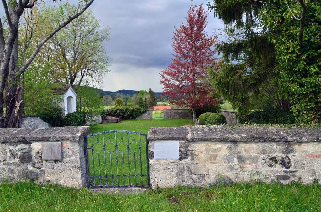
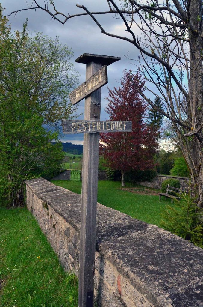
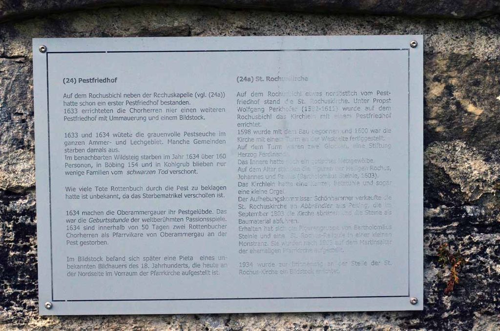
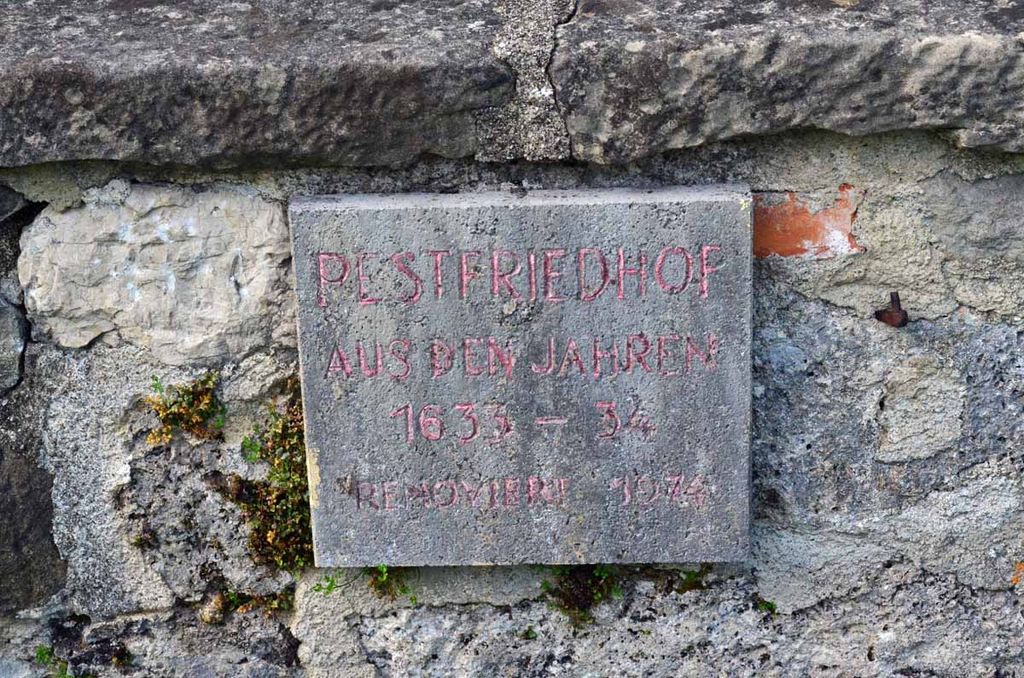
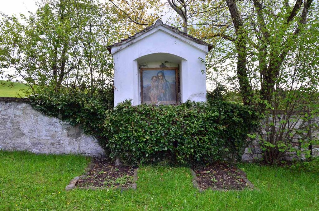
| Description | : | Used for burial of plague victims in 1633-34. Take the road to Steingaden about 1.3 km west from Rottenbuch, then a farm road about 200 m north. There is a small sign on the main road. There may be no records of who was buried here almost 500 years ago. |
frequently asked questions (FAQ):
-
Where is Pestfriedhof?
Pestfriedhof is located at Rottenbuch, Landkreis Weilheim-Schongau ,Bavaria (Bayern) ,Germany.
-
Pestfriedhof cemetery's updated grave count on graveviews.com?
0 memorials
-
Where are the coordinates of the Pestfriedhof?
Latitude: 47.7324500
Longitude: 10.9459800
Nearby Cemetories:
1. Friedhof Wildsteig
Wildsteig, Landkreis Weilheim-Schongau, Germany
Coordinate: 47.7017096, 10.9363596
2. Kirchfriedhof Bad Bayersoien
Bayersoien, Landkreis Garmisch-Partenkirchen, Germany
Coordinate: 47.6913400, 10.9955800
3. Steingaden
Steingaden, Landkreis Weilheim-Schongau, Germany
Coordinate: 47.7016670, 10.8624720
4. Waldfriedhof Schongau
Schongau, Landkreis Weilheim-Schongau, Germany
Coordinate: 47.8098248, 10.8876269
5. City Cemetery
Schongau, Landkreis Weilheim-Schongau, Germany
Coordinate: 47.8145903, 10.8983352
6. St. Rochus Cemetery
Bad Kohlgrub, Landkreis Garmisch-Partenkirchen, Germany
Coordinate: 47.6658499, 11.0505612
7. Friedhof Unterammergau
Unterammergau, Landkreis Garmisch-Partenkirchen, Germany
Coordinate: 47.6137300, 11.0280800
8. Friedhof Bayerniederhofen
Halblech, Landkreis Ostallgäu, Germany
Coordinate: 47.6249014, 10.8006797
9. Wessobrunn Friedhof
Wessobrunn, Landkreis Weilheim-Schongau, Germany
Coordinate: 47.8777200, 11.0219100
10. St. Peter and Paul Cemetery
Oberammergau, Landkreis Garmisch-Partenkirchen, Germany
Coordinate: 47.5956700, 11.0689900
11. St. Salvator and Sebastian Churchyard
Weilheim in Oberbayern, Landkreis Weilheim-Schongau, Germany
Coordinate: 47.8413490, 11.1485280
12. Friedhof Untersöchering
Untersochering, Landkreis Weilheim-Schongau, Germany
Coordinate: 47.7430952, 11.2065270
13. Friedhof Murnau
Murnau am Staffelsee, Landkreis Garmisch-Partenkirchen, Germany
Coordinate: 47.6762500, 11.2029600
14. Ettal War Memorial
Ettal, Landkreis Garmisch-Partenkirchen, Germany
Coordinate: 47.5692200, 11.0924300
15. Kloster Ettal
Ettal, Landkreis Garmisch-Partenkirchen, Germany
Coordinate: 47.5695900, 11.0945000
16. Friedhof Waltenhofen
Waltenhofen, Landkreis Oberallgäu, Germany
Coordinate: 47.5863890, 10.7291110
17. Bergfriedhof Oberau
Oberau, Landkreis Garmisch-Partenkirchen, Germany
Coordinate: 47.5587111, 11.1341443
18. Friedhof Hopfen am See Gemeindefriedhof
Fussen, Landkreis Ostallgäu, Germany
Coordinate: 47.6058660, 10.6857650
19. Neuer Friedhof Oberau
Oberau, Landkreis Garmisch-Partenkirchen, Germany
Coordinate: 47.5574273, 11.1346397
20. Kirchhof Hopfen am See
Fussen, Landkreis Ostallgäu, Germany
Coordinate: 47.6052950, 10.6853410
21. Friedhof Wilzhofen
Wilzhofen, Landkreis Weilheim-Schongau, Germany
Coordinate: 47.8796960, 11.1833250
22. Waldfriedhof Füssen
Fussen, Landkreis Ostallgäu, Germany
Coordinate: 47.5795220, 10.7073350
23. Friedhof Marktoberdorf
Marktoberdorf, Landkreis Ostallgäu, Germany
Coordinate: 47.7811811, 10.6221476
24. Kirche St. Pankratius
Marktoberdorf, Landkreis Ostallgäu, Germany
Coordinate: 47.7773209, 10.6147911