
| Memorials | : | 0 |
| Location | : | Earl Shilton, Hinckley and Bosworth Borough, England |
| Coordinate | : | 52.5780650, -1.3089390 |
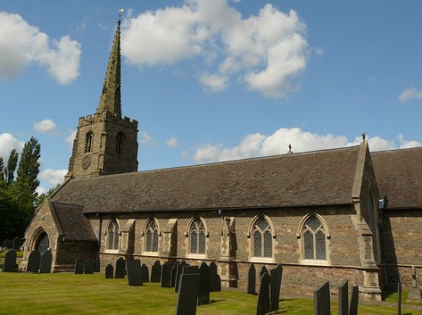
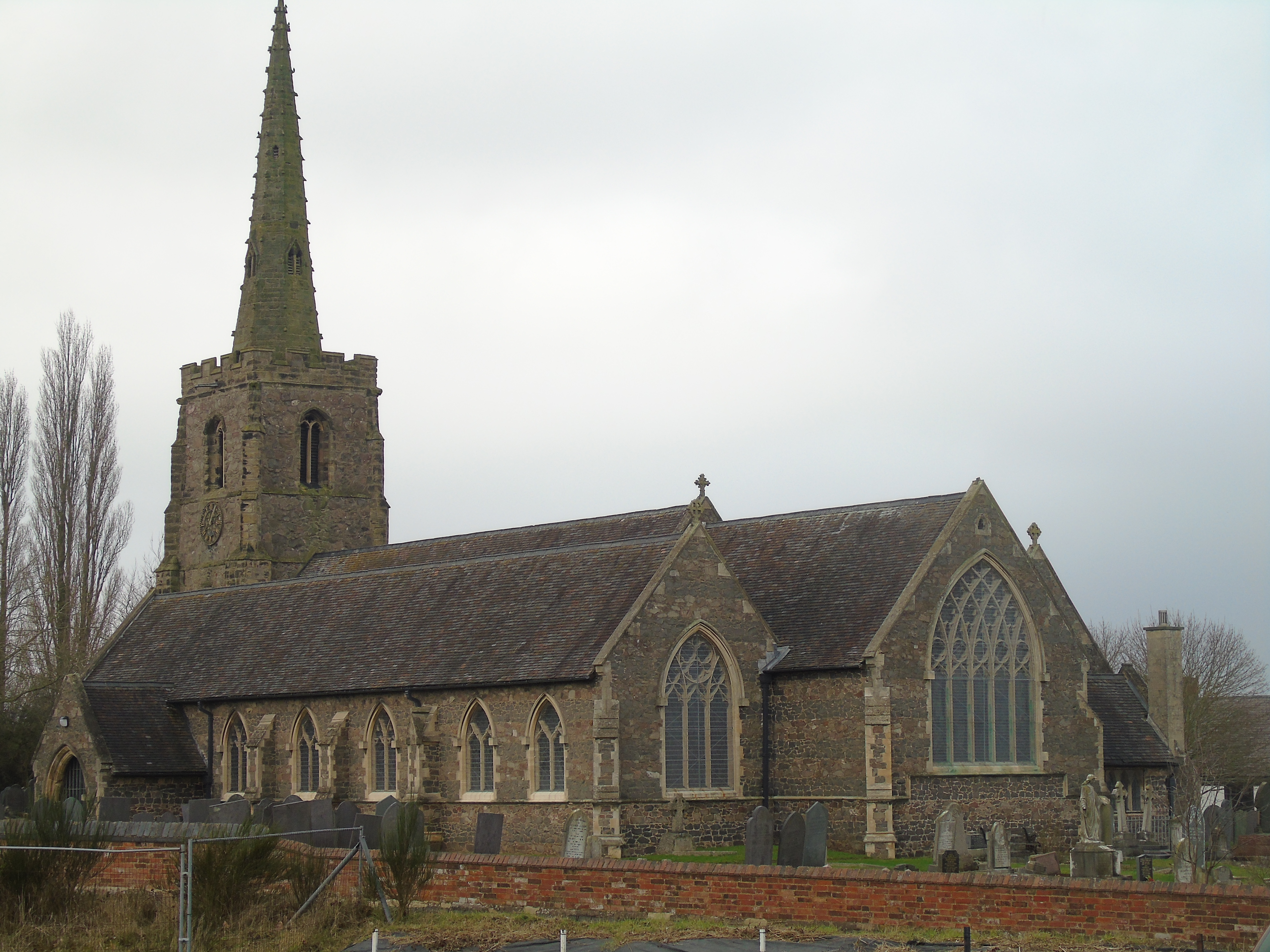
| Description | : | Church is a Grade II Listed Victorian building, built in 1854. It features a medieval tower. |
frequently asked questions (FAQ):
-
Where is St Simon & St Jude Churchyard?
St Simon & St Jude Churchyard is located at Maughan Street, Earl Shilton, Leicestershire Earl Shilton, Hinckley and Bosworth Borough ,Leicestershire , LE9 7BAEngland.
-
St Simon & St Jude Churchyard cemetery's updated grave count on graveviews.com?
0 memorials
-
Where are the coordinates of the St Simon & St Jude Churchyard?
Latitude: 52.5780650
Longitude: -1.3089390
Nearby Cemetories:
1. The Independent Chapel
Earl Shilton, Hinckley and Bosworth Borough, England
Coordinate: 52.5759700, -1.3108500
2. East Shilton Cemetery
Earl Shilton, Hinckley and Bosworth Borough, England
Coordinate: 52.5768930, -1.2987500
3. Barwell Cemetery
Hinckley, Hinckley and Bosworth Borough, England
Coordinate: 52.5726070, -1.3458250
4. All Saints Churchyard
Kirkby Mallory, Hinckley and Bosworth Borough, England
Coordinate: 52.5989960, -1.3309200
5. St Mary Magdalene Peckleton
Peckleton, Hinckley and Bosworth Borough, England
Coordinate: 52.6031910, -1.3071160
6. St Mary's Churchyard
Barwell, Hinckley and Bosworth Borough, England
Coordinate: 52.5644950, -1.3467240
7. All Saints Churchyard
Thurlaston, Blaby District, England
Coordinate: 52.5870530, -1.2599600
8. St Martin Churchyard
Stapleton, Hinckley and Bosworth Borough, England
Coordinate: 52.5821160, -1.3599100
9. Nock Verges Cemetery
Stoney Stanton, Blaby District, England
Coordinate: 52.5492300, -1.2807020
10. St Michael's Churchyard
Stoney Stanton, Blaby District, England
Coordinate: 52.5487420, -1.2794980
11. St Michael & All Angels
Croft, Blaby District, England
Coordinate: 52.5593821, -1.2484472
12. Huncote Cemetery
Huncote, Blaby District, England
Coordinate: 52.5764090, -1.2391220
13. Ashby Road Cemetery
Hinckley, Hinckley and Bosworth Borough, England
Coordinate: 52.5500533, -1.3631002
14. All Saints
Sapcote, Blaby District, England
Coordinate: 52.5344520, -1.2810440
15. Sapcote Cemetery
Sapcote, Blaby District, England
Coordinate: 52.5336420, -1.2842020
16. St Peter's Church
Aston Flamville, Blaby District, England
Coordinate: 52.5307260, -1.3187510
17. St Martin Churchyard
Desford, Hinckley and Bosworth Borough, England
Coordinate: 52.6268250, -1.2943410
18. Desford Cemetery
Desford, Hinckley and Bosworth Borough, England
Coordinate: 52.6278100, -1.3068590
19. Church of Saint James
Sutton Cheney, Hinckley and Bosworth Borough, England
Coordinate: 52.6003100, -1.3864300
20. Burbage Cemetery
Burbage, Hinckley and Bosworth Borough, England
Coordinate: 52.5278950, -1.3347280
21. St Catherine's Churchyard
Burbage, Hinckley and Bosworth Borough, England
Coordinate: 52.5309330, -1.3483010
22. St Marys Parish Churchyard
Hinckley, Hinckley and Bosworth Borough, England
Coordinate: 52.5407970, -1.3721560
23. All Saints Churchyard
Cadeby, Hinckley and Bosworth Borough, England
Coordinate: 52.6171420, -1.3724790
24. St Helen
Sharnford, Blaby District, England
Coordinate: 52.5228440, -1.2886350