
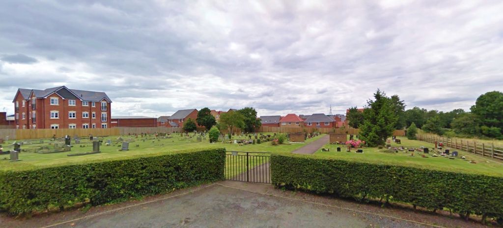
| Memorials | : | 4 |
| Location | : | Stoney Stanton, Blaby District, England |
| Coordinate | : | 52.5492300, -1.2807020 |
frequently asked questions (FAQ):
-
Where is Nock Verges Cemetery?
Nock Verges Cemetery is located at Nock Verges Stoney Stanton, Blaby District ,Leicestershire , LE9 4LREngland.
-
Nock Verges Cemetery cemetery's updated grave count on graveviews.com?
4 memorials
-
Where are the coordinates of the Nock Verges Cemetery?
Latitude: 52.5492300
Longitude: -1.2807020
Nearby Cemetories:
1. St Michael's Churchyard
Stoney Stanton, Blaby District, England
Coordinate: 52.5487420, -1.2794980
2. All Saints
Sapcote, Blaby District, England
Coordinate: 52.5344520, -1.2810440
3. Sapcote Cemetery
Sapcote, Blaby District, England
Coordinate: 52.5336420, -1.2842020
4. St Michael & All Angels
Croft, Blaby District, England
Coordinate: 52.5593821, -1.2484472
5. St Helen
Sharnford, Blaby District, England
Coordinate: 52.5228440, -1.2886350
6. St Peter's Church
Aston Flamville, Blaby District, England
Coordinate: 52.5307260, -1.3187510
7. East Shilton Cemetery
Earl Shilton, Hinckley and Bosworth Borough, England
Coordinate: 52.5768930, -1.2987500
8. Sutton Elms Baptist Chapelyard
Broughton Astley, Harborough District, England
Coordinate: 52.5389370, -1.2328020
9. The Independent Chapel
Earl Shilton, Hinckley and Bosworth Borough, England
Coordinate: 52.5759700, -1.3108500
10. St Simon & St Jude Churchyard
Earl Shilton, Hinckley and Bosworth Borough, England
Coordinate: 52.5780650, -1.3089390
11. Huncote Cemetery
Huncote, Blaby District, England
Coordinate: 52.5764090, -1.2391220
12. Broughton Astley Cemetery
Broughton Astley, Harborough District, England
Coordinate: 52.5259830, -1.2325190
13. Burbage Cemetery
Burbage, Hinckley and Bosworth Borough, England
Coordinate: 52.5278950, -1.3347280
14. St Marys Parish Churchyard
Broughton Astley, Harborough District, England
Coordinate: 52.5287810, -1.2253600
15. All Saints Churchyard
Thurlaston, Blaby District, England
Coordinate: 52.5870530, -1.2599600
16. Saint Nicholas Churchyard
Frolesworth, Harborough District, England
Coordinate: 52.5112740, -1.2599970
17. St Mary's Churchyard
Barwell, Hinckley and Bosworth Borough, England
Coordinate: 52.5644950, -1.3467240
18. St Catherine's Churchyard
Burbage, Hinckley and Bosworth Borough, England
Coordinate: 52.5309330, -1.3483010
19. Barwell Cemetery
Hinckley, Hinckley and Bosworth Borough, England
Coordinate: 52.5726070, -1.3458250
20. Ashby Road Cemetery
Hinckley, Hinckley and Bosworth Borough, England
Coordinate: 52.5500533, -1.3631002
21. Cosby Cemetery
Cosby, Blaby District, England
Coordinate: 52.5560490, -1.1962970
22. All Saints Churchyard
Narborough, Blaby District, England
Coordinate: 52.5730420, -1.2038480
23. St Michael and All Angels Churchyard
Cosby, Blaby District, England
Coordinate: 52.5488260, -1.1933700
24. St Peters Churchyard
Leire, Harborough District, England
Coordinate: 52.5053690, -1.2266430