
| Memorials | : | 0 |
| Location | : | Stanley, Metropolitan Borough of Wakefield, England |
| Coordinate | : | 53.7147890, -1.4735250 |
frequently asked questions (FAQ):
-
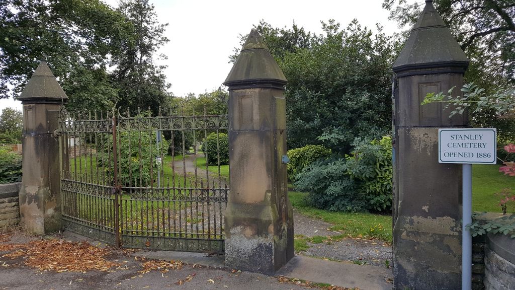
Where is Stanley Cemetery?
Stanley Cemetery is located at Lake Lock Road Stanley, Metropolitan Borough of Wakefield ,West Yorkshire ,England.
-
Stanley Cemetery cemetery's updated grave count on graveviews.com?
0 memorials
-
Where are the coordinates of the Stanley Cemetery?
Latitude: 53.7147890
Longitude: -1.4735250
Nearby Cemetories:
1. St Peter Churchyard
Stanley, Metropolitan Borough of Wakefield, England
Coordinate: 53.7136330, -1.4712940
2. St. Mary Magdelene Churchyard
Outwood, Metropolitan Borough of Wakefield, England
Coordinate: 53.7112550, -1.5012190
3. Outwood Cemetery
Outwood, Metropolitan Borough of Wakefield, England
Coordinate: 53.7105970, -1.5011840
4. Christ Church Churchyard
Lofthouse, Metropolitan Borough of Leeds, England
Coordinate: 53.7287400, -1.4960500
5. Lofthouse Cemetery
Lofthouse, Metropolitan Borough of Leeds, England
Coordinate: 53.7332670, -1.4959060
6. Altofts Cemetery
Altofts, Metropolitan Borough of Wakefield, England
Coordinate: 53.7089350, -1.4352310
7. St Mary Magdalene Churchyard
Altofts, Metropolitan Borough of Wakefield, England
Coordinate: 53.7094970, -1.4289600
8. St. John The Baptist Churchyard
Wakefield, Metropolitan Borough of Wakefield, England
Coordinate: 53.6883040, -1.5055020
9. Kirkthorpe St Peter's Church
Wakefield, Metropolitan Borough of Wakefield, England
Coordinate: 53.6837930, -1.4543120
10. St Peter the Apostle Churchyard
Warmfield, Metropolitan Borough of Wakefield, England
Coordinate: 53.6837930, -1.4541410
11. St Andrew and St Mary Churchyard
Wakefield, Metropolitan Borough of Wakefield, England
Coordinate: 53.6826980, -1.4898550
12. St. Peter Churchyard Extension Cemetery
Warmfield, Metropolitan Borough of Wakefield, England
Coordinate: 53.6833560, -1.4538230
13. Vicar’s Croft Burial Ground (Defunct)
Wakefield, Metropolitan Borough of Wakefield, England
Coordinate: 53.6833820, -1.4943720
14. Wakefield Cathedral Churchyard
Wakefield, Metropolitan Borough of Wakefield, England
Coordinate: 53.6828910, -1.4962640
15. St. John the Evangelist Churchyard
Oulton, Metropolitan Borough of Leeds, England
Coordinate: 53.7480340, -1.4560300
16. Holy Trinity Churchyard
Rothwell, Metropolitan Borough of Leeds, England
Coordinate: 53.7503340, -1.4810830
17. Westgate Chapel
Wakefield, Metropolitan Borough of Wakefield, England
Coordinate: 53.6823200, -1.5042600
18. West Parade Wesleyan Methodist Burial Ground
Wakefield, Metropolitan Borough of Wakefield, England
Coordinate: 53.6795410, -1.4954980
19. Normanton Upper Cemetery
Normanton, Metropolitan Borough of Wakefield, England
Coordinate: 53.6964700, -1.4156370
20. All Saints Churchyard
Normanton, Metropolitan Borough of Wakefield, England
Coordinate: 53.6979280, -1.4142980
21. Rothwell Cemetery
Rothwell, Metropolitan Borough of Leeds, England
Coordinate: 53.7545200, -1.4734100
22. Alverthorpe Cemetery
Alverthorpe, Metropolitan Borough of Wakefield, England
Coordinate: 53.6926990, -1.5318500
23. Normanton Lower Cemetery
Normanton, Metropolitan Borough of Wakefield, England
Coordinate: 53.7002440, -1.4081200
24. St Paul Churchyard
Alverthorpe, Metropolitan Borough of Wakefield, England
Coordinate: 53.6921960, -1.5320940