
| Memorials | : | 0 |
| Location | : | Stilwell, Adair County, USA |
| Coordinate | : | 35.7857490, -94.6302030 |
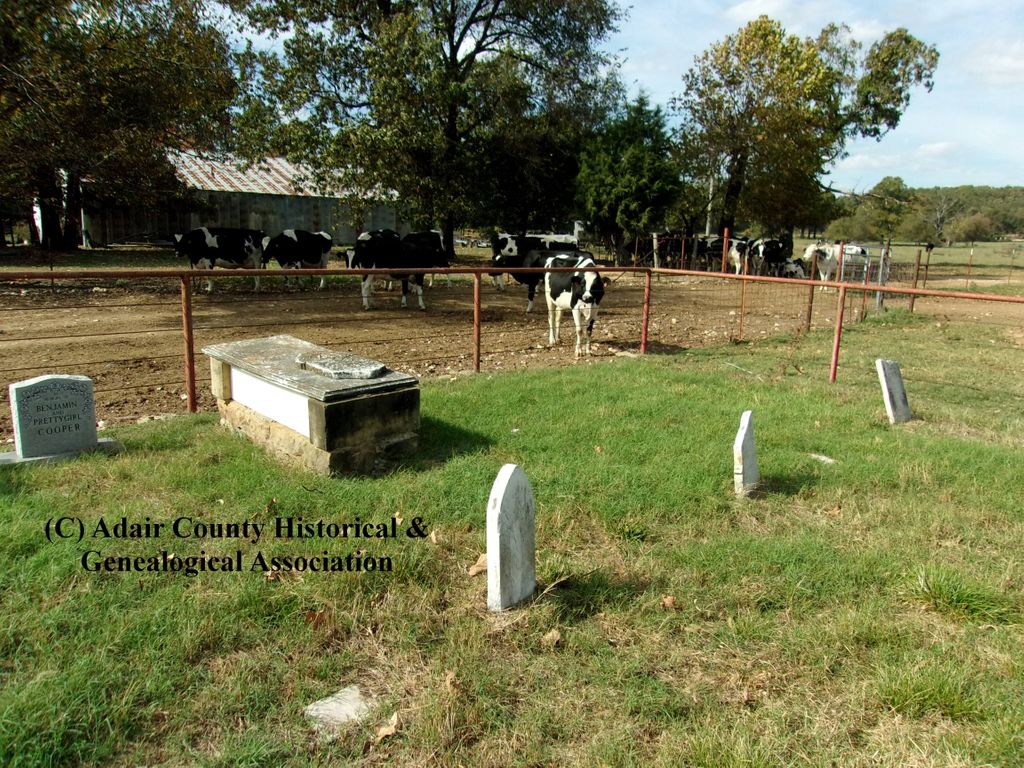
| Description | : | This cemetery is located in the NW4,SW4, SW4 of Section 11, Township 15N, Range 25E. It is approximately a mile and a half south of Stilwell in Adair County, Oklahoma. In 1937, W.J.B. Bigby surveyed this cemetery through his work with the Works Progress Administration. He recorded the existence of approximately fifteen graves in this cemetery, however only six contained tombstones. He noted the cemetery began about the year 1870. Source: W.J.B. Bigby, May 19, 1937. Burial Ground Form, Indian-Pioneer Papers, Western History Collections, University of Oklahoma, Norman, OK. Submitted to Find A Grave by Luke Williams. |
frequently asked questions (FAQ):
-
Where is Starr Spring Cemetery?
Starr Spring Cemetery is located at Stilwell, Adair County ,Oklahoma ,USA.
-
Starr Spring Cemetery cemetery's updated grave count on graveviews.com?
0 memorials
-
Where are the coordinates of the Starr Spring Cemetery?
Latitude: 35.7857490
Longitude: -94.6302030
Nearby Cemetories:
1. Zion Cemetery
Stilwell, Adair County, USA
Coordinate: 35.7820000, -94.6375000
2. McLemore Cemetery
Stilwell, Adair County, USA
Coordinate: 35.8008660, -94.6259840
3. Doublehead Cemetery
Adair County, USA
Coordinate: 35.7627983, -94.6339035
4. Davis Cemetery #2
Stilwell, Adair County, USA
Coordinate: 35.8146500, -94.6077700
5. Paden Cemetery
Stilwell, Adair County, USA
Coordinate: 35.7901950, -94.5836400
6. Stilwell Cemetery
Stilwell, Adair County, USA
Coordinate: 35.8222008, -94.6436005
7. Morris Cemetery
Stilwell, Adair County, USA
Coordinate: 35.8139080, -94.5914940
8. Chulio Cemetery
Cherry Tree, Adair County, USA
Coordinate: 35.7421989, -94.6544037
9. Bunch Family Cemetery
Adair County, USA
Coordinate: 35.7744700, -94.5709200
10. Fairfield Cemetery
Stilwell, Adair County, USA
Coordinate: 35.8397000, -94.6130000
11. Honey Hill Cemetery
Stilwell, Adair County, USA
Coordinate: 35.7673000, -94.5645000
12. Chalk Bluff Cemetery
Stilwell, Adair County, USA
Coordinate: 35.8260994, -94.5766983
13. Ewing Chapel Cemetery
Adair County, USA
Coordinate: 35.8027992, -94.5597000
14. Tyler Spring Cemetery
Stilwell, Adair County, USA
Coordinate: 35.8460999, -94.6296997
15. Salem Indian Cemetery
Bell, Adair County, USA
Coordinate: 35.7315950, -94.5956540
16. Pilgrims Rest Cemetery
Adair County, USA
Coordinate: 35.8258018, -94.6877975
17. Clear Spring Cemetery
Adair County, USA
Coordinate: 35.7757988, -94.7117004
18. Candy Mink Cemetery
Cherry Tree, Adair County, USA
Coordinate: 35.7164400, -94.6390900
19. Davis Cemetery
Adair County, USA
Coordinate: 35.8123800, -94.5368200
20. Elm Grove Cemetery
Adair County, USA
Coordinate: 35.7763000, -94.5275000
21. Fourkiller Cemetery
Piney, Adair County, USA
Coordinate: 35.8572006, -94.5725021
22. Oak Grove Cemetery
Stilwell, Adair County, USA
Coordinate: 35.8182983, -94.5325012
23. Sanders Cemetery
Lyons, Adair County, USA
Coordinate: 35.7539800, -94.7287100
24. Proctor Family Cemetery
Adair County, USA
Coordinate: 35.7018600, -94.6543800