
| Memorials | : | 1 |
| Location | : | Lyons, Adair County, USA |
| Coordinate | : | 35.7539800, -94.7287100 |
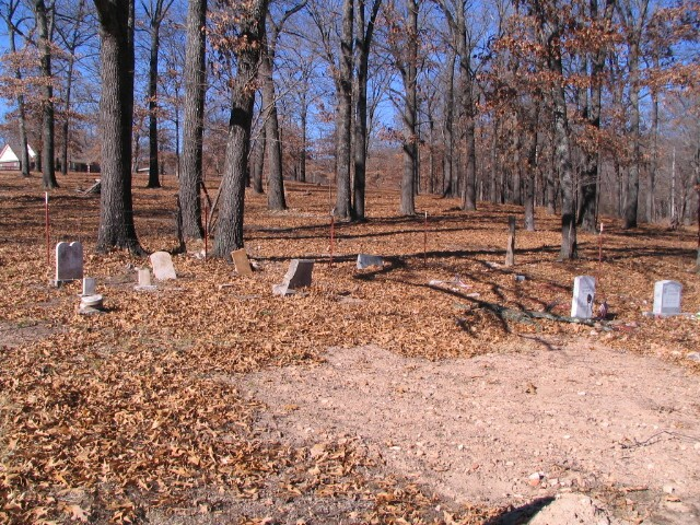
| Description | : | All photos of this cemetey were taken by Martha Real This Cemetery is located 3.5 miles south of Highway 100 west on Bunch Road "old highway 17". This is the site of an old church Mission the only thing left of the Sanders home and the church is a well... Read More |
frequently asked questions (FAQ):
-
Where is Sanders Cemetery?
Sanders Cemetery is located at Bunch- Cave Springs Road Lyons, Adair County ,Oklahoma , 74960USA.
-
Sanders Cemetery cemetery's updated grave count on graveviews.com?
1 memorials
-
Where are the coordinates of the Sanders Cemetery?
Latitude: 35.7539800
Longitude: -94.7287100
Nearby Cemetories:
1. Clear Spring Cemetery
Adair County, USA
Coordinate: 35.7757988, -94.7117004
2. Hickory Vann Cemetery
Bunch, Adair County, USA
Coordinate: 35.7191670, -94.7202780
3. Scott Cemetery
Bunch, Adair County, USA
Coordinate: 35.7163100, -94.7541400
4. Buzzard Cemetery
Bunch, Adair County, USA
Coordinate: 35.7088700, -94.7661900
5. Chuculate Cemetery
Greasy, Adair County, USA
Coordinate: 35.6981010, -94.7007980
6. Chulio Cemetery
Cherry Tree, Adair County, USA
Coordinate: 35.7421989, -94.6544037
7. Echota Cemetery
Stilwell, Adair County, USA
Coordinate: 35.8180000, -94.7495000
8. Hungry Mountain Cemetery
Cherokee County, USA
Coordinate: 35.7614190, -94.8189860
9. Bunch Cemetery
Bunch, Adair County, USA
Coordinate: 35.6840000, -94.7645000
10. Doublehead Cemetery
Adair County, USA
Coordinate: 35.7627983, -94.6339035
11. Pilgrims Rest Cemetery
Adair County, USA
Coordinate: 35.8258018, -94.6877975
12. Zion Cemetery
Stilwell, Adair County, USA
Coordinate: 35.7820000, -94.6375000
13. Proctor Family Cemetery
Adair County, USA
Coordinate: 35.7018600, -94.6543800
14. Candy Mink Cemetery
Cherry Tree, Adair County, USA
Coordinate: 35.7164400, -94.6390900
15. Killer Cemetery
Adair County, USA
Coordinate: 35.6958008, -94.6530991
16. Starr Spring Cemetery
Stilwell, Adair County, USA
Coordinate: 35.7857490, -94.6302030
17. Studie Family/Dry Creek Cemetery
Cherokee County, USA
Coordinate: 35.7320726, -94.8340834
18. Prichett Gravesite
Stony Point, Adair County, USA
Coordinate: 35.8427170, -94.7366200
19. Dickson Cemetery
Adair County, USA
Coordinate: 35.8424988, -94.7619019
20. Beaver Cemetery
Adair County, USA
Coordinate: 35.6650009, -94.6877975
21. McLemore Cemetery
Stilwell, Adair County, USA
Coordinate: 35.8008660, -94.6259840
22. Stilwell Cemetery
Stilwell, Adair County, USA
Coordinate: 35.8222008, -94.6436005
23. S qua de li tsl Cemetery
Bunch, Adair County, USA
Coordinate: 35.6645140, -94.7854470
24. Barber Cemetery
Tahlequah, Cherokee County, USA
Coordinate: 35.7619019, -94.8593979