
| Memorials | : | 0 |
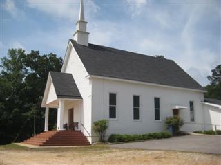
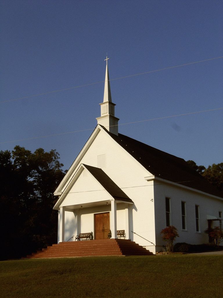
| Location | : | Standing Rock, Chambers County, USA |
| Coordinate | : | 33.0466830, -85.2232670 |
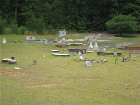
| Description | : | From LaGrange, GA, drive west on Roanoke Road, Route 109. At the Alabama state line, the route number changes to 278. About 1000 feet after the state line, turn left (south) on State Line Road and drive about 1200 feet to the church and cemetery located on the right (west). In addition to the 91 marked graves, there are an additional 30 unlettered graves. |
frequently asked questions (FAQ):
-
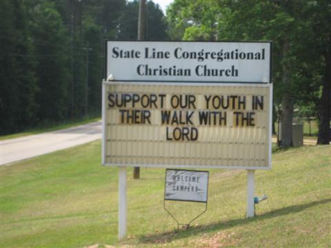
Where is Stateline Congregational Christian Church Cemetery?
Stateline Congregational Christian Church Cemetery is located at Standing Rock, Chambers County ,Alabama ,USA.
-
Stateline Congregational Christian Church Cemetery cemetery's updated grave count on graveviews.com?
0 memorials
-
Where are the coordinates of the Stateline Congregational Christian Church Cemetery?
Latitude: 33.0466830
Longitude: -85.2232670
Nearby Cemetories:
1. Bethlehem Missionary Baptist Church Cemetery
Standing Rock, Chambers County, USA
Coordinate: 33.0575020, -85.2239090
2. Standing Rock Methodist Church Cemetery
Chambers County, USA
Coordinate: 33.0786018, -85.2518997
3. Sweet Home Baptist Church Cemetery
Chambers County, USA
Coordinate: 33.0358900, -85.3035370
4. Howell Cemetery
Fredonia, Chambers County, USA
Coordinate: 33.0030446, -85.2903180
5. New Hope Baptist Church Cemetery
Fredonia, Chambers County, USA
Coordinate: 32.9939100, -85.2857490
6. Fredonia Methodist Church Cemetery
Fredonia, Chambers County, USA
Coordinate: 32.9901237, -85.2916107
7. Stephens Family Cemetery
Stroud, Chambers County, USA
Coordinate: 33.0767600, -85.3129300
8. Littlefield Cemetery
Stroud, Chambers County, USA
Coordinate: 33.0853930, -85.3176780
9. Mount Zion Methodist Church Cemetery
Fredonia, Chambers County, USA
Coordinate: 32.9892006, -85.3043976
10. Miller Family Cemetery
Five Points, Chambers County, USA
Coordinate: 33.0040700, -85.3170950
11. Kistler Family Cemetery
Glenn, Heard County, USA
Coordinate: 33.1397100, -85.2179050
12. Mount Pisgah Primitive Baptist Cemetery
Stroud, Chambers County, USA
Coordinate: 33.0661011, -85.3337021
13. Fellowship Baptist Church Cemetery
Bacon Level, Randolph County, USA
Coordinate: 33.1270650, -85.2868900
14. Old Union Methodist Church Cemetery
Five Points, Chambers County, USA
Coordinate: 33.0437810, -85.3397370
15. Garrett Cemetery
Heard County, USA
Coordinate: 33.1418991, -85.1941986
16. Skyview Memorial Garden
Five Points, Chambers County, USA
Coordinate: 33.0731010, -85.3368988
17. Pleasant Grove Cemetery
Heard County, USA
Coordinate: 33.1528015, -85.2294006
18. Pleasant Grove Church Cemetery
Heard County, USA
Coordinate: 33.1535988, -85.2266998
19. Old Five Points Cemetery
Five Points, Chambers County, USA
Coordinate: 33.0205910, -85.3485430
20. Glenn-Burpee-Cole Cemetery
Heard County, USA
Coordinate: 33.1519012, -85.1856003
21. Mount Zion Cemetery
Heard County, USA
Coordinate: 33.1549988, -85.2007980
22. Bethel Baptist Church Cemetery
Chambers County, USA
Coordinate: 33.0872002, -85.3463974
23. Five Points Belcher Cemetery
Chambers County, USA
Coordinate: 33.0212390, -85.3542120
24. Bethany Lime Cemetery
Randolph County, USA
Coordinate: 33.1579680, -85.2596960