
| Memorials | : | 0 |
| Location | : | Stroud, Chambers County, USA |
| Coordinate | : | 33.0853930, -85.3176780 |
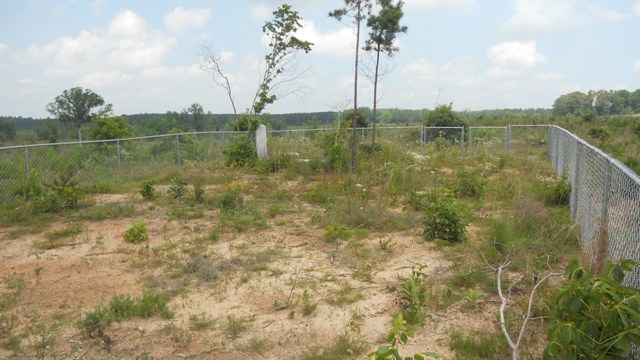
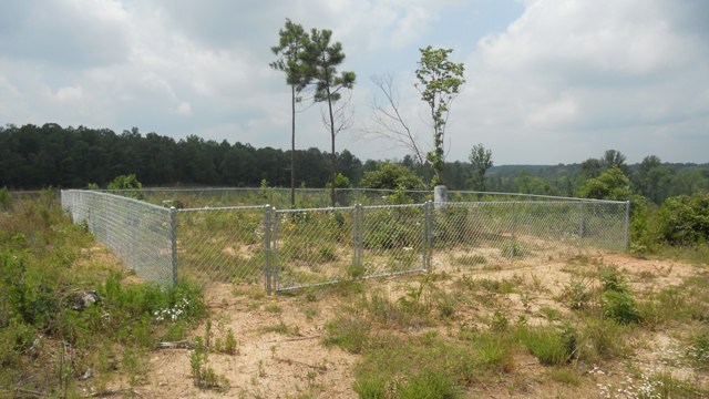
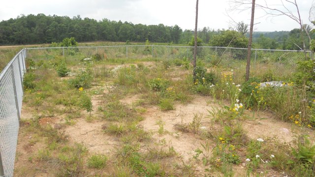
| Description | : | In 1983, this cemetery was surveyed for the book "A Survey of Cemeteries in Chambers County, Alabama" published by the Chattahoochee Valley Historical Society. At the time the cemetery was in a heavily wooded area. There were twelve identifiable grave sites with only two having markers. Since that time a chain link fence has been installed surrounding the cemetery and all field stones that marked the other graves have been removed. |
frequently asked questions (FAQ):
-
Where is Littlefield Cemetery?
Littlefield Cemetery is located at Stroud, Chambers County ,Alabama ,USA.
-
Littlefield Cemetery cemetery's updated grave count on graveviews.com?
0 memorials
-
Where are the coordinates of the Littlefield Cemetery?
Latitude: 33.0853930
Longitude: -85.3176780
Nearby Cemetories:
1. Stephens Family Cemetery
Stroud, Chambers County, USA
Coordinate: 33.0767600, -85.3129300
2. Skyview Memorial Garden
Five Points, Chambers County, USA
Coordinate: 33.0731010, -85.3368988
3. Mount Pisgah Primitive Baptist Cemetery
Stroud, Chambers County, USA
Coordinate: 33.0661011, -85.3337021
4. Bethel Baptist Church Cemetery
Chambers County, USA
Coordinate: 33.0872002, -85.3463974
5. Old Union Methodist Church Cemetery
Five Points, Chambers County, USA
Coordinate: 33.0437810, -85.3397370
6. Lanes Chapel Methodist Church Cemetery
Roanoke, Randolph County, USA
Coordinate: 33.1129210, -85.3645760
7. Fellowship Baptist Church Cemetery
Bacon Level, Randolph County, USA
Coordinate: 33.1270650, -85.2868900
8. Sweet Home Baptist Church Cemetery
Chambers County, USA
Coordinate: 33.0358900, -85.3035370
9. Old Salem Primitive Baptist Cemetery
Bacon Level, Randolph County, USA
Coordinate: 33.1375200, -85.3103400
10. Standing Rock Methodist Church Cemetery
Chambers County, USA
Coordinate: 33.0786018, -85.2518997
11. Sanders Cemetery
Chambers County, USA
Coordinate: 33.0558014, -85.3771973
12. Antioch Christian Church Cemetery
Doublehead, Chambers County, USA
Coordinate: 33.0963330, -85.3916360
13. Randolph Memory Gardens
Rock Mills, Randolph County, USA
Coordinate: 33.1535988, -85.3107986
14. Finney Cemetery
Five Points, Chambers County, USA
Coordinate: 33.0311012, -85.3692017
15. Old Five Points Cemetery
Five Points, Chambers County, USA
Coordinate: 33.0205910, -85.3485430
16. East Roanoke Cemetery
Roanoke, Randolph County, USA
Coordinate: 33.1432991, -85.3644028
17. Five Points Belcher Cemetery
Chambers County, USA
Coordinate: 33.0212390, -85.3542120
18. Rock Mills Missionary Baptist Church Cemetery
Randolph County, USA
Coordinate: 33.1570530, -85.3077420
19. Booger Hill Cemetery
Roanoke, Randolph County, USA
Coordinate: 33.1481018, -85.3610992
20. Higgins Family Cemetery
Chambers County, USA
Coordinate: 33.0475006, -85.3933029
21. Peace and Goodwill Baptist Church Cemetery
Randolph County, USA
Coordinate: 33.1240270, -85.3954800
22. Rehope Baptist Church Cemetery
Chambers County, USA
Coordinate: 33.0573690, -85.4029200
23. Cedarwood Cemetery
Roanoke, Randolph County, USA
Coordinate: 33.1519012, -85.3681030
24. Roanoke Baptist Church Cemetery
Roanoke, Randolph County, USA
Coordinate: 33.1506600, -85.3730260