
| Memorials | : | 0 |
| Location | : | Jefferson County, USA |
| Coordinate | : | 34.1795120, -91.9126810 |
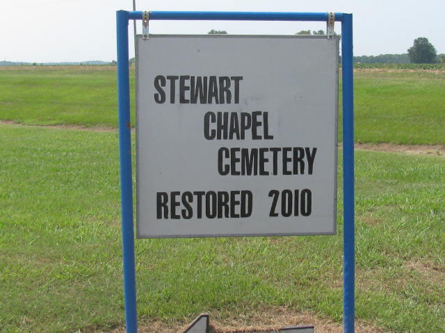
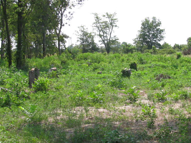
| Description | : | This cemetery is located several hundred yards behind the Ladd Water Company's office on Hwy. 425. A truck is needed to drive to the cemetery, as you will be circling a rice field in order to get to the cemetery. It's adviseable to visit Stewart Chapel during dry periods in order not to get your vehicle stuck. A group of citizens are trying to keep this cemetery up. |
frequently asked questions (FAQ):
-
Where is Stewart Chapel Cemetery?
Stewart Chapel Cemetery is located at Jefferson County ,Arkansas ,USA.
-
Stewart Chapel Cemetery cemetery's updated grave count on graveviews.com?
0 memorials
-
Where are the coordinates of the Stewart Chapel Cemetery?
Latitude: 34.1795120
Longitude: -91.9126810
Nearby Cemetories:
1. Bethany Chapel
Pine Bluff, Jefferson County, USA
Coordinate: 34.1815700, -91.9465360
2. Patterson Cemetery
Jefferson County, USA
Coordinate: 34.1800003, -91.8775024
3. Smith Chapel Cemetery
Jefferson County, USA
Coordinate: 34.1963997, -91.9428024
4. Atkins Cemetery
Jefferson County, USA
Coordinate: 34.2078018, -91.8792038
5. Smith Cemetery
Jefferson County, USA
Coordinate: 34.1397018, -91.8927994
6. Cottondale Cemetery
Jefferson County, USA
Coordinate: 34.1878014, -91.8597031
7. Pilgrim Rest Cemetery
Jefferson County, USA
Coordinate: 34.1653300, -91.8521400
8. Fairfield Cemetery
Jefferson County, USA
Coordinate: 34.2322006, -91.9094009
9. Bethel Church Cemetery
Melton Township, Jefferson County, USA
Coordinate: 34.1362719, -91.9513634
10. Noble-Gravier Family Cemetery
Noble Lake, Jefferson County, USA
Coordinate: 34.1696660, -91.8479940
11. Highline Cemetery
Pine Bluff, Jefferson County, USA
Coordinate: 34.1856200, -91.9802000
12. Taylor Cemetery
Pine Bluff, Jefferson County, USA
Coordinate: 34.1953011, -91.9794006
13. Burke's Place
Pine Bluff, Jefferson County, USA
Coordinate: 34.1664719, -91.9803975
14. Shell Chapel Cumberland Presbyterian Church Cemete
Hooker, Jefferson County, USA
Coordinate: 34.1220620, -91.8838500
15. Saint Ruth Cemetery
Jefferson County, USA
Coordinate: 34.2092018, -91.8447037
16. New Saint Hurricane MBC Cemetery
Pine Bluff, Jefferson County, USA
Coordinate: 34.1948200, -91.9890300
17. Mulberry Grove Cemetery
Jefferson County, USA
Coordinate: 34.1977997, -91.8364029
18. Prairie Lake Baptist Church Cemetery
Jefferson County, USA
Coordinate: 34.2466680, -91.9162990
19. Mount Calvary Baptist Church Cemetery
Pine Bluff, Jefferson County, USA
Coordinate: 34.1907260, -91.9959910
20. Mount Lebanon Cemetery
Jefferson County, USA
Coordinate: 34.1164530, -91.8763760
21. Jefferson Cemetery
Jefferson County, USA
Coordinate: 34.1161003, -91.8750000
22. Hunters Cemetery
Jefferson County, USA
Coordinate: 34.1506004, -91.8324966
23. Solomon Hill Cemetery
Jefferson County, USA
Coordinate: 34.1398920, -91.9887700
24. Nebraska Street Grave
Pine Bluff, Jefferson County, USA
Coordinate: 34.2214670, -91.9884220