| Memorials | : | 0 |
| Location | : | Easton, Leavenworth County, USA |
| Coordinate | : | 39.3211100, -95.1016700 |
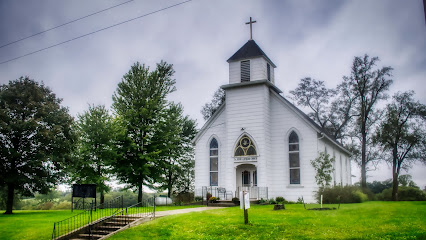
| Description | : | AKA Stranger Baptist Church Cemetery. 2 1/2 miles SE of Easton, KS. The land was first bought by a Mr. White, a wealthy pro-slavery man. After Kansas became a free state, he donated 210 acres to the slaves he had owned. In 1876 the first burial was made on a hill on the donated land. The frame church erected in 1873 and at least part of the cemetery were destroyed in 1930 by a tornado. 2004: "At this time only 6 of over 100 limestone markers remain, none with engraving." The names of... Read More |
frequently asked questions (FAQ):
-
Where is Stranger Creek Cemetery?
Stranger Creek Cemetery is located at Easton, Leavenworth County ,Kansas ,USA.
-
Stranger Creek Cemetery cemetery's updated grave count on graveviews.com?
0 memorials
-
Where are the coordinates of the Stranger Creek Cemetery?
Latitude: 39.3211100
Longitude: -95.1016700
Nearby Cemetories:
1. Easton Cemetery
Easton, Leavenworth County, USA
Coordinate: 39.3395882, -95.1237793
2. Saint Lawrence Cemetery
Easton, Leavenworth County, USA
Coordinate: 39.3443985, -95.1335983
3. Sparks Cemetery
Easton, Leavenworth County, USA
Coordinate: 39.2958336, -95.1355591
4. Mount Olivet Cemetery
Easton, Leavenworth County, USA
Coordinate: 39.3385010, -95.0582962
5. Bethel Cemetery
Springdale, Leavenworth County, USA
Coordinate: 39.2846985, -95.0777969
6. Mary Ackley Gravesite
Leavenworth County, USA
Coordinate: 39.3317300, -95.0402100
7. Langley Cemetery
Easton, Leavenworth County, USA
Coordinate: 39.3616982, -95.1611023
8. Springdale Cemetery
Springdale, Leavenworth County, USA
Coordinate: 39.2672200, -95.1413900
9. Oak Hill Cemetery
Millwood, Leavenworth County, USA
Coordinate: 39.3833008, -95.0943985
10. Saint Thomas Cemetery
Springdale, Leavenworth County, USA
Coordinate: 39.2597008, -95.1192017
11. Evergreen Cemetery
Millwood, Leavenworth County, USA
Coordinate: 39.3833008, -95.1333008
12. Friends Church Cemetery
Springdale, Leavenworth County, USA
Coordinate: 39.2532800, -95.1237100
13. Pleasant Ridge Cemetery
Lowemont, Leavenworth County, USA
Coordinate: 39.3792000, -95.0344009
14. High Prairie Cemetery
Leavenworth County, USA
Coordinate: 39.2724991, -95.0168991
15. Saint Johns Lutheran Cemetery
Millwood, Leavenworth County, USA
Coordinate: 39.4042015, -95.1386032
16. Schrimpf Family Cemetery
Lowemont, Leavenworth County, USA
Coordinate: 39.2353400, -95.0632500
17. Campbell Cemetery
Jarbalo, Leavenworth County, USA
Coordinate: 39.2303600, -95.0753400
18. Round Prairie Cemetery
Lowemont, Leavenworth County, USA
Coordinate: 39.4122009, -95.0738983
19. Sons of Truth Cemetery
Leavenworth, Leavenworth County, USA
Coordinate: 39.3302994, -94.9775009
20. Fall Creek Cemetery
Jarbalo, Leavenworth County, USA
Coordinate: 39.2242012, -95.0883026
21. Sunset Memory Gardens
Leavenworth, Leavenworth County, USA
Coordinate: 39.2999992, -94.9653015
22. Fowler Cemetery
McLouth, Jefferson County, USA
Coordinate: 39.2383003, -95.1911011
23. Isaac Gruber Gravesite
Kickapoo Township, Leavenworth County, USA
Coordinate: 39.3349400, -94.9585400
24. Sully Family Cemetery
Leavenworth, Leavenworth County, USA
Coordinate: 39.3226790, -94.9571080

