
| Memorials | : | 35 |
| Location | : | Centerville, Montgomery County, USA |
| Coordinate | : | 39.6367493, -84.1579666 |
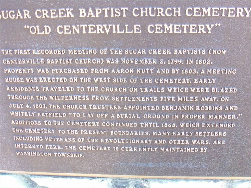
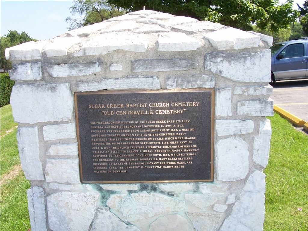
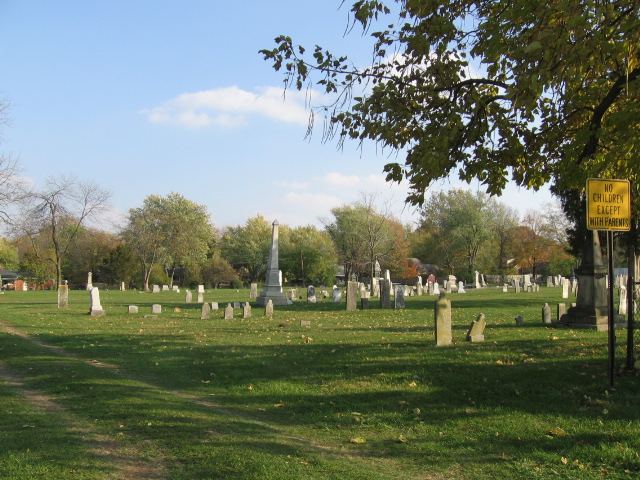
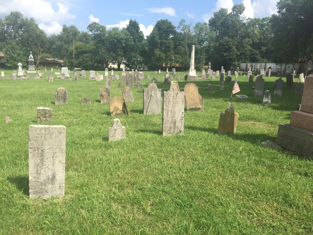
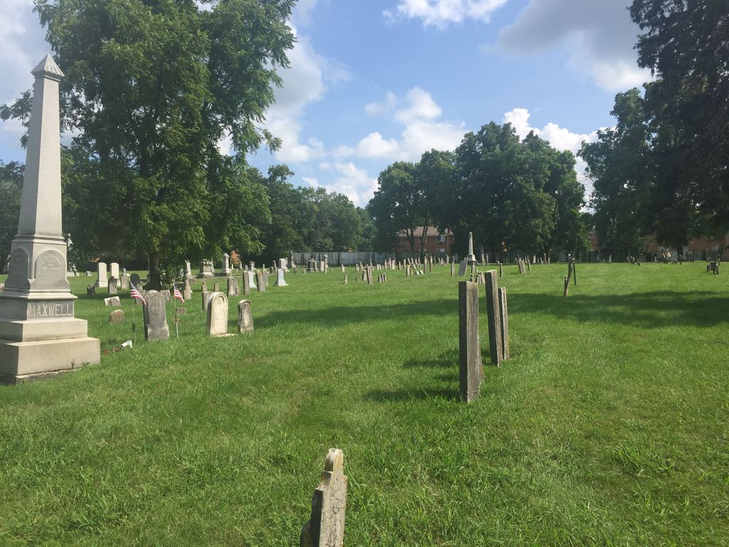
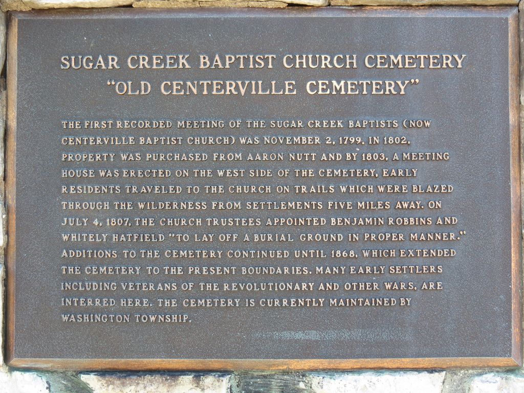
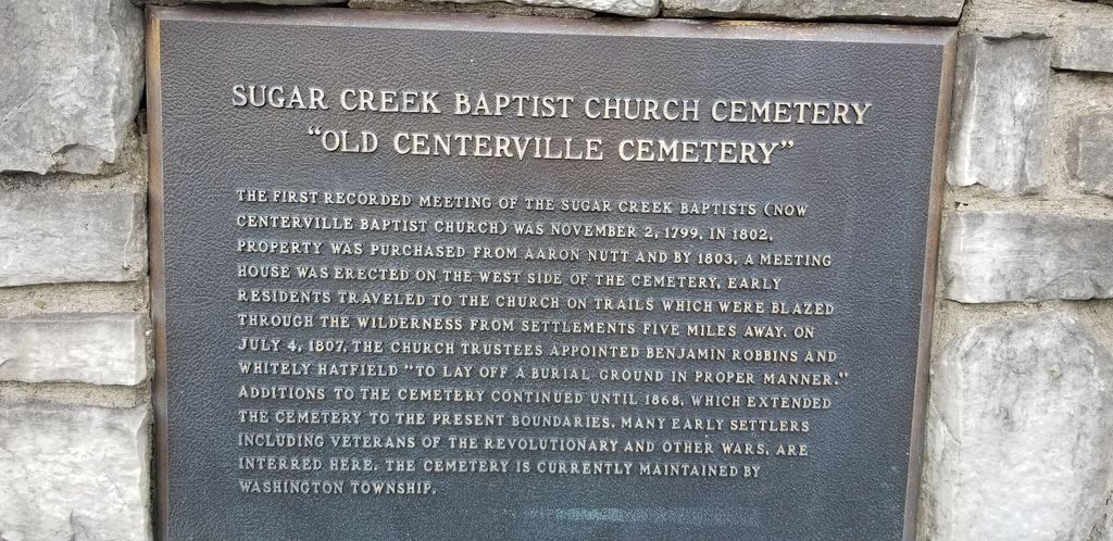
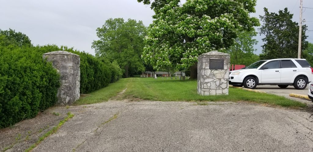
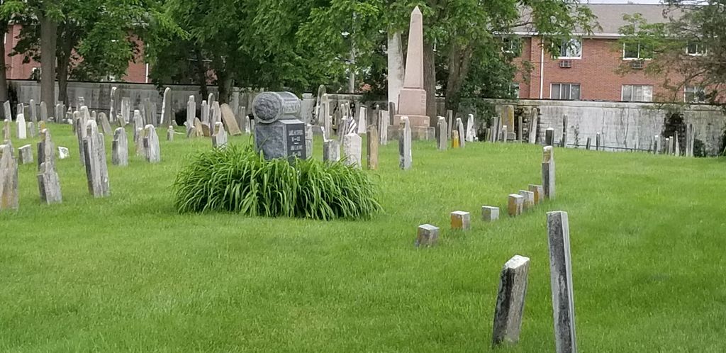
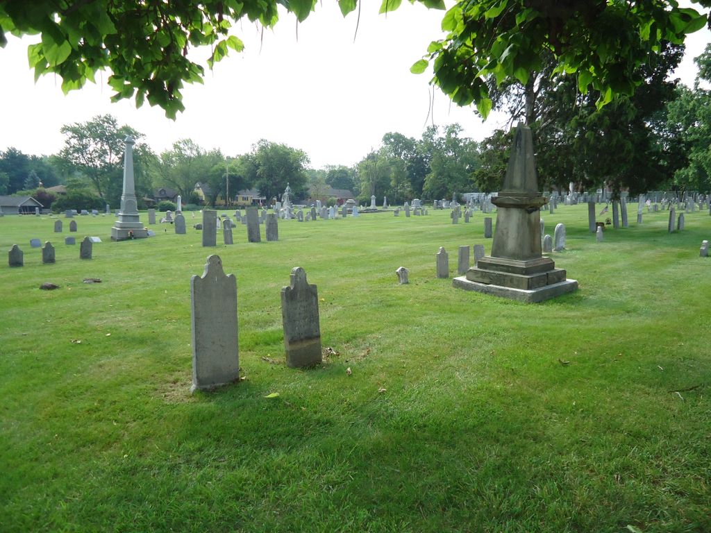
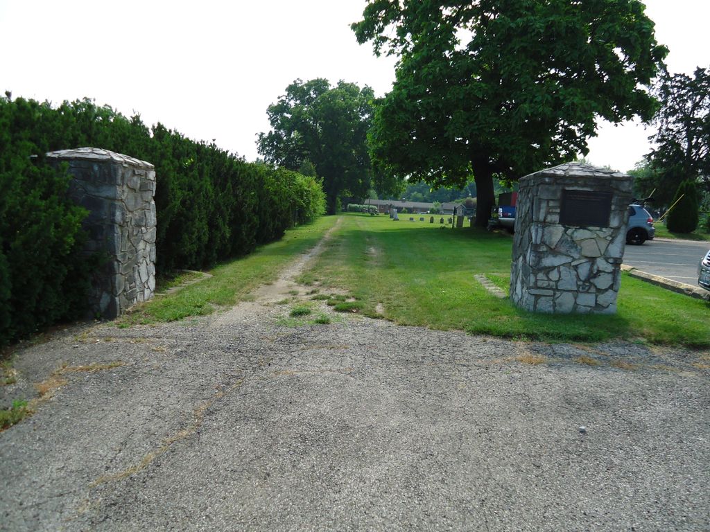
| Description | : | Sugar Creek Baptist Church Cemetery (East side of 725, northeast of Bill's Donut Shop and south of Williamsburg Lane) This cemetery should not be confused with the other "Sugar Creek Baptist Chuch Cemetery" a short distance away in Washington Court House. Below posted by Washington Township Government, Montgomery Co, OH at http://www.washingtontwp.org/cem/index.html "Historical Briefs of the Cemeteries Sugar Creek Baptist Church Cemetery (Northeast of Bill's Donut Shop) The first recorded meeting of the Sugar Creek Baptists (now Centerville Baptist Church) was November 2, 1799. In 1802, property was purchased from Aaron Nutt and by 1803 a meeting house was erected on the west side... Read More |
frequently asked questions (FAQ):
-
Where is Sugar Creek Baptist Church Cemetery?
Sugar Creek Baptist Church Cemetery is located at N. Main Street (Ohio State Route 725) Centerville, Montgomery County ,Ohio , 45459USA.
-
Sugar Creek Baptist Church Cemetery cemetery's updated grave count on graveviews.com?
23 memorials
-
Where are the coordinates of the Sugar Creek Baptist Church Cemetery?
Latitude: 39.6367493
Longitude: -84.1579666
Nearby Cemetories:
1. Centerville Cemetery
Centerville, Montgomery County, USA
Coordinate: 39.6307983, -84.1539001
2. Epiphanys Lutheran Memorial Garden
Dayton, Montgomery County, USA
Coordinate: 39.6510760, -84.1548340
3. Sugar Creek Friends Cemetery
Centerville, Montgomery County, USA
Coordinate: 39.6204681, -84.1393509
4. Woodbourne Cemetery
Montgomery County, USA
Coordinate: 39.6588783, -84.1727676
5. Saint Georges Episcopal Church Memorial Garden
Dayton, Montgomery County, USA
Coordinate: 39.6672760, -84.1608950
6. Washington Cemetery
Montgomery County, USA
Coordinate: 39.6332000, -84.2060300
7. Munger Road Cemetery
Centerville, Montgomery County, USA
Coordinate: 39.6556220, -84.2048980
8. Davids Cemetery
Kettering, Montgomery County, USA
Coordinate: 39.6789017, -84.1697006
9. Rehoboth Cemetery
Montgomery County, USA
Coordinate: 39.5833015, -84.1669006
10. McLane Cemetery
Beavercreek, Greene County, USA
Coordinate: 39.6735916, -84.1019592
11. Fallis Pioneer Cemetery
Bellbrook, Greene County, USA
Coordinate: 39.6553690, -84.0881860
12. Fairview Primitive Baptist Church Cemetery
Bellbrook, Greene County, USA
Coordinate: 39.6258888, -84.0815048
13. Beavertown Cemetery
Beavertown, Montgomery County, USA
Coordinate: 39.6981010, -84.1288986
14. Huston Cemetery
Bellbrook, Greene County, USA
Coordinate: 39.6576080, -84.0756870
15. Bellbrook Cemetery
Bellbrook, Greene County, USA
Coordinate: 39.6441480, -84.0697750
16. Pioneer Cemetery
Bellbrook, Greene County, USA
Coordinate: 39.6464005, -84.0691986
17. Miami Valley Memory Gardens
Springboro, Warren County, USA
Coordinate: 39.5668300, -84.1613100
18. Zion Cemetery
Moraine, Montgomery County, USA
Coordinate: 39.6931877, -84.2118378
19. Gebhart Church Cemetery
Miamisburg, Montgomery County, USA
Coordinate: 39.6321983, -84.2557983
20. Morgan Cemetery
Kettering, Montgomery County, USA
Coordinate: 39.7033830, -84.1067830
21. Lytle Cemetery
Lytle, Warren County, USA
Coordinate: 39.5605830, -84.1301230
22. Middle Run Cemetery
Bellbrook, Greene County, USA
Coordinate: 39.5816800, -84.0745480
23. Evergreen Cemetery
West Carrollton City, Montgomery County, USA
Coordinate: 39.6744003, -84.2585983
24. Hillgrove Cemetery
Miamisburg, Montgomery County, USA
Coordinate: 39.6385994, -84.2735977