| Memorials | : | 0 |
| Location | : | Ripley County, USA |
| Coordinate | : | 36.5253640, -90.9451680 |
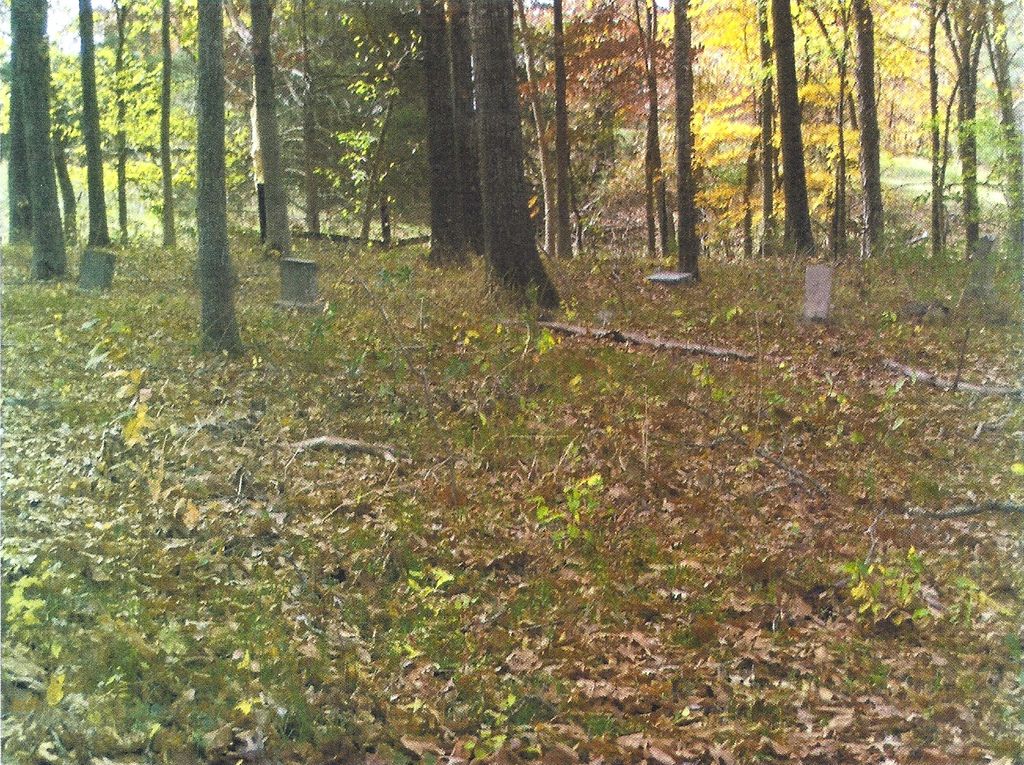
| Description | : | The Sugar Tree Grove Cemetery is located on the farm of now Ron Smith (2013). It had been in disrepair for many years. Mr. Smith allowed the Patterson Family to fence it several years ago and he has made much improvement to it since then. In the 1840's it was the property of John Patterson and it is believed that he and his wife Mary are probably buried there. It is said there are a number of graves with no stones. For many years the graveyard was used as a pasture for cattle. And before that... Read More |
frequently asked questions (FAQ):
-
Where is Sugar Tree Grove Cemetery?
Sugar Tree Grove Cemetery is located at Ripley County ,Missouri ,USA.
-
Sugar Tree Grove Cemetery cemetery's updated grave count on graveviews.com?
0 memorials
-
Where are the coordinates of the Sugar Tree Grove Cemetery?
Latitude: 36.5253640
Longitude: -90.9451680
Nearby Cemetories:
1. Patterson Cemetery
Ripley County, USA
Coordinate: 36.5242004, -90.9464035
2. Poynor Cemetery
Poynor, Ripley County, USA
Coordinate: 36.5261220, -90.9159990
3. Murrell Cemetery
Ripley County, USA
Coordinate: 36.5036011, -90.9235992
4. Old Dalton Family Cemetery
Ponder, Ripley County, USA
Coordinate: 36.5568780, -90.9547810
5. Dalton Cemetery
Ripley County, USA
Coordinate: 36.5003014, -90.9772034
6. Plunk Cemetery
Ripley County, USA
Coordinate: 36.5649986, -90.9269028
7. Johnston Chapel Cemetery
Union Township, Ripley County, USA
Coordinate: 36.5338100, -91.0053100
8. Union Grove Cemetery
Ripley County, USA
Coordinate: 36.5597000, -90.9981003
9. Sanky Hall Cemetery
Ripley County, USA
Coordinate: 36.5139008, -90.8724976
10. Mizell Cemetery
Ripley County, USA
Coordinate: 36.5321999, -90.8694000
11. Ponder Cemetery
Doniphan, Ripley County, USA
Coordinate: 36.5814018, -90.9792023
12. Ponder Catholic Cemetery
Ponder, Ripley County, USA
Coordinate: 36.5814100, -90.9793800
13. Glaze Creek Cemetery
Randolph County, USA
Coordinate: 36.4791985, -90.8852997
14. Old Ponder Cemetery
Ripley County, USA
Coordinate: 36.5830994, -90.9871979
15. Brakebill Cemetery
Maynard, Randolph County, USA
Coordinate: 36.4590820, -90.9602290
16. Price Cemetery
Ripley County, USA
Coordinate: 36.5821991, -90.8882980
17. Siloam Cemetery
Middlebrook, Randolph County, USA
Coordinate: 36.4536018, -90.9024963
18. Burr Cemetery
Randolph County, USA
Coordinate: 36.4667015, -91.0152969
19. Kennon Cemetery
Ripley County, USA
Coordinate: 36.6082993, -90.9593964
20. Pratt Cemetery
Randolph County, USA
Coordinate: 36.4543991, -91.0010986
21. Whittenberg Cemetery
Warm Springs, Randolph County, USA
Coordinate: 36.4682999, -91.0282974
22. Ainley Cemetery
Randolph County, USA
Coordinate: 36.4693985, -90.8582993
23. Warm Springs Cemetery
Warm Springs, Randolph County, USA
Coordinate: 36.4813995, -91.0457993
24. Pratt Cemetery
Ripley County, USA
Coordinate: 36.5286903, -90.8300934

